Download
1 / 46
500 likes | 570 Views
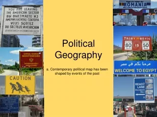
Political Geography. I. Political geography vocabulary II. Number of states, area, shape, etc. III. Geographic irregularities IV. Boundaries V. Pressures on state primacy VI. International political organizations. I. Political geography vocabulary.

E N D
I. Political geography vocabularyII. Number of states, area, shape, etc.III. Geographic irregularitiesIV. BoundariesV. Pressures on state primacyVI. International political organizations
I. Political geography vocabulary • State: an area organized into a political unit and ruled by an established government that has control over its internal and foreign affairs (sovereignty) • Defined territory, permanent population • Synonym for country • A nation is not a country, but rather the people • A formal region
Sovereignty: independence from control of its internal affairs by other states • A sovereign state has control over its affairs • Internal: laws, print money • External: treaties, passports (diplomatic relationships with other states) • Tribal governments are not sovereign, but they have autonomy
Nation-state: a sovereign state inhabited by a homogeneous group of people who share a feeling of common nationality. • Examples: • Japan (most Japanese are in Japan) • Poland • By contrast, most countries are multi-ethnic
Stateless nation: people without their own state • Kurds live in Iraq, Eastern Turkey, Iran, Syria http://img.timeinc.net/time/daily/special/photo/salgado/kurds.jpg
http://www.globalsecurity.org/military/world/iraq/images/kurdistan1.gifhttp://www.globalsecurity.org/military/world/iraq/images/kurdistan1.gif
Turkey Authorizes Troops to Enter Iraq to Fight Rebels NY Times October 10, 2007 Turkish troops have received authorization to cross the Iraq border to eliminate separatist Kurdish rebel camps in the northern region. http://www.nytimes.com/2007/10/10/world/europe/10turkey.html?em&ex=1192161600&en=eec6b40cbf94a082&ei=5087%0A
II. Number, size, shape, etc. • Number: approximately 200 countries in the world
Size • Giants • Russia: 6.6 million square miles (far exceeds any other country) • Canada: 3.8 million square miles • Canadians invented GIS to simplify mapmaking • China: 3.7 million square miles • USA: 3.6 million square miles • Brazil: 3.3 million square miles • Australia: 3 million square miles
Microstates • Smallest of the small • Most in Europe (leftover of medieval feudal period, afterwards was consolidation and they invented the nation-state) • Less than 200 square miles (2.5 times Washington, D.C.) • Examples: • Andorra • Malta • Liechtenstein • San Marino • Monaco • Vatican City
Shape • Compact state • Distance from center to border varies little • Communication and transportation is easier • Fosters a sense of national identity • Example: South Korea
Prorupt state • Compact with extension • Access can vary • Economically important • Strategically important • Narrow • High military presence • Away from core
Examples • Caprivi Strip in Namibia Germans colonized in 1890 http://www.holiday-namibia.com/Suggested-Tours.gif
Afghanistan http://worldatlas.com/webimage/countrys/asia/afghreg.gif
Thailand http://thailand.yinyangandtaichichuan.org/maps/thailand.jpg
Elongated state • Must be longer than wide • There are great distances • Various climatic, resource, culture zones (climate more varied if state runs north-south) • Difficult communication, transportation, fostering national identity • Example: Chile http://www.chilefungi.cl/images/chile.jpeg
Fragmented state • Physically broken, multiple pieces • Difficult transportation, fostering a sense of national identity • Examples • Indonesia • Philippines http://www.lonelyplanet.com/mapimages/south_east_asia/indonesia/indonesia.gif
Perforated state • One state surrounds the other (perforated state surrounds landlocked state) • Relationships are important (the surrounded state is always weaker) • Examples • The Republic of South Africa (surrounds Lesotho (“Lesootu”)) • France (inside is a Spanish town) • Italy (surrounds San Marino and Vatican City) http://www.playforpeace.org/images/maps/south_africa_map.gif
Problems of defining states • Morocco and Western Sahara (Morocco claims the territory, but it is considered by many African countries as a sovereign state) • Turkish Republic of Northern Cyprus (island in eastern Mediterranean inhabited by Greeks and Turks) • Republic of Turkey occupies a portion of the island • U.S. doesn’t recognize it, so is it a country? • China and Tibet: Tibet is occupied • China and Taiwan: different passports, money, political systems • The world treats them as two countries, but China says it is part of China • Taiwan says it is separate
III. Geographic irregularities • Enclaves • Fragments of states separated from main bodies • Different identity • High military presence • Examples: • Bangladesh (East Pakistan is now Bangladesh) http://www.zum.de/whkmla/histatlas/india/haxpakistan.html
Tin Bigha Corridor • A unique approach to solving an enclave problem • A piece of Indian land between Bangladesh territories • Less than 1,000 feet wide • Roads opened at certain hours for Indians and certain hours for Bangladeshis
IV. Boundaries • Vertical territory • How much airspace and subsurface does a state own? • Van Bynkershoek Principle • The state’s claim to space is as far as the state has the ability to back up the claim unless there is an international agreement
Boundary development • Three step process • Definition: the boundary is defined and described • Delimitation: the boundary is mapped • Demarcation: the boundary is made visible in the physical landscape
Frontier: a zone where no state has political control • Arabian peninsula • Antarctica is claimed by many different states
Cultural boundaries • Geometric: straight line, ignores physical/cultural features • Religious: religion is used to select the boundary line • The British partitioned India into two states on the basis of religion: Muslim portions allocated to Pakistan and Hindu portions became the state of India • Language: language as a criterion in creating boundaries • Europe
Physical boundaries • Mountain: hard to cross, permanent, and sparsely inhabited • Argentina and Chile • Desert: hard to cross and sparsely inhabited • Common in Asia and Africa (the Sahara Desert) • Water (rivers, lakes, and oceans) • Most common and relatively unchanging • Typically in the middle of the water body • Offer good protection against attack (troops must be transported by air or ship) • Can cause difficulties • Rivers change their course (Rio Grande) • Ocean boundaries: not at the coastline, but out at sea
Iowa • Missouri River on western border, but Iowa is on both sides of river because it meandered • A flood which created Carter Lake (an oxbow lake)
Hartshorne’s genetic class system for describing boundaries • Antecedent: pre-existing (ex: a river) • Subsequent: • Different groups converge and there is some blending • The border is often a squiggly line • Superimposed: a geometric boundary is superimposed by a stronger outside force • Relict: ceases to function, but still has a visible imprint on landscape • East and West Germany • The Khmer Krom people in present-day Vietnam
Superimposed: Map of the Khmer Krom nation
Law of the Sea • Needed because of the weakness of the older 'freedom of the seas' concept, dating from the 17th century: national rights limited to 3 nautical miles. All water beyond national boundaries was considered international waters - free to all nations, but belonging to none of them. • In the 20th century many nations expressed a need to extend national claims. In 1945 President Truman extended the US’s control to cover all the natural resources of its continental shelf. • Other nations were quick to emulate the USA. Between 1946 and 1950, Argentina, Chile, Peru, and Ecuador all extended their sovereign rights to a 200 nautical miles distance, to cover fishing grounds. Other nations extended their territorial seas to 12 nautical miles. • As of 2006, only a handful of countries use the old 3 miles limit (Jordan, Palau, and Singapore, and others).
Exclusive economic zone: Under the Law of the Sea, an Exclusive Economic Zone (EEZ) is a sea zone over which a state has rights to the exploration and use of marine resources.
V. Pressures on state primacy • Over the centuries, power has changed hands from church to state to corporations • Trends that weaken a state: • Globalization of economy, transnational corporations • Proliferation of international institutions • Emergence of NGOs (non-governmental organizations) • International migration • Increase in nationalist and separatist movements
VI. International political organizations • Today there is more globalization and homogenization • When a state joins an international organization, it must give up some of its sovereignty • Examples: UN, WHO, UNICEF, the World Bank, IMF, EU, NATO • NATO: North Atlantic Treaty Organization – a military alliance • The member states agree to defend each other if attacked by an external party
Homework 2: Political Geography • Choose an orange-headed section in Key Issue 1, 2, or 3 • Read the section and write a paragraph summary • Due next class