Download

1 / 28
290 likes | 458 Views
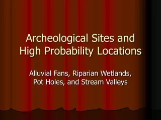
Archeological Sites and High Probability Locations. Alluvial Fans, Riparian Wetlands, Pot Holes, and Stream Valleys. The Importance of Topography to the Distribution of Cultural Resources. Neither ancient nor modern peoples settled on the landscape in a random manner.

E N D
Archeological Sites and High Probability Locations Alluvial Fans, Riparian Wetlands, Pot Holes, and Stream Valleys
The Importance of Topography to the Distribution of Cultural Resources • Neither ancient nor modern peoples settled on the landscape in a random manner. • Food resources, water resources, transportation corridors, raw material availability, defendable positions, good views, and desirable micro-climates all played roles in concentrating where people settled. • Our Agency’s responsibility to take cultural resources into account necessitates that our field personnel be aware of high probability areas where such resources may be encountered.
Low Angle Alluvial Fans • Low angle alluvial fans are the single most likely topographic feature to contain significant cultural resources. • They commonly contain buried sites. • Field offices shall contact the state office before working on alluvial fans. Tributary Source of Fan Low Angle Fan with village site
How Alluvial Fans Form • Alluvial fans occur where a tributary empties into a larger valley. As the grade becomes less, sediment drops out. • This causes a fan shaped deposit to form at the mouth of the tributary. BURIED ARCHEOLOGICAL SITE FAN TRIBUTARY MAIN STREAM
How to Identify an Alluvial Fan • Visually check in the field the mouths of tributaries in larger valleys. • Check topographic maps, and look for fan shaped elevation lines at the mouths of tributaries. • Check soils maps for soils designated as “local alluvium.” FAN FAN FAN
Why Do Fans Have Such a Concentration of Significant Cultural Resources? • Factors may include the proximity to water, to food resources in wetlands, to streams that could be canoed, and to flood protection from the stream in the main valley. • Spring run-off from the tributary would annually bury with sediment the campsites occupied during the other seasons, thus preserving a stratified record valuable to scientists. • The large fan shown to the left has 4 known prehistoric sites, 4 farmsteads (over 50 years of age), and 1 cemetery.
Wetlands As a Focus of Cultural Resources • Our agency’s interest in protecting and restoring wetlands as valuable natural resources, necessitates that our field offices understand that they will be working in a cultural resource rich environment. • We will discuss two types of wetlands, pot holes and riparian wetlands
Why Are Archeological Sites So Abundant Near Wetlands? • Wetlands are some of the planet’s most biologically rich ecosystems. • They produce an enormous quantity of usable plant material. Native Americans camped near these valuable natural resources. • The Ioway, for example, ate the root of the cattail, used the leaves of the cattail as a salad, and used the stalks to make insulating mats that covered their lodges. They used willow (a wetland plant) saplings to frame their lodges. Edible plants are very abundant in wetlands cattail arrowhead
Wetland Edible Plant Abundance A field of cattails • Edible plants are present in a wide variety. • Often, there are stands of edible plants in wetland zones that approach the monoculture of farm fields. • This served as a powerful magnet to attract ancient settlements. A natural garden of Arrowhead (Indian Potato)
The Wet Bottom, Dry Bottom Principle of Site Distribution • Archeological sites tend to fringe wetlands. This distribution has been likened to a “ring around a bathtub.” • People like to camp as close as possible to the rich natural resources in the wetland, but don’t want to process these resources on damp ground. • The goal was to have a wet bottom (topographically speaking) and a dry bottom (anatomically speaking).
Pot Hole Wetlands • These wetlands are found in areas that have been de-glaciated during relatively recent times. • In Iowa, this area corresponds to the Des Moines Lobe. • Pot holes resulted from uneven topography created by glaciations. Without a well developed drainage system, water collects in the low spots creating ponds and marshes.
The Distribution of Archeological Sites Relative to Pot Holes • Archeological sites tend to be located next to, but not on hydric soils. • In the field, the contrast between the lighter, better drained soils and the darker, poorly drained soils is often dramatic. • Soils maps can be examined to locate the boundaries between hydric and non-hydric soils. • Topographic maps can be used to identify higher and therefore drier locations
Vertical Aspects of Archeological Sites in Pot Hole Environments • Most agency ground disturbances in pot holes are very shallow. For deep disturbances you need to discover what lies below. • Precipitation fluctuations have caused wetlands to expand or shrink. The contact between hydric and non-hydric soils has shifted over time. In some cases, archeological sites on non-hydric deposits may be buried by hydric deposits. • If deep disturbance is planned, use a soil probe to find out whether there are underlying non-hydric deposits which have the potential to have archeological sites. • Your local soil scientist can be of great help. • Colluvium may bury archeological sites near the wetland.
Riparian Wetlands • Riparian wetlands are found in stream valleys. • They have formed in abandoned meander scars, on aggrading floodplains, in areas adjacent to seeps in adjoining valley walls, and in slack-water deposits away from the main channel.
Archeological Site Distributions in Riparian Wetlands • Damp areas were avoided. Drier areas adjacent to wetlands were selected. • Drier areas on floodplains include natural levees, sand dunes, alluvial terraces, fans, and sandy areas. Sediments that are elevated or consist of larger grain sediments have a tendency to be drier.
Sandy Soils and Archeological Site Locations in Riparian Wetlands • Sandy deposits bordering hydric areas were attractive for ancient campsites. • Sand holds less water and will potentially drain faster than finer grain sediments. • These sandy deposits are on sand bars, aeolian deposits, and natural levees. They are often slightly higher than surrounding areas. • Use soil maps and field observations to identify sandy areas.
Drier Deposits and Archeological Site Locations in Riparian Wetlands • People chose the best site available. Although sandy areas are probably ideal, ancient campsites are found on finer grain deposits that have low water tables when sandy deposits were lacking.
Common Ground Disturbing Actions in Wetlands • Shallow Water Excavations for Wildlife (SWEW) • Water Control Structure and Dike Construction • Tile Plugging SWEW DIKES
Shallow Water Excavations for Wildlife • SWEW’s are shallow areas scooped out by earthmoving equipment • Most are made in low spots in the topography. These are mostly meander scars or filled in potholes. • They usually contain hydric deposits or post settlement alluvium (PSA), which lack significant potential for cultural resources. • Cultural resources can be found beneath these deposits, so be careful if your SWEW is deep or you are on the fringe of the low spot. • A soil scientist can be very helpful in these situations.
Water Control Structures and Dike Construction • Dikes and their water control structures are mostly on hydric deposits or PSA, with little potential for cultural resources. • However, dikes have to key into higher locations which are very high probability areas for cultural resources. • The “key in” areas must be very carefully examined. Shovel test and use screens if necessary. DIKE
Plugging Tile • Many wetlands are drained by laying tile. • The tile needs to be plugged or interrupted to restore wetlands. • When the tile location is known, the tile can be plugged by digging into already disturbed ground. There is no cultural resource problem. • If the tile can be located with a tile probe, there is no problem. • A careful investigation must be done if a long backhoe trench is needed to locate tile outside the original “footprint” of construction, and outside hydric or PSA deposits. Interrupted tile in a wetland restoration
River Valleys as High Potential Areas for Cultural Resources • River valleys have always attracted ancient and modern settlement. • River valleys provide dependable sources of water, transportation corridors, a source of timber in prairie regions, a wide variety of rich environmental resources, and shelter from the wind. • Some of the high potential areas already discussed (fans and riparian wetlands) are found in river valleys.
Topography and Concentrations of Archeological Sites in River Valleys • Many favored camp sites were on better drained ground (fans, stream terraces, natural levees, and dunes) near water (stream channels, oxbows, springs and wetlands). • Overlooks, especially those near springs are high probability areas. VALLEY TOPOGRAPHY
Post Settlement Alluvium (PSA) • PSA is very young over wash. Much of it is the result of modern cultivation. • PSA is common in river valleys (and sometimes in pot holes). • PSA has little or no potential for cultural resources. PSA PSA PSA PALEOSOL PSA
How to Identify PSA • PSA may have a poorly developed A horizon, but always lacks a B horizon. • PSA usually shows alluvial stratification. • PSA is at the top of the stratigraphic column usually overlying a paleosol. • Soils descriptions may indicate the presence of over wash. PSA Field Office Personnel Pointing to Artifacts in a Paleosol Underlying PSA
Trees as Indicators of PSA • Trees are a quick way to spot PSA. • Tree trunks spread out near their base when on a stable surface. • Tree trunks that have their basal areas covered by PSA stick out of the ground like fence posts. • Scientists have even counted tree rings, then measured the depth to the root spread, and have used this to estimate when the PSA began accumulating. Present Land Surface PSA Original Land Surface
Archeological Sites Are Often Associated with Special Resources • Flint outcrops. • Salt licks • Rock shelters and caves • Food rich wetlands • Springs A spring issuing from a small cave. A flint outcrop and large archeological site are nearby.
Things to think about • Although cultural resources do concentrate in certain areas, they can be found thinly scattered over much of the landscape. • Rare, but sometimes important cultural resources, such as steamboat wrecks and prehistoric fish weirs, are located where one would not expect to find a campsite or farmstead. • The landscape changes over time. What is now dry land may once have been a river bank or wetland, or some other magnet for human settlement.