Download
1 / 14
170 likes | 451 Views
EUMETSAT. Monitoring weather and climate from space. EUMETSAT headquarters. 26 Member States & 5 Cooperating States. Member States. CZECH REPUBLIC. CROATIA. AUSTRIA. BELGIUM. FINLAND. GERMANY. FRANCE. DENMARK. GREECE. HUNGARY. ITALY. IRELAND. NETHERLANDS. NORWAY. LUXEMBOURG.

E N D
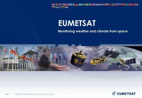
EUMETSAT Monitoring weather and climate from space
26 Member States & 5 Cooperating States Member States CZECH REPUBLIC CROATIA AUSTRIA BELGIUM FINLAND GERMANY FRANCE DENMARK GREECE HUNGARY ITALY IRELAND NETHERLANDS NORWAY LUXEMBOURG LATVIA ROMANIA SLOVAK REPUBLIC POLAND PORTUGAL SWEDEN SWITZERLAND SPAIN SLOVENIA Cooperating States UNITED KINGDOM TURKEY BULGARIA ESTONIA ICELAND SERBIA LITHUANIA
What we do USER REQUIREMENTS European National Meteorological Services Operating Agency European Space Industry Interface with users and overall system design and development. Responsible for procurement of ground segment and launch services Satellite development and procurement agency Private Enterprises, Value-Added Services, End-Users DELIVERY
Geostationary satellites Meteosat Second Generation (MSG) • consists of a series of four geostationary weather satellites • scheduled to operate consecutively until 2018 • provides important image data on European weather on a daily basis, every 15 minutes with 12 spectral bands • Meteosat-9 (in operation since 2006) provides data collection and environmental monitoring data • Meteosat-8 (in operation since 2004) provides Rapid Scan Service (RSS) images every five minutes • RSS delivers image data and meteorological products for the detection of rapidly developing localised convective weather systems.
EUMETSAT’s geostationary satellite coverage 60 N Meteosat-9 (0° Longitude) Meteosat-8 (9.5° E) 0 Meteosat-7 (57.5° E) Meteosat-6 (67.5° E) 60 S 80 160 140 120 100 80 60 40 20 0 20 40 60 100 120 140 160 180
Geostationary satellites Meteosat Third Generation (MTG) • will consist of four imaging and two sounding satellites • scheduled to start operations from 2019, taking over from MSG • will provide important image data on European weather on a daily basis, every 10 minutes with 16 spectral bands • the imaging satellites will carry the revolutionary new Lightning Imager providing better data for users such as civil aviation • the sounding satellites will carry an infrared sounder for the first time ever providing four-dimensional (over time and space) high-resolution data on water vapour and temperature structures • also on board the sounding satellites will be the Global Monitoring for Environment and Security Sentinel-4 Ultraviolet Visible Near-infrared spectrometer for atmospheric chemistry and air quality monitoring
Polar-orbiting satellites EUMETSAT Polar System (EPS) • Europe’s first series of polar-orbiting satellites for • operational meteorology consists of three Metop in • low Earth orbit to operate over a period of at least • 14 years. • Metop-A (launched in 2006) • carries imaging and sounding instruments • direct broadcasting and data collection capabilities • significant contribution to the Global Observing System and the monitoring of climate and atmospheric chemistry. • EPS data • unprecedented accuracy; used in various applications such as Numerical Weather Prediction models, atmospheric composition, cloud detection analysis or radiation budget components. • EPS –SG (in approval process) • Second Generation EPS ready in 2018 • two satellite configuration being studied with distributed payloads for the two satellites • Payload to include GMES Sentinel-5 Partners:
Monitoring the oceans Jason satellites • Jason-2 • launched in June 2008 from Vandenberg, California • EUMETSAT’s first optional programme on ocean altimetry • enabled EUMETSAT to extend its expertise in data and product dissemination for weather forecasting and climate monitoring • inclusion of data in support of marine meteorology, operational oceanography, seasonal prediction and climate monitoring. • Jason-3 • programme under development • will provide continuity after Jason-2 • satellite scheduled for launch in 2013 • Jason-CS • future programme under discussion • to provide continuity after Jason-3 Partners:
EUMETSAT space segment YEAR... 00 01 02 03 04 05 06 07 08 09 10 11 12 13 14 15 16 17 18 19 20 21 22 23 24 25 26 27 28 29 30 31 32 33 34 35 36 37 38 39 40 METEOSAT FIRST GENERATION METEOSAT-6 METEOSAT-7 METEOSAT SECOND GENERATION METEOSAT-8 METEOSAT-9 METEOSAT-10 METEOSAT-11 METEOSAT THIRD GENERATION MTG-l-1 MTG-S-1 MTG-l-2 MTG-l-3 MTG-S-2 MTG-l-4 EUMETSAT POLAR SYSTEM (EPS) METOP-A METOP-B METOP-C EPS SECOND GENERATION OCEAN SURFACE TOPOGRAPHY MISSION JASON-2 JASON-3 JASON CONTINUITY OF SERVICES (CS) THIRD-PARTY PROGRAMMES GMES SENTINEL-3 GMES SENTINEL-4 ON MTG GMES SENTINEL-5 ON EPS SECOND GENERATION
EUMETSAT ground segment overview EUMETSAT Polar System Metop satellites EUMETSAT geostationary systems Meteosat satellites Jason-2 Optional programme for ocean altimetry NOAA satellites Data acquisitionand control Flight Operations Third-party data sources Pre-processingEUMETSAT HQ Data CentreEUMETSAT HQ Darmstadt Meteorological product extractionEUMETSAT HQ Darmstadt Satellite Application Facilitieswithin the Member States Centralised processingand generation of products Decentralised processingand generation of products Data disseminationvia EUMETCast ApplicationsGroundSegment Users
Member State Cooperating State EPS Ground Station, Svalbard MSG Ground Station and EUMETCast Uplink, Usingen EUMETSAT HQ, Mission Control Centre, Darmstadt EUMETCast African Turnaround Uplink, near Paris EUMETCast African Turnaround Reception Station, Madrid EPS Backup Control Centre, Madrid MTP Primary Ground Station and EUMETCast Turnaround Station, Fucino MSG Backup and Ranging Ground Station, Maspalomas MTP Backup Ground Station, Cheia ASCAT Transponder 1, Ankara Province ASCAT Transponder 2, Eskisehir Province ASCAT Transponder 3, Yozgat Province 7 10 8 5 5 2 4 10 11 9 3 2 4 1 8 5 6 7 3 1 6 11 9 EUMETSAT ground segment
Member State Cooperating State 6 7 4 3 2 1 5 8 Satellite Application Facilities (SAFs) in Europe Support to Nowcasting and Very Short Range Forecasting Ocean and Sea Ice Climate Monitoring Numerical Weather Prediction Land Surface Analysis Ozone and Atmospheric Chemistry Monitoring GRAS Meteorology Support to Operational Hydrology and Water Management SAF Consortium Member Additional Met Service Users
EUMETSAT Data Centre • Archive dating back to 1981 • Over 530 Terabytes of data stored • Over 1.3 Petabytes of data retrieved annually • Raw and reprocessed data, centrally and decentrally produced • Data retrieval for reprocessing for climate monitoring • Seamless Data Centre Network with data from EUMETSAT Satellite Application Facilities (SAFs) • Access online via Product Navigator