Globes and Maps
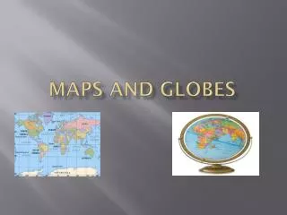
Globes and Maps. A globe is a scale model of the Earth that presents the most accurate depiction of geographic information such as area, distance, and direction. A printed map is a symbolic representation of all or part of the planet. . Great Circle Routes.

Globes and Maps
E N D
Presentation Transcript
Globes and Maps • A globe is a scale model of the Earth that presents the most accurate depiction of geographic information such as area, distance, and direction. • A printed map is a symbolic representation of all or part of the planet.
Great Circle Routes • A great circle is an imaginary line that follows the curve of the Earth and represents the shortest distance between two points. • Traveling along a great circle is called following a great circle route.
Projections • To create maps, cartographers project the round Earth onto a flat surface—making a map projection. • Distance, shape, direction, or size may be distorted by a projection. • The three basic categories of map projections are planar,cylindrical,and conic.
Projections (cont.) Planar Projection A planar projection shows the Earth centered in such a way that a straight line coming from the center to any other point represents the shortest distance. Also known as an azimuthal projection, it is most accurate at its center. As a result, it is often used for maps of the Poles.
Projections (cont.) Cylindrical Projection A cylindrical projection is based on the projection of the globe onto a cylinder. This projection is most accurate near the Equator, but shapes and distances are distorted near the Poles.
Projections (cont.) Conic Projection A conic projection comes from placing a cone over part of a globe. Conic projections are best suited for showing limited east-west areas that are not too far from the Equator. For these uses, a conic projection can indicate distances and directions fairly accurately.
Common Map Projections Most general reference world maps are the Winkel Tripel projection. It provides a good balance between the size and shape of land areas as they are shown on the map. Even the polar areas are depicted with little distortion of size and shape.
Common Map Projections (cont.) An interrupted projection resembles a globe that has been cut apart and laid flat. Goode’s Interrupted Equal-Area projection shows the true size and shape of Earth’s landmasses, but distances are generally distorted.
Common Map Projections (cont.) The Robinson projection has minor distortions. The sizes and shapes near the eastern and western edges of the map are accurate, and outlines of the continents appear much as they do on the globe. However, the polar areas are flattened.
Common Map Projections (cont.) The Mercator projection increasingly distorts size and distance as it moves away from the Equator. However, Mercator projections do accurately show true directions and the shapes of landmasses, making these maps useful for sea travel.
Determining Location • The basic tool for answering the question “Where?”is location. • A grid system on maps and globes helps you find exact places on the Earth’s surface. • A hemisphere is one of the halves into which the Earth is divided. Most places are located in two of the four hemispheres.
Determining Location (cont.) Latitude Lines of latitude, or parallels, circle the Earth parallel to the Equator and measure the distance north or south of the Equator in degrees. The Equator is measured at 0° latitude, while the Poles lie at latitudes 90°N (north) and 90°S (south). Parallels north of the Equator are called north latitude. Parallels south of the Equator are called south latitude.
Determining Location (cont.) Longitude Lines of longitude, or meridians, circle the Earth from Pole to Pole. These lines measure distance east or west of the Prime Meridianat 0° longitude. Meridians east of the Prime Meridian are known as east longitude. Meridians west of the Prime Meridian are known as west longitude. The 180° meridian on the opposite side of the Earth is called the International Date Line.
Determining Location (cont.) The Global Grid Every place has a global address, or absolute location. You can identify the absolute location of a place by naming the latitude and longitude lines that cross exactly at that place. For example, Tokyo, Japan, is located at 36°N latitude and 140°E longitude. For more precise readings, each degree is further divided into 60 units called minutes.
Determining Location (cont.) Northern and Southern Hemispheres The diagram shows that the Equator divides the Earth into the Northern and Southern Hemispheres. Everything north of the Equator is in the Northern Hemisphere. Everything south of the Equator is in the Southern Hemisphere.
Determining Location (cont.) Eastern and Western Hemispheres The Prime Meridian and the International Date Line divide the Earth into the Eastern and Western Hemispheres. Everything east of the Prime Meridian for 180° is in the Eastern Hemisphere. Everything west of the Prime Meridian for 180° is in the Western Hemisphere.
Reading a Map Key Title Scale Bar Compass Rose Capitals Boundary Lines Cities
Using Scale • All maps are drawn to a certain scale. • Scale is a consistent, proportional relationship between the measurements shown on the map and the measurement of the Earth’s surface.
Using Scale (cont.) Small-Scale Maps A small-scale map, like this political map of France, can show a large area but little detail.
Using Scale (cont.) Large-Scale Maps A large-scale map, like this map of Paris, can show a small area with a great amount of detail.
Absolute and Relative Location • Absolute location is the exact point where a line of latitude crosses a line of longitude. • Relative location is the location of one place in relation to another. Physical Maps • A physical map shows the location and the topography, or shape of the Earth’s physical features. • A study of a country’s physical features often helps to explain the historical development of the country.