Download
1 / 14
140 likes | 237 Views
A presentation on Butte Creek area and the Water Evaluation and Planning (WEAP) system. Includes analyses of hydrology, water management, and fish dynamics for effective water resource planning. Proposed work plan details model building, scenario development, evaluation, and scaling up in the South Lahontan region.

E N D
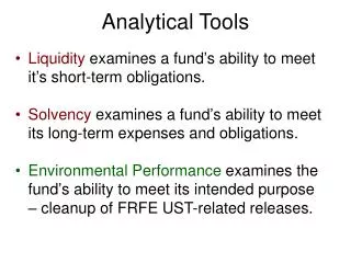
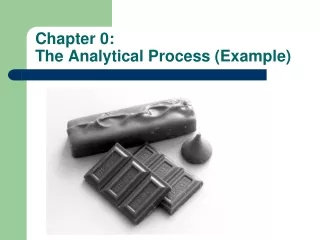
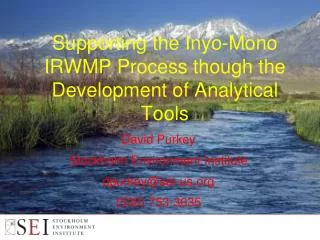
Supporting the Inyo-Mono IRWMP Process though the Development of Analytical Tools David Purkey Stockholm Environment Institute dpurkey@sei-us.org (530) 753-3035
Presentation Outline A side trip to Butte Creek An introduction to WEAP WEAP a the California Water Plan Update Ideas for WEAP and the Inyo-Mono IRWMP Conclusions
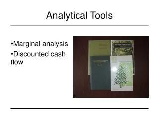
BUTTE CREEK SUBWATERSHEDS BUTTE CREEK AND FEATHER RIVER Feather River Butte Creek Area: Butte Creek: 382 km2 WB Feather River: 130 km2 Average Precipitation: 900-1700 mm/year
Pool Riffle Run Temperature Model Domain
Summer Survival of Adult Salmon Year Added 15,000 adults each spring Calculated proportion that survived to spawn Extinction criterion = 4 years with no survival
River Basin Assessment: Butte Creek Linked Hydrology/Management (WEAP) and Fish Dynamics Models (SALMOD)
WEAP: Hydrologic and water management model • Developed by Stockholm Environment Institute • Integrates watershed hydrologic processes with the water resources management system • Climatic information direct input • Based on a holistic vision of integrated water resources management – supply and demand
McCloud R. Trinity R. WEAP and the State Water Plan Sacramento R. Trinity Clear Ck Upper Pit R. Whiskeytown Shasta Pit R. 1 Cow Ck. Cottonwood Ck Battle Ck. Almanor Elder/Thomes Ck Big Chico Ck. North and Middle Fk. Feather R. East Park/Stony Gorge/Black Butte Butte Ck. Oroville Tehama-Colusa Canal South Fk. Feather R. Glen-Colusa Canal New Bullards Bar Stony Ck. Sutter Bypass North Fk. Yuba R. Middle and South Fk. Yuba R. Camp Far West Bear R. Clear Lake Cache Ck. Cross Canal North and Middle Fk. American R. Sacramento R. Yolo Bypass South Fk. American Berryessa Putah Ck. Folsom Cosumnes R. Camanche Pardee Mokelumne R. Net Delta Outflow DELTA New Hogan Calaveras R. Tulloch New Melones Stanislaus R. Delta-Mendota Canal California Aqueduct San Joaquin River New Don Pedro Tuolumne R. McClure Merced R. San Luis Eastman/Hensley Chowchilla/Fresno R. Eastside Bypass Madera Canal Millerton San Joaquin R. San Luis San Luis Canal Friant-Kern Canal James Bypass/Fresno Slough Pine Flats Kings R. Kaweah Kaweah R. Tulare Lake Success Tule R. Coastal Aqueduct Isabella Kern R.
WEAP for Inyo-Mono IRWMP Develop catchment modules to assess changes in hydrology in the eastern Sierra under climate change. Represent Mono Basin and Owens Valley water systems, including demands, infrastructure and operating arrangements. Focus in some detail on the ecosystem conditions in the Owens River Gorge part of the system (Butte Creek scale analysis). Perhaps, Expand to cover entire South Lahontan Hydrologic Region and integrate with State Water Plan WEAP application. Eventually, expand State Water Plan WEAP application to cover South Coast Hydrologic Region allowing for local and regional analysis of water management strategies.
Proposed Work Plan Task 1: Build WEAP Model of the Owens River Watershed Sub-Task 1.1: Information and Data Gathering Sub-Task 1.2: Characterize Watershed Sub-Catchments Sub-Task 1.3: Characterize Water Usage Sub-Task 1.4: Define Network Schematic and System Operations Sub-Task 1.5: Water Flow Model Calibration and Validation Sub-Task 1.6: Water Temperature Routines for the Owens River Gorge Task 2: Develop Scenarios Task 3: Evaluate Scenarios Task 4: Model Training Workshop Task 5: Scaling Up to the South Lahontan Hydrologic Region