Download
1 / 18
180 likes | 328 Views
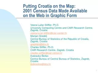
Putting Croatia on the Map: 2001 Census Data Made Available on the Web in Graphic Form. Vesna Lužar-Stiffler, Ph.D. University Computing Centre and CAIR Research Centre, Zagreb, Croatia vesna.luzar-stiffler@cair-center.hr Marijan Gredelj

E N D
Putting Croatia on the Map: 2001 Census Data Made Available on the Web in Graphic Form Vesna Lužar-Stiffler, Ph.D. University Computing Centre and CAIR Research Centre, Zagreb, Croatia vesna.luzar-stiffler@cair-center.hr Marijan Gredelj Central Bureau of Statistics of the Republic of Croatia, Zagreb, Croatia gredeljm@dzs.hr Charles Stiffler, Ph.D. CAIR Research Centre, Zagreb, Croatia charles.stiffler@cair-center.hr Dubravko Škrlec Central Bureau of Central Bureau of Statistics, Zagreb, Croatia dubravkos@dzs.hr
Outline • Introduction (Motivation) • Results: • Technical features and benefits • DEMO • Conclusions • Limitations • Future Developments
Introduction • Aim/Goal of this research: • to “digitalize” the government’s interface, so as • to provide faster data to the public, • at less expensive delivery costs of 2001 Census data. • Method (…or ways to improve customer satisfaction): • Since graphs (visualization) are better than tables, • Internet is better than printouts, and • drill-down is better than scrolling, the basic strategy was to use SAS (http://www.sas.com ) GRAPH with ODS to provide the Administrative Area/ Geographic Information System (AA/GIS) functionality • Tactic: After researching typical public usage behavior, the SW was used to develop • a logical search • logical comparison, • logical ranking, and • logical presentation of the 2001 Census Data
Tables vs. Graphs e.g., Ethnic diversity table:
Tables vs. Graphs Ethnic diversity map(w/ Croats):
Tables vs. Graphs Ethnic diversity map(w/out Croats):
Results: Technical Features and Benefits of the Administrative Area GIS • Technical features: • Developed using SAS base and GRAPH with ODS (Output Delivery System) and intensive macro programming (25+ macros) • New administrative borders (at the county/ municipality level) for the first time implemented and used in SAS GRAPH maps (based on coordinate data provided by Croatian Geodesic Institute) • 16 consult. days (design + development) • 1114 files (html [frame, content, body], gif) • 4000+ graphs (maps, bars, pies, pin charts, “pyramids”) • multiple links • No additional intervention in HTML code (generated by SAS ODS) was necessary • Full national language support (čžš) available
Results: Technical Features and Benefits of the Administrative Area GIS • Benefits: • Global view of demographic data (e.g., “diversity maps” for immediate insight) • Easy comparison, ranking, and identification of percentages (e.g., % illiterate) by geographic region (counties, municipalities), by name, or by rank (using “4 graphs views”) • Logical “drill-down” by geographic dimension (from counties to municipalities) • Individual graphs (maps, bars, pies, pin-charts, “age pyramids”) are readily available for download
Results: DEMO • Site map • Ethnicity graphs and “drill-down” • Population by education • Main Table (“Other attributes”) • Age pyramids • Population density
graphs density graphs graphs graphs Other education gender ethnicity graphs graphs age pyr. age households % by counties % by counties % by municip. % by municip. % by counties % by counties % by municip. % by municip. % by counties % by municip. Site map (http://www.dzs.hr/Eng/Census/census2001.htm)
graphs ethnicity education gender Other graphs age households % by counties % by municip. DEMO: Ethnicity graphs
graphs ethnicity education gender Other graphs age households % by counties % by municip. DEMO: Population by education
graphs ethnicity education gender Other age households DEMO: Main Table (“Other”)
graphs ethnicity education gender Other age pyr. age households DEMO: Age Pyramids
graphs density ethnicity education gender Other age households DEMO: Population Density
Conclusions • Aims were accomplished due to: • SAS/ ODS flexibility in creating HTML linked files, tables, graphs • CBS staff expertise, collaboration with CAIR Research Center (http://www.cair-center.hr ) • AA/ GIS data made available with the cooperation of Croatian State Geodetic Administration
Conclusions • Limitations: • Pilot project (time & budget constraints) • 4 demographic tables only (more later) • Graph types limited to maps, bar/pie/”pin” charts, pyramids (customer key needs) • Dimensionality (1-2 variables at the time) • GIF graphics files used only (because Java, Activex were too large and slow) • Lowest administrative unit was municipality • Zagreb town “quarters” AA/GIS data not available at development time
Conclusions • Future developments: • English version • Additional tables and attributes (e.g., financial/economic) • Multiple variable analyses/presentations • “drill-down” to the lower level administrative units (settlements) • Zagreb town quarters AA/GIS data • Fully functional street-level SAS/GIS?