Download
1 / 21
210 likes | 227 Views
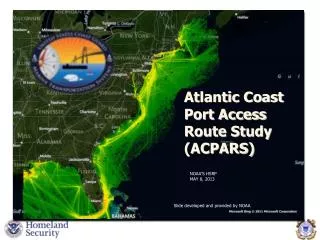
Atlantic Coast Port Access Route Study (ACPARS). NOAA’S HSRP MAY 8, 2013. Slide developed and provided by NOAA. AGENDA. Definition of PARS Background Interim ACPARS Report ACPARS Process Overview Phases 1 and 2 Summary and Conclusions AIS Phase 3 - Modeling and Analysis Future.

E N D
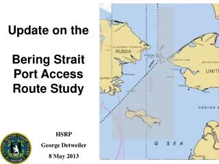
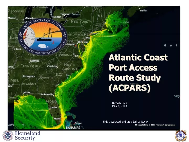
Atlantic Coast Port Access Route Study(ACPARS) NOAA’S HSRP MAY 8, 2013 Slide developed and provided by NOAA
AGENDA • Definition of PARS • Background • Interim ACPARS Report • ACPARS Process Overview • Phases 1 and 2 • Summary and Conclusions • AIS • Phase 3 - Modeling and Analysis • Future
PORT ACCESS ROUTE STUDY (PARS) • PWSA requires Coast Guard to conduct a PARS before establishing new or adjusting existing fairways or TSS’s. • Consult/coordinate with Federal, State, and foreign state agencies (as appropriate) and maritime community representatives, environmental groups, and other interested stakeholders. • Primary purpose of this coordination is, to the extent practicable, to reconcile the need for safe access routes with other reasonable waterway uses. • PARS process (complete or modified) may be used to determine and justify if safety zones, security zones, recommended routes, regulated navigation areas and other routing measures should be should be created.
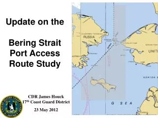
ATLANTIC COASTPARS • Marine Spatial Planning • Characterize existing MTS/Shipping Routes • Balance multiple uses • Ensure safe access routes • Wind Energy Initiatives • Cooperating Agency • Navigational Conflicts • Cumulative Impacts Source: NOAA
INTERIM ACPARS REPORT • Interim report finished • Announced in Federal Register on 11 SEP 2012 • 30 day comment period ended on 11 OCT 2012 • Is available on website www.uscg.mil/LANTAREA/ACPARS • Comments directly to ACPARS@USCG.MIL • Report shared with government partners before announcement • Report shared with stakeholders
ACPARS PROCESS OVERVIEW Phase 1 - Data Gathering Phase 2 - Determine existing shipping routes and apply the R-Y-G Methodology Phase 3 - Modeling and Analysis Phase 4 - Implementation of StudyResults
UK Maritime Guidance Note MGN-371 RED YELLOW GREEN
SUMMARY AND CONCLUSIONS Impact to Shipping • Will increase risk of allision • May increase risk of collision • May increase risk of grounding Establishment of WEAs • R-Y-G is defensible • Leaves moderate conflicts available for further study • Highlights area of concern Cumulative Impacts of Wind Farms • A primary objective of ACPARS assess cumulative impacts to MTS • Displacement, Funneling, Increased Density • Cascading effects
SUMMARY AND CONCLUSIONS Establishment of Routing Measures • Existing system of traditional routes is complex • Determining nav impacts as a result of a significant change to routing is beyond capabilities of the WG • Routes should not be created without full analysis Tug and Barge Routes • Most direct and safe route • Vary based on weather, sea state and depth of water • WEAs could force tug and barges further inshore or offshore • Increase congestion at port entrances • Higher sea states offshore • Mixing of vessel types (slow vs. fast moving)
SUMMARY AND CONCLUSIONS Deep Draft Routes • Coastwise routes further offshore • Higher conflict with next round • Higher conflict at harbor approaches • Proposed WEAs would require modification or elimination of some routes Risks of Postponing Assessment of Navigational Impacts • EA for leases only evaluates impacts due to site assessment & site characterization activities • Navigation Safety Risk Assessment → COP • Removal of areas late in process could hamper wind development efforts • USCG has recommended impacts be evaluated prior to establishing WEAs Other Offshore Energy Installations • Emphasis currently on Wind • Future “All of the Above Approach” for Oil/Gas, hydrokinetics, other uses
PHASE 3- MODELING AND ANALYSIS • Develop a GIS based model to predict traffic density and traffic patterns given alternative siting scenarios • Determine the resultant nav safety risk • Increased density • Mixing of vessel types • Risk of allision • Risk of collision • Evaluate mitigation measures • Has commenced – PNNL • BOEM funded • USCG provided AIS data for 2010, 2011, and 2012 • Expert panel for PNNL modeling and analysis • Technical panel for PNNL modeling and analysis
PNNL Deliverables and Milestones • Data Analysis • Model Setup • Decision Tree and Scenario Development • Presentation of interim results – • May - June 2013, Washington, DC • Deliverables – November 2013 • Processed AIS Data • Visual displays of existing shipping routes and operational areas, with BOEM lease blocks • Numerical model in executable form • Final report • Presentation of final results – Washington, DC
FUTURE • Publish 2nd Interim Report/comment period after PNNL interim results • PNNL finishes analysis and modeling tool (Phase 3) • Publish Final ACPARS report/comment period • Public outreach to present report/gather input concerning recommendations • Provide input to BOEM concerning all the WEAs • PHASE FOUR - Implement study recommendations • Routing measures • IMO papers • Regulations • Other mitigation measures
QUESTIONS “We Help Mariners Get There” COMMANDANT (CG-NAV-3) ATTN: NAVIGATION STANDARDS DIVISION US COAST GUARD 2100 2ND ST SW STOP 7580 WASHINGTON, DC 20593-7580 George Detweiler George.H.Detweiler@uscg.mil 202-372-1566 (office) 202-372-1991 (fax)