Download
1 / 25
260 likes | 591 Views
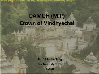
DAMOH (M.P) Crown of Vindhyachal. Prof. Madhu Tyagi Dr. Neeti Agrawal SOMS. Map of Damoh District. District Profile.

E N D
DAMOH (M.P)Crown of Vindhyachal Prof. Madhu Tyagi Dr. Neeti Agrawal SOMS
District Profile • The existence of Damoh can be traced back to ancient times and has been mentioned in the Ramayana as Damayantipur after the name of queen Damyanti , wife of the legendary king Nal. • It is situated between 23.50 north latitude and between -79.30 east longitude . • The tropic of cancer passes through the southern part of district. • Damoh is located in the revenue division of Sagar, among rising hills and flowing rivers, in the central part of Madhya Pradesh and is accessible through rail . • It lies on Bina –katni railway line of western –central Railway. • It is famous for the Jain tirth Kundalpur ,40 kms from the district headquarter. • The famous Shiva temple Jageshwarnath Mandir is situated 16 kms away from district headquarter. • Damoh district is predominantly a backward class district.
About Damoh • Area is 7306 sq. km. • Height is 34 metres from the sea level. • Length is about 145 km in the North- South direction and 80 km in the East West direction.
Profile • Area 7,3,06 Sq. kms. • Geo-Location 23-09-0 N and 79-03-0 E • Roads • National Highway SH- 37 (183 KM) State Highway • Tar Road 1437 KM • Other Road 1112 KM
Profile • Electrification • Electrified Villages 1110 • Non Electrified Villages 274 • ICDS Projects 8 • Anganwadi Centres • Rural 932 • Urban 125 • Total 1057 • Ration Shops • Rural 390 • Urban 41 • Total 431
Profile • Villages 1229 • Habitiated Villages 1188 • Unhabitiated Villages 41 • Forest Villages 0 • Towns (Urban) 5 • Revenue Sub Divisions 3 • Tehsils 7 • Sub Tehsils 1 • Zila Panchayat 1 • Janpad Panchayat 7 • Gram Panchayat 461
Profile • Assembly Segments 4 • Post Offices 1 • Branch Post Offices 29 • Police Stations 17 • Goverment Degree Colleges 4 • Goverment PG Colleges 2 • Govt. Higher Sec. Schools 32 • Govt. High Schools 44 • Govt. Middle Schools 520 • Govt. Primary Schools 1424 • Central School 1 • Navodaya School 1 • Registered Unemployed 3036
Geographical background Chattarpur Panna Tikamgarh N W E Damoh Jabalpur S Sagar
Geographical Background • Forest area 4135 sq. km. • Cultivated area 1655 sq. km. • Double crop area 832 sq. km. • Irrigated area 917 sq. km
Economic Status • Most of the people at Damoh live in rural areas and below the poverty line. • The only industry at Damoh is the diamond cement factory . • Major mode of living is agriculture. • The other main source of income is Bidi making. • Damoh district is economically backward because of unfertile land and lack of irrigation sources . • Each member of the family including children assist the elders to improve the economic condition of their families. • The school dropouts is high in this area.
Social Profile • Predominant castes • About 80% people live in rural areas. • The society is still under the impact of old traditional values and the people have prejudiced and superstitious views towards life. • This adversely affects education, specially the education of girls.
Social Profile • Data as per census 2001 • Total 211258 (19.5% of SC) lived out • 171391 lived in urban area • 39867 lived in rural area • Blocks Hatta and Patharia haveapproximately 25% of SC population • Unawareness towards education reflects as only 21.5% of SC students are enrolled in Schools • district is dominated by OBC which constitutes about 50% of the total population
Tribal scenario • The district has 12.6% of the tribal population that means 136175 ST people lived in district out of which urban population is 4334 and rural is 131841. • Out of total govt. school enrolment ST are only 15% . • Blocks Jabera and Tendukheda have predominantly the tribal community. • Gonds and Pardhi are the two main sub castes of the tribes in district
Position of women • Sex ratio in rural areas is 903 while it is 905 in urban areas. • The sex ratio in Block Hatta and Patharia is of major concern as it is lower than 900. • The female literacy rate is 47.3% showing the growth of 16.84% during the decade. • 47% girls from total population are enrolled at elementary level.
Migration • Why? • Less job opportunities; • No other means of livelihood except agriculture or bidi making; • Very less industrialisation to create job opportunities.
Population • The total population of Damoh as per census 2001 is 10,81,909. • 5,68,704 are males ; • 5,13,205 are females; • Density of population is 148 persons per sq. km. • Overall sex ratio of the district is 902.
Population • BLOCK TOTAL RURAL URBAN • Batiagarh 900 900 - • Damoh 897 890 905 • Hatta 889 889 886 • Jabera 919 919 - • Patera 906 906 - • Patharia 894 894 893 • Tendukheda 920 921 - • Total 902 903 905
Distribution of Urban population • TOWN MALE FEMALE TOTAL • Batiagarh - - - • Damoh 77473 69950 147423 • Hatta 15141 13373 28514 • Jabera - - - • Patera - - - • Patharia 9070 8115 17185 • Tendukheda 5897 5332 11229 • Total 107881 96770 204651
General Administration • District Head Quarters - Damoh • Blocks - 07 • Tehsils - 07 • Gram Panchayats - 456 • Zila Panchayat - 01 • Sub Divisions - Damoh, Hatta & Tendukhera • Revenue Villages - 1229 • Deserted Villages - 35
Administration • The District is divided into seven non tribal blocks; • Hatta in the north east; • Batiagarh in the north west; • Patharia in the west; • Jabera in the east; • Tendukheda in south; Patera in the east; • Damoh at the centre..The growth in literacy in the last decade had been rapid. There had been a growth of almost 17% in female literacy in the rural areas. The efforts for the universalization of elementary education through programmes like DPEP and SSA would raise this growth to a much higher level in this decade
Population in Rural and Urban Areas • AREA TOTAL MALE FEMALE • Rural 879298 462348 416950 • Urban 204651 107881 96770 • Total 1083949 570229 513720
Issues of Concern • High dropout rate at elementary level; • Migration of the unemployed; • Economic Status; • Social status. • How then to increase the GER in HIGHER Education?
Strategies (Plan of action) • Field visit; • Sensitization of the work place; • To figure out the actual need of the area; • Meetings with the authorities at centre as well as block levels to get the present status of the district; • Conducting workshops to sensitize the population about the importance of education; • DPEP and SSA have been active in the area. To liaison with them to asses the educational needs of the area. • Liasoning with the RC at Bhopal.
Sources • Google images • damoh.nic.in/ • www.mapsofindia.com