Download

1 / 21
210 likes | 246 Views
Learn about the history and progress of the Cape Fear Skyway project in New Hanover and Brunswick Counties, North Carolina, as it aims to provide enhanced transportation infrastructure. The project includes feasibility studies, development plans, and key milestones achieved and anticipated.

E N D
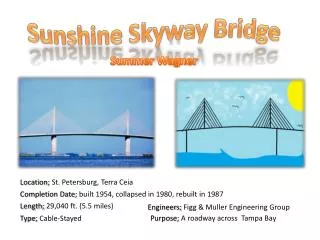
Cape Fear Skyway STIP Project No. U-4738 Federal Aid Project No. STP-0017(53) WBS No. 40114 New Hanover and Brunswick Counties, North Carolina October 14, 2009
Cape Fear Skyway STIP Project No. U-4738 Federal Aid Project No. STP-0017(53) WBS No. 40114 New Hanover and Brunswick Counties, North Carolina October 14, 2009
Project History • “Southern Outer Loop” • Project from 1993 Thoroughfare Plan • Described part of this loop as the “Southern Bridge” – an extension from Independence Blvd. northward to Eagle Island to interchange with US 74/76
1993 Thoroughfare Plan Proposed Southern Outer Loop
Project History • Project described as “Southern Bridge” in Greater Wilmington Urban Area Transportation Plan 1999-2025 • Revised description to have western terminus at existing US 17 and proposed Wilmington Bypass (I-140) interchange • 2025 Plan removed “Southern Outer Loop” project completely
Project History • Included in current WMPO Long Range Transportation Plan (2030) as “Cape Fear Skyway” • Described as a project that extends east from US 17 at the proposed I-140 (Wilmington Bypass) interchange, across the Cape Fear River, to Independence Boulevard at US 421. • Listed as one of six priority projects in the 2030 Plan. • Included in the Strategic Highway Corridor Initiative and the NC Intrastate System
2005 Thoroughfare Plan Proposed Southern Bridge
The I-140 Loop “B” I-140 “A” FUTURE I-140
I-140 and the Cape Fear Skyway Study Area Future I-140 Cape Fear Skyway Study Area
Feasibility Study Alignment - 2003 Cape Fear Skyway
Brunswick Forest Development Plan Mallory Creek Brunswick Forest Proposed New Development
Brunswick Forest – Current Development Mallory Creek Brunswick Forest Proposed New Development
Additional Preliminary Alignment Segments Mallory Creek Brunswick Forest Proposed New Development
Potential New Corridors Mallory Creek Brunswick Forest Proposed New Development
Project History • Feasibility Study in 2003 by NCDOT • Current WMPO LRTP adopted in 2005 • Agency Scoping Meeting – January 13, 2006 • Citizen’s Informational Workshops – April 10, 2006 and April 11, 2006 • Notice of Intent – May 11, 2006 • Project included in NCDOT’s 2009-2015 STIP
Project Status • Preliminary design and planning studies are currently being developed • Purpose and Need Statement • Alternatives Screening
Project Status – Milestones Achieved • Prepared Draft Section 6002 Coordination Plan • Prepared Draft Purpose & Need Report • Prepared Draft Alternatives Screening Analysis • Prepared Draft Bridge Study Report • Conducted Preliminary Field Studies • Prepared functional design plans for bridge crossing area
Project Status – Anticipated Milestones • Draft Environmental Impact Statement March 2011 • Final Environmental Impact Statement March 2012 • Record of Decision September 2012