Download
1 / 28
280 likes | 477 Views
Global Precipitation Measurement Mission Developed by Kristen Weaver GPM Master Teacher NASA Goddard Space Flight Center. Erosion and Landslides Lesson. Guiding Questions. Erosion: How can soil and other materials be moved from one place to another?

E N D
Global Precipitation Measurement Mission Developed by Kristen Weaver GPM Master Teacher NASA Goddard Space Flight Center Erosion and Landslides Lesson
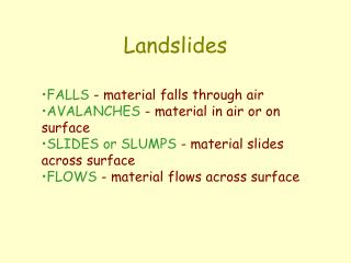
Guiding Questions Erosion: How can soil and other materials be moved from one place to another? Landslides: What are landslides and how do they occur? Landslides Inquiry Lab: How will different types of soil affect how much precipitation it takes to cause a landslide? Predicting landslides: What do we need to know to predict when and where a landslide may occur? How can we get that data? Using Satellites: How can we measure precipitation from space, and why do we want to? Risk and Preparation: What areas are currently at risk for landslides? What can people do to prepare?
Engage • Look at the different types of soil in the tray in front of you. How many ways can you think of to move the material from one side of the tray to the other? Image Source: Microsoft Office Clip Art
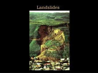
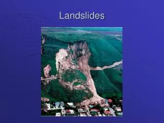
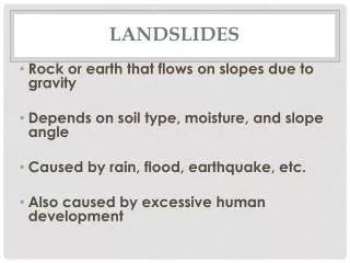
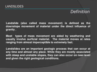
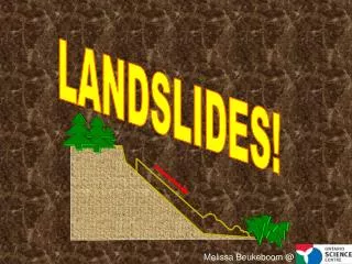
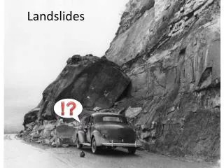
Landslides • What is a landslide and what causes one? A landslide is defined as "the movement of a mass of rock, debris, or earth down a slope" (Cruden, 1991). Landslides are a type of "mass wasting," which denotes any down-slope movement of soil and rock under the direct influence of gravity. Source: USGS Landslide FAQ • What variables might affect whether a landslide occurs at a particular time and place?
What causes a landslides? • Landslide: a rapidly moving mass of debris, rock, earth, and/or mud triggered by intense and/or prolonged rainfall, earthquakes, freezing, coastal/river weathering, and human influence
Landslides Lab • Ingredients for a landslide • Steep Slopes • Weak soil • Rain • Earthquakes • Human activity La Conchita landslide, California in 2005 Destroyed 13 houses, severely damaged 23 others, and caused 10 fatalities.
Landslides Lab • Today, you will investigate one of those variables – type of soil – and how much precipitation it takes to start a landslide. Make sure you follow the lab directions and make careful observations as you proceed.
Lab Results • Was your hypothesis supported by the data? Explain.
Landslides: Why study them? Landslide observed from EO-1 Satellite ALI instrument in August, 2010 in China • They happen all over the world • They kill thousands of people each year and cause extensive property damage
Vargas State, Venezuela, December 1999 Fatalities: 30,000 Laguna Beach, CA June, 2005 La Jolla, CA October, 2007 Gansu Province, China August 2010, Fatalities: 1,765
Predicting Landslides • What do we need to know to be able to predict landslides? • How can we get that data?
Landslide Risk in the U.S. • Landslide risk levels in the continental United States Risk potentials: red = very high, yellow= high, green = moderate (Note: landslides can still happen in the black areas, but the potential is low)
Tracking Precipitation from Space • As you saw in the experiment, knowing how much rain is falling in an area is very important to predicting when and where a landslide may occur. Scientists are using satellites, such as the Tropical Rainfall Measure Mission (TRMM) to track that data. Soon, the Global Precipitation Measurement (GPM) satellite will launch, improving the data and extending its range.
Landslide modeling with satellite data SRTM Topography Data, 30m MODIS Land Cover, 500m
Landslide Risk Hotspots These maps show areas currently at high risk for landslides, based on precipitation data from TRMM. Click on the image for a website with the most recent data.
How can we make better predictions? • Satellites can provide a more complete picture of rain from space, allowing scientists to look at storms, rainfall totals, and changes throughout days to years • The Tropical Rainfall Measuring Mission (TRMM) has been providing rainfall data since 1998 in the tropics and mid latitudes • The Global Precipitation Measurement (GPM) Mission will extend observations of rain and snow up to the Arctic and Antarctic Circles
Global Precipitation Measurement (GPM) The GPM Core Observatory will provide improved measurements of precipitation from the tropics to higher latitudes GPM is an international mission which will use inputs from an international constellation of satellites to provide improved space and time coverage of precipitation (rain, snow) over the globe
GPM: Too Much, Too Little • Why do we need to measure precipitation using satellites?
Landslide Research • You will now research landslide risks, and use that information, plus data from your own experiment, to create a public service announcement for one of the areas currently in danger of a landslide, you may create a poster, script or any other form of presentation approved by your teacher. • Be sure that your announcement includes: • A description of what a landslide is • A description of and data from your own experiment • Data from TRMM/GPM about where is currently at risk for landslides • How to prepare in case of a landslide • Some kind of diagram or visual aid
Landslide Research • Possible sources for research: • USGS Landslides Hazards Program: http://landslides.usgs.gov/ • Most current data from TRMM about landslide hazards locations: http://trmm.gsfc.nasa.gov/publications_dir/potential_landslide.html • Landslide Hazards Publication: http://pubs.usgs.gov/fs/2005/3156/2005-3156.pdf • Preparation for Landslides: http://www.ready.gov/landslides-debris-flow
Stay Connected! • Follow us on Twitter: @NASA_Rain • “Like” us on Facebook: www.facebook.com/NASA.Rain • Precipitation Education Website: pmm.nasa.gov/education
Extension: Faces of GPM Meet a scientist who studies landslides! • Dr. Kirschbaum discusses her role with GPM, how she became a scientist, and how remotely sensed satellite data can be used to study and evaluate natural hazards such as landslides.
The GPM Core Observatory will carry two instruments that can view precipitation (rain, snow, ice) in new ways and connect measurements to those taken on other partner satellites GPM Core Observatory GPM Microwave Imager (GMI): 10-183 GHz 13 channels that provides an integrated picture of energy emitted by precipitation, including light to heavy rain to falling snow (Ball Aerospace) Dual-frequency Precipitation Radar (DPR): Ku-Ka bands Two different radar frequencies that can look at precipitation in 3-D throughout the atmospheric column (JAXA)
Landslides: dynamic agent, destructive force Mars Reconnaissance Orbiter and the on-board HiRISE camera took this image of a landslide in the Zunil Crater, which may have been triggered by a Marsquake or small impact NASA/JPL/University of Arizona www.bbc.co.uk/
Landslides: landscape catalyst, destructive force Can you spot the landslide? The impact of a meteorite near the edge of Noctis Labyrinthus on Mars appears to have set off an enormous landslide into the canyon. Landslides happen on Mars and other moons as well!