Download
1 / 12
120 likes | 279 Views
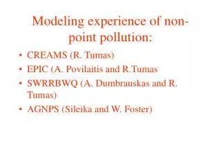
Modeling experience of non-point pollution:. CREAMS (R. Tumas) EPIC (A. Povilaitis and R.Tumas SWRRBWQ (A. Dumbrauskas and R. Tumas) AGNPS (Sileika and W. Foster). ARS (Agricultural Research Station) models development.

E N D
Modeling experience of non-point pollution: • CREAMS (R. Tumas) • EPIC (A. Povilaitis and R.Tumas • SWRRBWQ (A. Dumbrauskas and R. Tumas) • AGNPS (Sileika and W. Foster)
ARS (Agricultural Research Station) models development. • In response to the Clean Water Act, ARS assembled a team of interdisciplinary scientists from across the U.S. to develop a process-based, nonpoint source simulation model in the early 1970s. • CREAMS is a field scale model designed to simulate the impact of land management on water, sediment, nutrients and pesticides leaving the edge of the field. A number of other ARS models such as GLEAMS, EPIC, SWRRB and AGNPS trace their origins to the CREAMS model.
EPIC modelErosion/Productivity Impact Calculator Topography • Weather Input data Nitrogen (N) in wet deposition Land management practices Soil Crop/vegetation 83 Subprograms • Nitrogen leaching Outputs Daily-monthly-annual Soil erosion Nitrogen transport by surface runoff
The EPIC computer model requires four input data groups: climate, soil, topography and management. Climate input data include daily maximum and minimum weather temperatures, solar radiation, rainfall and concentration of nitrogen in rainfall. In addition, if the Penman’s potential evapotranspiration equation is used, the relative humidity and wind speed data should be included. Soil input data parameters include soil albedo, drainage code, initial soil water content, bulk density, soil texture, soil pH, sum of bases, organic carbon, calcium carbonate, cation exchange capacity, 1/3 and 15 bar soil water contents, nitrate concentration, labile P concentration and saturated conductivity. The topography data include the following physical features: basin drainage area, average steepness, average slope length, roughness factors and aspects. The management data requires the land use information. Thus, an information about the management practices of each land type was collected. For instance, the information about the types and dates of tillage, planting and harvesting.
Nitrogen concentrations in drainage water for the calibration period.
The mentioned above parameters have been collected for each 44 Lithuanian district separately and inserted into the EPIC model’s data files. Daily-based data on rainfall, minimum and maximum weather temperatures as well as solar radiation collected for this study from seven meteorological stations, which locations are characteristic to the different regions of Lithuania. The data for 1978-1994 period have been taken into account. Hydrophysical and agrochemical soil characteristics for each district were adjusted according to the soil type and soil texture from the national data base as well as the data on topography. The mineral fertilization rate for grain crops consists of 60 N kg/ha per year. Consequently, this value is taken for all simulations to all the districts under the cropping system scenario. Fertilization application rate for phosphorus is taken as zero. As all the necessary data are collected, 44 computer simulations pertaining to all the data from all the districts in Lithuania have been conducted. The nitrogen leaching and transportation by the surface runoff are calculated for the agricultural land (grain cropping system scenario) excluding settlement areas, gardens, roads, forests and water bodies.
Modeling by EPIC results The low values of inorganic nitrogen leaching are estimated mainly in Middle Lithuania (up to 15 kg/ha), where soils are of high water holding capacity and annual precipitation is low (less than 600 mm). In the North part of this Middle region, where the actual percentage of loamy sands is very high, the average annual amount of leaching contains from 15 to 30 N kg/ha. Very high nitrogen leaching is estimated in the Western part of country where the precipitation yearly amount is the highest (800-900 mm) - 40 N kg/ha and more.
The U.S. Department of Agriculture's (USDA) Simulator for Water Resources in Rural Basins-Water Quality (SWRRBWQ) was developed to simulate hydrologic, sedimentation, and nutrient and pesticide transport in a large, complex watershed. The model operates on a continuous time scale and allows for subdivision of basins to account for differences in soils, land use, rainfall, etc. It can predict the effect of management decisions on water, sediment, and pesticide yield with reasonable accuracy for ungaged rural basins.
Results of modeling by SWRRBWQ. Basin of Nevezis headwater 1090 km2 for years 1980-2024
The AGNPS (Agricultural Nonpoint Source Pollution) model was developed by the Agricultural Research Service (ARS) in cooperation with the Minnesota Pollution Control Agency and Soil Conservation Service
The model predicts run off volume and peak rate, eroded and delivered sediment, and nitrogen, phosphorus, and chemical oxygen demand concentrations in runoff and sediment for single storm events for all point of watersheds The AGNPS model's nitrogen concentration versus the average observed in the Rusne polder in 1993-1995.