Download
1 / 26
260 likes | 284 Views
Explore the constructive and destructive forces that shape Earth's surface through processes such as weathering, erosion, and deposition. Learn about the agents responsible and the various landforms they create. Discover how streams, rivers, glaciers, ocean waves, wind, and mass wasting contribute to the constant change of our planet's surface.

E N D
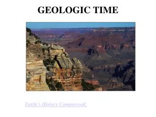
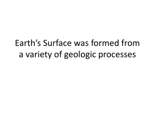
Earth’s Surface was formed from a variety of geologic processes
Constructive vs. Destructive • Constructive force – processes that build up Earth's crust, create new landforms, or add sediment to existing areas of land • Destructive force – processes that break down rocks and landforms and carry sediment away
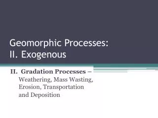
Weathering • Process by which rock materials are broken down • 2 kinds • Mechanical Weathering • Chemical Weathering
Mechanical Weathering • Breakdown of rock into smaller pieces by PHYSICAL means • Ex: Ice, wind, water, gravity, plants, animals
Chemical Weathering • The process by which rocks break down as a result of CHEMICAL reactions • Ex: Water, Acid Precipitation, groundwater acid, acid in living things, air
Erosion • The process by which soil and sediment is transported from one location to another
Deposition • The process by which sediments are released (dropped).
Agents responsible for Weathering, Erosion, and Deposition • Running Water (Streams and Rivers) • Moving Ice (Glaciers) • Ocean Waves • Wind • Mass Wasting (Huge amounts of rock/sediment moving downhill)
Streams and Rivers • Erosion starts upstream and deposition happens downstream • Sediment is smooth because of weathering (water rolling over the sediment) • Young rivers have faster erosion • Mature Rivers have more deposition • Deposition happens mostly at mouth of ocean/lake and inside bends of rivers/streams
Factors Making Faster Erosion • Shape of channel – Narrow and V shaped • Gradient (Slope) – Steep • Velocity (Speed) - High
Factors Making Deposition Faster • Shape of Channel – Wider • Gradient (Slope) – Gentler • Velocity (Speed) - Low
Floodplains • A nearly flat expanse of land that stretches from the banks of a slow, meandering river
Glaciers’ Erosion • Glacier - a large body of snow and ice that forms on land and does not melt annually • Creates U shaped valleys • Smooth bedrock beneath and on sides of valley • Rocks trapped in glacier cut lines into bedrock
Depositional Features of Glaciers • Moraines – deposit of sediment that forms at the edge of a glacier as it pauses • Till – Sediment directly deposited by glacial ice as it melts
Depositional Features of Glaciers • Drumlins – Hills molded from till by glaciers moving over it • Outwash Plains – Broad, flat area in front of a glacier where large amounts of sediment are deposited by glacial melt water
Depositional Features of Glaciers • Kettles – Large depression left when ice melts • Kettle lakes form when water wills the depression • Erratic – a rock or boulder that differs from the surrounding rock and is believed to have been brought from a distance by glacial action
Depositional Features of Glaciers • Eskers – A long, narrow, winding ridge composed of sand and gravel deposited by a glacier.
Weathered Features of Ocean Waves • Cliffs – A vertical, or near vertical, rock exposure • Sea Stacks – landform consisting of a steep and often vertical column or columns of rock in the sea near a coast.
Erosional and Depositional Features of Ocean Waves • Beach – Sand is deposited by waves • Spits - A depositional landform found off coasts where at one end, spits connect to land, and extend into the water
Erosional and Depositional Features of Ocean Waves • Barrier Islands – a coastal landform and a type of barrier system, are exceptionally flat and lumpy areas of sand, that are parallel to the mainland coast
Wind • Weathering, erosion, and deposition by wind is common in: • Arid reqions with no veggitation so sediment is exposed. • Along costal regions where wind is active • Deserts where sandblasting occurs
Wind Landforms • Yardangs - A hill carved from bedrock by the dual action of wind abrasion, from dust and sand • Unique Rock Textures • Dunes – Hills formed by deposition of sand • Along coasts and in deserts
Erosion and Deposition from Mass Wasting • Materials such as rock and sediment move downhill because of gravity • Threat to humans and their property • Mass wasting can be: • Dry or wet • Slow or fast • Large chunks or small particles
Erosion and Deposition from Mass Wasting • Avalanches – a rapid flow of snow down a sloping surface • Soil Creep – the slow downward progression of rock and soil down a low grade slope
Erosion and Deposition of Mass Wasting • Mudslides – a rapid movement of a large mass of mud formed from loose dirt and water • Rockfall – quantities of rock falling freely from a cliff
Erosion and Deposition of Mass Wasting • Landslides - the sudden movement of large amounts of loose soil, rocks, and other materials as they fall or slide downward due to gravity