Download
1 / 21
210 likes | 352 Views
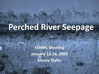
Perched River Seepage. ESHMC Meeting January 13-14, 2009 Stacey Taylor. Outline. Review of ESPAM 1 Overview of current techniques used to calculated perched river seepage (bed loss) in ESPAM 1 Other methods of predicting stream discharge in ungaged basins Conclusions Next Steps.

E N D
Perched River Seepage ESHMC Meeting January 13-14, 2009 Stacey Taylor
Outline • Review of ESPAM 1 • Overview of current techniques used to calculated perched river seepage (bed loss) in ESPAM 1 • Other methods of predicting stream discharge in ungaged basins • Conclusions • Next Steps
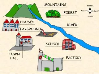
Review of ESPAM 1 • Perched river seepage is an input to the GIS recharge tool • Perched rivers that are seeping include river seepage for streams and rivers other than the Snake River • Most data was gathered from IDWR and old watermaster records and summarized to appropriate stress period lengths • Data was limited so methods were developed to interpolate missing periods
Need to add Beaver Creek Perched River Seepage Sites for ESPAM 2 For these sites, we can make possible improvements For these sites of perched river seepage, we have enough data
Current Techniques Camas Creek & Lone Tree • Based on difference in flow between 2 gaging stations • Looked for the best predictor of bed loss based on r-squared and visual inspection of scatter plots
Current Techniques (cont.) Camas Nat. Wildlife Refuge and Mud Lake • Perched river seepage for the wildlife refuge has surface water deliver volumes recorded by the watermaster (values are applied in the perched river seepage calculation • In some years, Camas Creek supplies Mud Lake so these flows are applied as perched river seepage. • During high water years, water is pumped from Mud Lake to the desert south of the farmlands and this is applied as perched river seepage
Current Techniques (cont.) Medicine Lodge Creek • Seepage found by subtracting diversions from gaged flow at Medicine Lodge near Small, ID for years after 1985. This data was compared to Big Lost River and linear regression was applied to years prior to 1985
Current Techniques (cont.) Birch Creek • Prior to 1987 (before hydropower plant), gage used and predictions made based on Birch Creek diversions. Linear regression was used for months when gage was not active. • After 1987, entire flow of Birch Creek was delivered to the plant and applied as irrigation; these discharge records were obtained for calculating bed loss.
Current Techniques (cont.) Little Lost River and LLR Flood Control • Perched river seepage calculated as difference in flow at the LLR gage and diversion volumes to 2 entities (IESW008 and 51) • Gaging station near Howe ceased functioning in 1991; linear regression was based on precipitation at Howe
Current Techniques (cont.) Big Lost River • Gage data complete for entire calibration period Big Wood River • Mostly represented with no perched river seepage; gage data available where it is perched Little Wood River • Gage data available for entire calibration period Twin Falls Canal and Lake Murtaugh
Prediction Methods Regionalization - transfer flow record based on linear regression using other predicting factors such as precipitation, diversions, or other similar basins (current technique used) • Quillian & Harenberg (1982) • Kjelstrom (1998) & Lipscomb (1998) • Hortness & Berenbrock (2001) • USGS StreamStats • Horn (1987)
Prediction Method 1Quillian& Harenberg(1982) • Multivariate regression analysis for ungaged sites in Idaho • Form of regression equation used: Y = b0x1b1x2b2 ... Xkbk Y is the dependent variable (average streamflow) and streamflowcharacteristic of interest; x1, x2, …, xk are independent; b0, b1, b2, …, bk are regression coefficients • Divided Idaho into 9 regions and developed separate regression equation for each • Basin area, mean annual precip, % forest cover, longitude of station, and mean basin elevation were used in one or more of the equations (regionalization) • May be too general for our purposes based on the 9 regions
Prediction Method 2Kjelstrom (1998) & Lipscomb (1998) • Kjelstrom developed method for estimating the 20, 50, and 80 percent monthly exceedance discharge values for the Salmon and Clearwater River Basins in central Idaho • Kjelstrom collected 73 gage station data to relate mean monthly discharge to daily mean discharges that are exceeded 20, 50, and 80 percent of the time • Estimates of daily mean discharge at 3 points on flow-duration curve can be made by multiplying a factor times mean monthly discharge (these factors are used for ungaged basins) • Kjelstrom method pertains to 1050 subbasins identified by Lipscomb • Lipscomb estimated mean monthly discharges for each subbasin by apportioning mean annual discharges into monthly increments on the basis of records from gage stations selected as being characteristic of the subbasin • Regional regression equations used were from Quillan & Harenberg (1982) • Again, this may be too general for our purposes
Prediction Method 3Hortness & Berenbrock (2001) • Nine basins were tested • Regression equations were developed for use in estimating the 20, 50, and 80 percent monthly exceedance discharges and mean annual discharge • Not applicable for streams that exhibit significant gains and/or losses as result of spring flow or seepage • Equations more reliable for estimating high streamflow statistics (20% exceedance) • In general this has been the case for all previous methods because it’s difficult to estimate low streamflow owing to effects of localized geology • This method similar to previous
Prediction Method 4USGS StreamStats • Estimates of ungaged sites either by regression equations or on basis of known flows for nearby station • GIS application developed by USGS And ESRI • Allows you to define drainage basin • Developed based on previous references
Prediction Method 5Horn (1987) • Assessed the problem of drought risk assessment in Idaho • At the time, 400 stream-flow measuring stations with data were available • These data stations were narrowed down to 124 locations based on record length, record quality,flow diversions, flow regulation (all stations with upstream impoundments were excluded) • Sites resulting from solely groundwater seepage were excluded in this study
Horn (1987) (cont.) • For the final set of 124 stations in Idaho, revised files were prepared of annual flow values • Flow values were deleted from certain sites so they could be recalculated and the statistics of results could be calculated • Data augmentation (used to fill in gaps or extend period of record) was based on Yevjevich model equations • Different from previous studies because it involves lag correlation coefficients • Preserves individual station statistics and has strict parameters for comparing a known station to a station requiring the data augmentation
Conclusions • All methods aimed at regionalization (multiple regression analysis) • Using regression equations for large areas have been found to not yield reliable estimates of flow – transposing flow data statistics from nearby gages with similar basin characteristics may provide better results • StreamStats is a user-friendly application with a lot of readily available information, but is too general for determining bed loss • Horn method allows you to choose a gauged site with respect to regionalization and allows calculation of statistics to choose the best site for estimating flow in ungauged site • Results of Horn’s method are most pleasing
Next Step • Test Horn’s method (Yevjevichapproach) • If this doesn’t work, then we may need to stick to the ESPAM 1 calculations
References Horn, D.R., 1987, Annual Flow Statistics and Drought Characteristics for Gaged and Ungaged Streams in Idaho: Idaho Water Resources Research Institute, University of Idaho, 170 p. Hortness, J.E., and Berenbrock, C., 2001, Estimating Monthly and Annual Streamflow Statistics at Ungaged Sites in Idaho: U.S. Geological Survey Water-Resources Investigations Report 01-4093, 12p. Kjelstrom, L.C., 1998, Methods for estimating selected flow-duration and flood frequency characteristics at ungauged sites in central Idaho: U.S. Geological Survey Water-Resources Investigations Report 94-4120, 10p. Lipscomb, S.W., 1998, Hydrologic classification and estimation of basin and hydrologic characteristics of subbasins in central Idaho: U.S. Geological Survey Professional Paper 1604, 49p. Quillian, E.W., and Harenberg, W.A., 1982, An evaluation of Idaho stream-gaging networks: U.S. Geological Survey Open-File Report 82-865, 57p. StreamStats, U.S. Geological Survey, http://streamstats.usgs.gov/