Download
1 / 25
250 likes | 408 Views
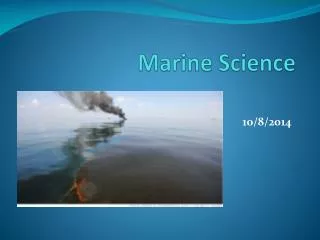
Explore the pivotal voyages in marine science history, from ancient navigations to modern expeditions. Learn about key figures such as Eratosthenes, Columbus, and Darwin, and their contributions to oceanography and exploration.

E N D
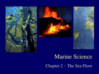
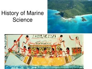
History of Marine Science Unit 2
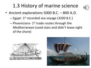
Voyaging • Traveling for a specific purpose • First navigation was by celestial navigation- finding one’s position in reference to heavenly bodies. • First Voyages • 4000 BC Egyptians organize commerce on Nile • 800 BC first cartographers make ocean charts
Library at Alexandria in Egypt • First university • Housed scrolls copied by law off ships that harbored. • Eratosthenes • Librarian whom calculated circumference of Earth. • Realized if the sun was directly over one place (shining straight down), and over another place (shining at an angle) then the Earth must be curved • Estimated Earth size within 8% of true value. • Developed longitude and latitude • present day longitude and latitude was developed by Hipparchus in 120 BC • Hypatia • Last librarian • First woman recognized as mathematician, philosopher, and scientist • Murdered • library burned because of religious opposition to knowledge-Incalculable loss
200 B.C. Eratosthenes mathematically calculated the circumference of the Earth to be 40,000 km. It actually is 40,032 km. 2,200 years ago his math was good enough to be off only 32 km! The Greeks • Eratosthenes knew that at noon on the summer solstice the Sun is directly overhead at Syene (a city) • He also knew the distance between Syene and Alexandria (another city) • combined with his measurement of the solar angle a between the Sun and the vertical, he was able to calculate Earth's circumference. From Encyclopædia Britannica, Inc.
Science Voyaging: 15thand 16th Centuries • 1492 Columbus • Sailing for Spain, sailed the Atlantic and “discovered” the America’s. • 1497 Vasco da Gama • Sailing for Portugal, sailed around Africa from Portugal to India to establish trade routes. • Europeans searched for the Northwest passage through northern Canada to trade with Asia; explored the Artic.
Science Voyaging16th Century • 1519 - Portuguese explorer Ferdinand Magellan • the 1st European expedition to circumnavigate the world. • 237 men began the voyage; 18 returned. • Magellan actually died before the journey was finished, but his crew returned in 1522. http://www.solarnavigator.net/history/explorers_history/ferdinand_magellan_charcoal_fur_robe.jpg
Science Voyaging 18th Century • 1768 James Cook of the British Royal Navy • First marine scientist • charted New Zealand, many islands, and the Great Barrier Reef of Australia sailing upon the HMS Endeavor. • Recorded and successfully interpreted natural history, anthropology, and oceanography with accuracy and thoroughness. • Insisted on cleanliness and made his men eat limes to ward off scurvy (Vitamin C deficiency)
Science Voyaging 18th Century • John Harrison in 1728 developed the first chronometer. • This was a timepiece governed by a spring instead of a pendulum • allowed longitude to be known • 4 are still located in Greenwich, England, which is the 0 meridian. • If your noon is before Greenwich noon then you are to the east, if your noon is after Greenwich then you are to the west. • Earth rotates 15° / hr (3 hours would be a 45° ). • Latitude can be known by stars (angle between your eyes, horizon and north star).
Science Voyaging 19th Century • 1831 Charles Darwin • HMS Beagle • Explored Galopagos Islands • led to the origin of species and the modern theories of evolution. http://uk.gizmodo.com/charles_darwin_l.jpg
Science Voyaging 19th Century • 1840 Matthew Maury of US Navy • Father of Oceanography • used sounding with a weighted line to discover the MidAtlantic Ridge, a hidden range of underwater mountains • Made charts and sailing directions • 1855 published the Physical Geography of the Sea • Monument in Richmond, VA
Science Voyaging19th Century • 1872-1876 Charles Wyville Thomson and John Murray (who coined the term oceanography) • set out on famous HMS Challenger Expedition for British • Took samples and disproved theory that there were no organisms below 1,800 feet due to pressure and lack of light. • Discovered 4,727 new species, tested water, made soundings, 151 trawls, currents, meteorology, sediments, and charted reefs. • The first pure oceanographic investigation that stimulated the science of marine biology. • Complied a 50 volume set of information still used today • gathered more data in its time than all other data to date. • Expedition is also still ongoing today and is considered the first “only for science expedition” • this voyage that discovered the world’s deepest ocean trench, the Marianas Trench, now sometimes called the Challenger Deep.
Science Voyaging19th Century • The map below shows the route of HMS Challenger (in red); the expedition lasted 1,000 days and covered more than 68,000 nautical miles. • 1895 Fridtj of Nansen • studied the polar oceans aboard the Fram, a ship built to withstand crushing ice • confirmed the relationship between whales and plankton- from a whaling stand point
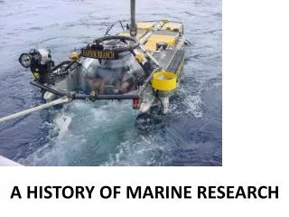
Research Vessels • Submersibles – small underwater vehicles with moveable arms, lights and windows for scientific research. Can accommodate on-board researchers • ROV – remotely operated vehicle, used for underwater data collection, but no on-board researchers • Bathysphere –lowered by a cable from a ship, cables posed dangers(potential snapping). Replaced by bathyscaphe • Drilling ships– take sediment cores • Floating and Fixed platforms(FLIP – floating instrument platform) -gather data like temperature, salinity, density, and weather patterns
ROV bathysphere submersible
Fixed platform Drilling ship Floating platform
Other Research Instruments • Airplanes • Satellites – SEASAT: 1st satellite dedicated to ocean studies • Echosounding • Underwater cameras • Side scan sonar – great for sunken ships
Science Voyaging20th Century • 1914 British explorer Sir Ernest Shackelton aboard the Endurance • pursues a dream of crossing Antarctica on foot by way of the South Pole. • 1925 German Meteor Expedition • the first to use echo sounding (depth and contour) to discover that the ocean was rugged, not flat as thought. • 1943 Jacque Cousteau and Emil Gagnan • invent the “aqualung”
Science Voyaging20th Century • 1960 Jacque Piccard and Don Walsch in the US Trieste bathyscaphe (small submarine) • descend 35,801 ft. into the deepest part of the ocean within the Marianas trench • NO ONE HAS BEEN BACK SINCE!
".... I saw a wonderful thing. Lying on the bottom just beneath us was some type of flatfish… Even as I saw him, his two round eyes on top of his head spied us … Why should he have eyes? Merely to see phosphorescence?...Here, in an instant, was the answer that biologists had asked for the decades. Could life exist in the greatest depths of the ocean? It could!” - J. Picard
Science Voyaging20th Century • 1962 Alvin • Designed by Woods Hole Oceanographic Institute • has traveled around the world completing 4,162 dives. • has mechanical arms and in 1966 helped to locate a H-bomb that was lost in the Mediterranean Sea. • In 1979 discovered black smokers on the sea floor.
“Black Smokers" are named for the soot-like appearance of the ejected material billowing out of the "chimneys". • Super-heated water from the Earth’s crust with very high concentrations of dissolved minerals. • As the super-heated water meets the very cold ocean-bottom water, the dissolved minerals precipitate out and settle onto the rock around them. • This causes the chimneys to grow in height over time.
Science Voyaging20th Century • 1968 GlomarChallenger • confirmed evidence of seafloor spreading and plate tectonics from core drilling samples.
Science Voyaging20th Century • 1985 JASON (a satellite) • found and documented the wreck of the Titanic. • 1989 - Japan launched the Shinkai 6500 - can carry a crew without a tether (rope) up to 21,414 ft deep into the ocean (a world record).
Science Voyaging21st Century • In 2006, a Chinese mineral company (COMRA) designed a craft to reach 23,000 ft
Conclusion • The ocean represents the Earth’s last frontier for exploration and the key to understanding the future of our planet. • The human race depends on the life and sustainability of the ocean for economic, biological, and environmental stability. • The world of Aquatic science is ever reaching for new discoveries in this blue realm.