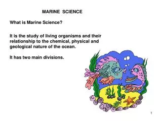
Marine Science
Marine Science. Chapter 2 – The Sea Floor. FOCUS QUESTIONS. What are the major physical features of the Earth’s surface? What explanation have scientists developed for the existence and distribution of these features? How do these features affect the Earth’s oceans?. The Water Planet.


Marine Science
E N D
Presentation Transcript
Marine Science Chapter 2 – The Sea Floor
FOCUS QUESTIONS • What are the major physical features of the Earth’s surface? • What explanation have scientists developed for the existence and distribution of these features? • How do these features affect the Earth’s oceans?
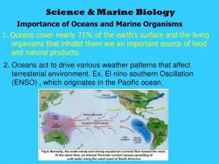
The Water Planet • 71% of earth covered in ocean • Oceans regulate climate and atmosphere • Four large basins: • Pacific – largest and deepest • Atlantic • Indian • Arctic – smallest and shallowest • (Southern ocean – continuous body of water surrounding Antarctica) • Large basins connected by smaller, shallow seas
Our Fledgling Planet • Earth – approximately 4.5 billion years old • Formed from an aggregation of dust clouds and gas particles that condensed into solid matter. • Intense heating melted many of these heavier elements in the core and mantle of the planet. • The uppermost of layers cooled and formed the Earth’s crust.
The Structure of the Earth d = m/V Lithosphere (crust – very thin) Materials have settled in the planet according to their density. Asthenosphere (upper mantle – fluid) Mesosphere (mid to lower mantle – solid but very hot) Core (mixtures of iron – inner is solid, outer is molten)
All Crust is not the Same • Continental crust is composed of granite. • Oceanic crust is composed of basalt. • Continental crust is: • lighter • thicker (20-50 km vs. 5 km for ocean) • less dense • geologically older … than Oceanic crust. See Table 2.2 on page 24
Hypothesis of Continental Drift • Developed by Alfred Wegener in 1915. • Proposed that present continents had drifted apart after the breakup of a single supercontinent, Pangaea. • Hypothesis not widely accepted (How?)
http://www.wiley.com/college/strahler/0471480533/animations/ch13_animations/animation3.htmlhttp://www.wiley.com/college/strahler/0471480533/animations/ch13_animations/animation3.html • http://education.sdsc.edu/optiputer/flash/pangea_4.htm • http://vimeo.com/14258924
Theory of Plate Tectonics Plate tectonics – the study of the processes by which the lithosphere moves laterally across the asthenosphere. • This hypothesis is supported by: • presence of the mid-ocean ridge • comparative fossil data from different continents • apparent puzzle-piece shape of different continents • magnetic reversal and sediment patterns on the sea floor • distribution of geological features on the Earth
Plate Tectonics in Action • Plates “float” on the asthenosphere. There are areas where plates spread apart… …and areas where plates collide. Mid-ocean Ridges/ Rifts Subduction zones/ Trenches
Types of Plate Boundaries http://pubs.usgs.gov/publications/text/Vigil.html Video http://www.youtube.com/watch?v=JmC-vjQGSNM&feature=related
Types of Boundaries • Convergence – plates collide • Oceanic-continental convergence • Continental-continental convergence • Oceanic-oceanic convergence • Shear Boundary – plates slide past each other • Divergence – plates separate • Mid-ocean ridge • Transforms faults • Rift valleys
Oceanic-Continental Boundaries • Heavy oceanic crust slides under continent. • Called subduction. • Trench forms. • Causes explosive earthquakes. • Molten lithosphere seeps up through continental crust and forms volcanoes. http://oceanexplorer.noaa.gov/explorations/03fire/logs/subduction.html
Oceanic-Oceanic Boundaries • One plate will slide under the other. • Trench forms. • Slow-flowing volcanoes form • sometimes break the ocean surface (island arcs). • Examples: • Aleutian Islands, AK • Mariana Islands
Continental-Continental Boundaries • Two continents smash against one another with force and become “welded” together. • Crust buckles forming mountain ranges. • No trenches or volcanoes. • India Collision (Animation) (http://geology-guy.com/teaching/iac/animations/india_asia_collision.htm)
Californians Get Closer Together • In addition the Pacific Plate (which contains the city of Los Angeles) and the North American Plate (which contains San Francisco) share a shear boundary. • These two plates slide past each other such that these cities get 4 inches closer each year. http://www.classzone.com/books/earth_science/terc/content/visualizations/es0804/es0804page01.cfm?chapter_no=visualization
The Mid-Ocean Ridge and Transform Faults • A continuous chain of submarine volcanic mountains that circles the globe • Caused by rising of hot mantle and pushes apart oceanic plates • Results in sea floor spreading http://www.classzone.com/books/earth_science/terc/content/visualizations/es0804/es0804page01.cfm?chapter_no=visualization
The Mid-Ocean Ridge and Transform Faults • Displaced at regular intervals by transform faults. • Occasionally breaks the surface at places like Iceland and the Azores. • Examples: • Mid-Atlantic Ridge • East Pacific Rise Above: Mid-Atlantic Ridge Left: Iceland –showing ridge
Rift Valleys • A gap or depression resulting in the center of a mid-ocean ridge or on land. • African Rift Valley
Features of Mid-Ocean Rifts • Hydrothermal vents – deep water hot-springs that dissolve minerals in the Earth’s crust (mainly sulfides) (http://oceanexplorer.noaa.gov/edu/learning/player/lesson05.html) • Black smokers – chimney-like structures that build up deposits of minerals and “smoke” a cloud of mineral particles. • Hot Spots – sporadic areas where molten magma forces its way through the lithosphere; creates volcanic activity (Hawaiian Islands) (http://www.youtube.com/watch?v=hOCfb9ox_90&feature=related)
Geological “Hot Spots” • Occur in over 100 places on the globe • Areas where hot magma sporadically forces its way through the lithosphere to erupt in volcanic activity. • Examples: • Hawaiian Islands • Yellowstone National Park
Hot Spot Formation Although this model has been contested, it describes a stationary magma source over which plates slide.
Geological Provinces of the Ocean Floor • Based on previous knowledge and logic, label the following parts of the map: • Abyssal plain • Continental rise • Continental shelf • Continental slope • Guyot • Seamount • Shelf break • Trench
Seafloor Topography • Continental shelf • Continental edge / Shelf break • Continental slope • Abyssal plain • Ocean ridge and rise systems • Trenches • Seamount
Geological Provinces of the Ocean Floor A. Continental shelf – The shallow gently sloping section of the continental margin that extends from the shore to the point where the slope gets steeper. B. Shelf break – The section of the continental shelf where the slope abruptly becomes steeper, usually at a depth of 120 to 200 m (400 to 600 ft). C. Continental Slope – The steeper, seaward section of the continental margin. D. Continental Rise –The gently sloping area at the base of the continental slope. • Abyssal Plain – The nearly flat region of the deep-sea floor. • Guyot – A flat topped- seamount • Trench – A narrow deep depression in the sea floor. • Seamount – A submarine volcano in the abyssal plain
Continental Margins • Active Margin – a continental margin that is colliding with another plate and as a result is geologically active • Passive Margin – a continental margin that is located at the trailing edge of a continent and as a result shows little geological activity
Continental Margin – active margin
Comparative Fossil/Sediment Data Geologists noted the similarities between the fossils and sediment deposits found on opposite sides of the Atlantic Ocean.
Magnetic Reversals • Rocks contain magnetic particles that align with the Earth’s magnetic field. • During periods called magnetic reversals, the Earth’s north pole switches to the opposite side of the globe as it is now. • Believed to be related to movements in the Earth’s molten core.
Magnetic Anomalies • When molten rock comes to the surface, the magnetic particles are free to align with the Earth’s magnetic pole. • When the rock cools, the particles are fixed in the magnetic orientation at the time.
Magnetic Anomalies • Geologists have thus discovered a pattern of magnetic banding parallel to the mid-ocean ridge.
References • Castro, P. & J. Huber (2005) Marine Biology, 5th ed. McGraw-Hill Higher Education, Boston, MA. • Watson, J.M. (1999) “Understanding plate motions.” USGS. Retrieved on September 27, 2004 from http://pubs.usgs.gov/publications/text/understanding.html • Watson, J.M. (1999) “Understanding plate motions.” USGS. Retrieved on September 27, 2004 from http://pubs.usgs.gov/publications/text/hotspots.html • http://www.ngdc.noaa.gov/mgg/fliers/97mgg03.html
Global projection of Earth showing tectonic boundaries and areas of active seismic and vulcan activity.
Above: The Glomar Challenger was the first research vessel specifically designed in the late 1960s for the purpose of drilling into and taking core samples from the deep ocean floor.
Further Evidence of Earth’s Changing Nature • Sediments • Sea Level Changes • Greenhouse Effect
Origin of the Atmosphere • Originally free oxygen not present in the atmosphere. • 600 mya – O2produced by single-celled photosynthetic organisms (cyanobacteria) • Stromatolites Photo credit http://www.discoverwest.com.au/australia-images/l741b.jpg
Stromatolites – Shark Bay, WA Photo credits http://www.ldeo.columbia.edu/~small/personal/Images/Stromatolites.jpg http://www.discoverwest.com.au/album/northwest/north_west_map.gif
Results of an O2 Rich Atmosphere • Aerobic organisms began to out-compete anaerobes. • Excess oxygen begins to react in the high atmosphere with ultraviolet radiation. This creates ozone (O3) • prevents harmful UV rays from penetrating to the earth. • Allows organisms to colonize the land. • Also, Earth ideally settled in an orbit where molecular water can exist in all three states • particularly the liquid state!
Sediments • Lithogenous sediment – results from the physical and chemical weathering of rocks on land. • Carried by run-off and rivers to the ocean. • Biogenous sediment – skeletons and shells of marine organisms that have fallen to the ocean floor. • Diatoms, radiolarians, foraminiferans, and coccolithophorids
Biogenous sediments • Calcareous ooze – skeletons composed of calcium carbonate (CaCO3) • Siliceous ooze – skeletons composed of silica (SiO2).