Understanding SLOSH: Predicting Storm Surge Threats from Hurricanes and Extratropical Storms
The SLOSH model, developed by NOAA's Meteorological Development Laboratory, predicts storm surge heights resulting from hurricanes using a finite differencing approach. It models overland flooding with a structured grid featuring finer resolutions inland and coarser offshore. The model does not account for tides, waves, or river flow. Key products include probabilistic storm surge forecasts, readiness assessments, and maximum envelope of water estimations for planning and mitigation strategies. Additionally, ETSS extends this capability to extratropical storms, offering vital guidance on potential flooding impacts.

Understanding SLOSH: Predicting Storm Surge Threats from Hurricanes and Extratropical Storms
E N D
Presentation Transcript
SLOSH Overview NOAA-Deltares Silver Spring, MD (June 24, 2011) Arthur Taylor – NOAA/NWS/MDL
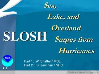
SLOSH • Sea, Lake and Overland Surges from Hurricanes • Finite differencing model developed by the Meteorological Development Laboratory to predict storm surge heights from historical, hypothetical or predicted hurricanes • Overland flooding • Parametric wind model for forcing • Structured grid with finer resolution overland, and coarser offshore • Models sub-grid features with flows though barriers and cuts • Does not include • Tides, waves, river flow
SLOSH Products • Deterministic / Historic Runs • P-Surge • Probabilistic Storm Surge • Response (<48 hr of landfall) • MEOW • Maximum Envelope Of Water • Readiness (48hr – 120 hr of landfall) • MOM • Maximum Of the MEOWs • Planning / Mitigation (>120 hr of landfall)
Maximum Envelope Of Water • User selects: • Category (Cat 3) • Landfall direction (wnw) • Forward speed (15 mph) • Initial tide (High)
MOM: Maximum Of MEOWs • User selects: • Category (Cat 3)
SLOSH Products • Deterministic / Historic Runs • P-Surge • Probabilistic Storm Surge • Response (<48 hr of landfall) • MEOW • Maximum Envelope Of Water • Readiness (48hr – 120 hr of landfall) • MOM • Maximum Of the MEOWs • Planning / Mitigation (>120 hr of landfall)
P-Surge – Vary Other Variables • Size: Small (30%), Medium (40%), Large (30%) • Forward Speed: Fast (30%), Medium (40%), Slow (30%) • Intensity: Strong (30%), Medium (40%), Weak (30%)
Probabilistic product shows considerable surge threat to Pensacola area
ETSS • Extra-Tropical Storm Surge • Finite differencing model developed by the Meteorological Development Laboratory based on SLOSH to predict storm surge heights from extra-tropical storms • Global Forecast System for wind forcing • Structured grid with finer resolution overland, and coarser offshore • Does not include • Tides, waves, river flow • Overland storm surge
Combine the ETSS output with: Observations from NOS / CO-OPs Tides computed from constituents provided by NOS/CO-Ops Uses a 5 day running average error to improve total water level forecast Provides guidance on flooding (when total water level exceeds the HAT) NOS/OPC also has ETSS model output http://www.opc.ncep.noaa.gov/et_surge/et_surge_info.shtml Animations of maps of ETSS output with GFS pressure fields Extratropical Storm Surge Websitehttp://www.weather.gov/mdl/etsurge http://www.weather.gov/mdl/etsurge