Download

1 / 22
220 likes | 424 Views
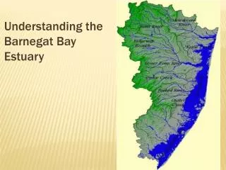
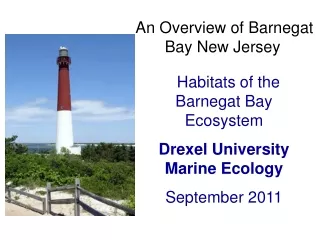
Understanding the Barnegat Bay Estuary. such as seagrasses, turtles and crabs. Salinity Levels Along an Estuary. Ocean. River. Fresh water flow. Salinity Patterns Along the Estuary . Barnegat Bay Estuary. Surface Water Inputs to Barnegat Bay.

E N D
such as seagrasses, turtles and crabs
Salinity Levels Along an Estuary Ocean River Fresh water flow
Surface Water Inputs to Barnegat Bay Barnegat Bay’s watershed is essentially all of Ocean County Slope is gradual from 800 feet on western edge to sea level in the East Sub-watersheds contain broad, slowly-flowing rivers and streams
Aquifers Water-bearing rock readily transmits water to wells and springs Precipitation eventually adds water into the porous rock of the aquifer. http://www.ranneymethod.com/images/collector_well.jpg
Groundwater inputs into the Barnegat Bay Kirkwood-Cohansey aquifer is main aquifer in Barnegat Watershed Opens under Bay, releasing freshwater into the Bay
Barnegat Bay Geography Barnegat Bay opens to ocean at Barnegat Inlet (between Island Beach and Long Beach Island) and Little Egg Inlet (at south end of Long Beach Island) There is also a canal (Bayhead-Manasquan Canal) between the Bay and Manasquan Inlet Atlantic Ocean
Barnegat Bay Estuary Water that’s a mix of fresh and salt is termed BRACKISH Brackish water can be different salinities (less salty than the ocean but more than rivers and streams) Where in the Bay would salinity be highest? Why? Barnegat Inlet Manahawkin Bay Little Egg Inlet
LOW FRESHWATER INPUT (DROUGHT YEAR) HIGH FRESHWATER INPUT (RAINY YEAR) Low Salt Low Salt Medium Salt Medium Salt High Salt High Salt
Impact of Water Use on Barnegat Bay Use of both surface and groundwater by humans reduces fresh water inputs into Bay
HIGH FRESHWATER INPUT (LOW WATER USE) LOW FRESHWATER INPUT (HIGH WATER USE) Low Salt Low Salt Medium Salt Medium Salt High Salt High Salt