Download

1 / 12
120 likes | 327 Views
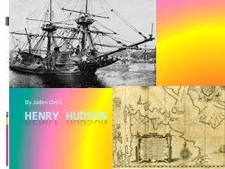
For “armchair” explorers of the Hudson, there are several excellent videos: . “The Hudson River: An American Paradise” “Henry Hudson’s River:A Biography” (narrated by Orson Welles) “World’s End: A Brief History of the Hudson River Highlands” (narrated by Richard Kiley)

E N D
For “armchair” explorers of the Hudson, there are several excellent videos: • “The Hudson River: An American Paradise” • “Henry Hudson’s River:A Biography” (narrated by Orson Welles) • “World’s End: A Brief History of the Hudson River Highlands” (narrated by Richard Kiley) Hudson River Film & Video Indian Brook Road, Garrison NY 10524 914-265-3405
One of the best sources for scientific information about the Hudson (or any river) is the EPA’s Surf Your Watershed • http://cfpub1.epa.gov/surf/locate/map2.cfm There’s so much about the Hudson on this site that the best way for you to learn about it is to explore it over by opening the links in the next few slides of this presentation. When you’re finished, close those screens and continue from here.
Start by opening http://cfpub1.epa.gov/surf/locate/map2.cfm • Then, click on “NY” in the map to select this state. • From here, you should be able to use your mouse to find which watersheds are part of the Hudson system http://cfpub1.epa.gov/surf/state.cfm?statepostal=NY Spend a few moments exploring the kinds of data available in these pages.
The Hudson is an estuary with tidal flows all the way to Albany • You can find more about these cyclical changes in the water level through the National Ocean Service web pages: www.nos.noaa.gov You can find both tide predictions http://www.co-ops.nos.noaa.gov/tp4days.html and, for some locations, the actual water levels http://tidesonline.nos.noaa.gov/.
The Lower Hudson has a tongue of saltier water extending upriver from the Atlantic beneath fresher water at the surface. • “Salt Front” data is monitored by the US Geological Survey http://ny.usgs.gov/htdocs/dialer_plots/saltfront.html
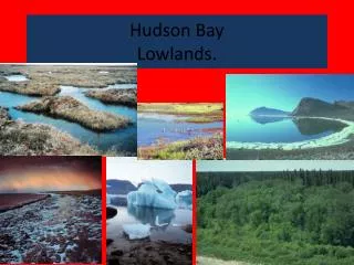
Geologically, the Hudson is also among the most fascinating river systems because of the many regions through which it passes • The Hudson begins in the Adirondacks as a small stream coming out of a small pond on the southeast side of Mt. Marcy. • As it flows through the Hudson-Mohawk Lowlands, it grows in size as tributaries join. • The ancient rocks of the Hudson Highlands have been sliced through, forming West Point and Bear Mountain.
The Tappan Zee is the widest part of the river, nearly three miles in places. This area is a boundary between the Manhattan Prong of the New England on the east and the Palisades and Triassic Lowlands on the west.
Not far north of LDEO is the Sparkill Gap, where the river once turned sharply westward through the Palisades to wander in a generally southward directions, eventually eroding what is now the Hackensack Meadowlands and reaching the Atlantic south of Staten Island.
Some of the best information about the geology of this region is available at http://everest.hunter.cuny.edu/bight/index.html • A vast amount of information about other parts of New York State’s geology can be located through the New York Geology Resource Page http://www.albany.net/~go/newyorker/
What happens when the Hudson meets the Atlantic? • During the Pleistocene when continental ice sheets covered much of this region, the Hudson Valley was beneath glacier more than a thousand feet thick. • Sea level was much lower, and the river carved out the largest of several submarine canyons along the Northeast coast, the Hudson Canyon
Many of the earliest Lamont Geological Observatory research cruises aboard the “Vema” investigated this fascinating drop-off valley. Recently, Diane Duane used this area as the setting for her science fantasy book “Deep Wizardry.” http://www.ldeo.columbia.edu/CORE_REPOSITORY/RHP1.html