Seacoast Utility Authority Water Use Permit
120 likes | 307 Views
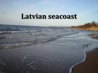
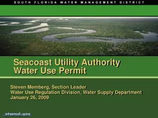
Seacoast Utility Authority Water Use Permit. Steven Memberg, Section Leader Water Use Regulation Division, Water Supply Department January 26, 2009. Seacoast Utility Authority. Loxahatchee River. Seacoast Utility Service Area. Seacoast Utility Authority.

Seacoast Utility Authority Water Use Permit
E N D
Presentation Transcript
Seacoast Utility AuthorityWater Use Permit Steven Memberg, Section LeaderWater Use Regulation Division, Water Supply DepartmentJanuary 26, 2009
Seacoast Utility Authority Loxahatchee River Seacoast Utility Service Area
Seacoast Utility Authority • Utility Service Area includes: Palm Beach Gardens North Palm Beach Juno Beach Lake Park Unincorporated areas of PBC Hood Road Wellfield PBG Wellfield NPB Wellfield Burma Road Wellfield
Seacoast Utility Authority • Originally permitted in 1976 • Current Allocation • Population 101,664 (2005) • Per Capita 190 • Annual 19.31 MGD • Proposed Allocation • Population 102,423 (2012) • Per Capita 190 • Annual 19.46 MGD
Minimum Flows and Levels (MFL) covers: Northwest Fork of the Loxahatchee River (G-92 to River Mile 6) Consumptive Use Permit Rule Protections for the Loxahatchee
Minimum Flows and Levels (MFL) covers: Northwest Fork of the Loxahatchee River (G-92 to River Mile 6) Including tributaries: Kitching Creek Hobe Grove Ditch Cypress Creek Consumptive Use Permit Rule Protections for the Loxahatchee
Minimum Flows and Levels (MFL) MFL violation occurs when an exceedance occurs more than once in a six year period. Flows over Lainhart Dam decline below 35 cfs for more than 20 consecutive days. Average daily salinity concentration on a 20-day rolling average exceeds two parts per thousand at river mile 9.2 Northwest Fork is not currently meeting the MFL, therefore rule requires implementation of a recovery strategy Consumptive Use Permit Rule Protections for the Loxahatchee
Recovery Strategy One component of recovery strategy is the implementation of the Regional Water Availability Rule Consumptive Use Permit Rule Protections for the Loxahatchee • “requested allocation will not cause a net increase in the volume or cause a change in the timing on a monthly basis of surface and ground water withdrawn from …the North Palm Beach County / Loxahatchee River Watershed Waterbodies over that resulting from the base case”
Seacoast Utility Authority Loxahatchee River Seacoast Utility Service Area Loxahatchee River Watershed Waterbodies
Regional Water Availability Calibrated groundwater flow model Annual requested withdrawal of 8,084 MG modeled to accommodate two operating plans: Prime Scenario – Hood Road Wellfield Alternate 1 – Palm Beach Gardens Wellfield Transient model using a 27-month scenario simulating 1-in-10 drought conditions Seacoast Utility Authority
Regional Water Availability No net increase in the volume or change in timing on a monthly basis of surface and ground water withdrawn from the “Waterbodies” Minimum Flows and Levels (MFL) No direct or indirect withdrawal from MFL body No contribution to existing MFL violations Other environmental considerations Drawdown impacts and mitigation for wetlands in the wellfields’ cone of influence are still under evaluation. Staff Evaluation