Download
1 / 27
270 likes | 295 Views
This article discusses Broward County's efforts to promote sustainable transportation choices through the implementation of complete streets and context sensitive corridors. Activities to date include the adoption of corridor designations, TOD and TOC land use classifications, new transit design standards, and the incorporation of complete street features into county projects. Collaboration with municipalities and FDOT is also highlighted.

E N D
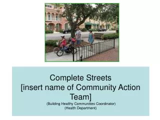
PROMOTING SUSTAINABLETRANSPORTATION CORRIDORS“COMPLETE STREETS” February 19, 2013
COUNTY ACTIVITIES TO DATE • Broward Urban Design Guidebook (2002 – 2007) -Establishment of a “Sense of Place” - One of the goals was to promote sustainable transportation choices by creating a more transit/pedestrian friendly environment. - Recommendations included designing corridors according to context and introduced seven “Corridor Context Types” or “Context Sensitive Corridors”
ACTIVITIES TO DATE • “Context Sensitive Corridor” Designations(2009) -Adopted as option in the Broward County Trafficways Plan in 2009 - Broward County Commission adopted the option into the Broward County Land Development Code in 2009 - MLK, Jr. Boulevard in the City of Pompano Beach was adopted as a CSC as part of the Trafficways Plan in June 2012 and as part of a TOC in October 2012. - Additional interest in pursuing CSC designations, but the current Trafficways Plan amendment application fee of $6,798 may be a barrier.
COUNTY ACTIVITIES TO DATE • “TOD/TOC” Land Use Classifications • - Classifications enable municipalities to integrate mixed, higher density, land uses with multi-modal transportation designs, which may help to achieve “Context Sensitive Corridors.” • - Ten (10) TOD/TOC, or similar, areas have been approved by the County Commission as part of the Broward County Land Use Plan, including much of the SR 7 corridor. • - The RAC and LAC designations have also been approved (e.g. municipal downtown areas) and may also be considered consistent with the “Context Sensitive Corridor” program.
COUNTY ACTIVITIES TO DATE • New Broward County Transit Design Standards and Guidelines Manual • - Creates minimum acceptable design criteria and general guidance for bus stops and other transit-supportive infrastructure elements that should be considered when designing and placing transit facilities in Broward County.
COUNTY ACTIVITIES TO DATE • Broward “Complete Streets” • Started in 2009, by the County’s MPO/Transportation Planning Division staff, who presented the concept of “Complete Streets” to the County Commission.
COUNTY ACTIVITIES TO DATE • Broward MPO “Complete Streets” Technical Advisory Committee (TAC) includes representation from the following Broward County agencies: • Broward County Traffic Engineering • Broward County Highway Construction and Engineering • Broward County Air Quality • Broward Bicycle/Pedestrian Advisory Committee • Broward County Transit • (Broward County Planning Council also represented)
COUNTY ACTIVITIES TO DATE • Many Complete Street Features Have Been Incorporated into County Projects • Sidewalks • Bike Lanes • Transit Infrastructure • Landscape Medians • ADA Upgrades • Count-Down Pedestrian Signals • Lighting
Bailey Road --- Pilot Project • 10 Foot Travel Lanes • Continuous Wide Sidewalks • Buffered Bike Lanes • Bicycle Markings With Green Background • Uncontrolled lighted mid-block crossing with median refuge area • Solar Powered Flashing Pedestrian Beacon • In-Road LED Crosswalk Lighting System • Transit Infrastructure • ADA Upgrades • Landscape Median • Count- Down Pedestrian Signals • Lighting
Ravenswood Road --- Pilot Project (FDOT Grant) • Buffered Bike lanes • Bicycle Markings With Green Background • Bicycle Box (see picture on the left below) • Continuous Sidewalk • Landscaped Buffered Area Between Sidewalk and Roadway • Count-Down Pedestrian Signals • ADA upgrades • Lighting • Transit Infrastructure • Raised Bike Lanes
Palm Avenue • Designated Bike Lanes • Bicycle Markings With Green Background • Continuous Sidewalk • Landscaped Buffered Area Between Sidewalk and Roadway • ADA Upgrades • Count-Down Pedestrian Signals • Lighting • Coconut Creek Education Corridor • 10 Foot Travel Lanes • Designated Bike Lanes • Bicycle Markings With Green Background • Continuous Sidewalk • Transit Infrastructure • ADA Upgrades • Landscaped Median
County Staff is working with Cities/FDOT on Multiple Initiatives for County Roadways: • MUNICIPALITIES • Cities of Hallandale Beach and Hollywood – Dixie Hwy – Passenger Rail Facilities/Bike/Sidewalk • City of Fort Lauderdale -- Andrews Ave – Bike Lanes • City of Fort Lauderdale-Broward Blvd—On-Street Parking • City of Fort Lauderdale – NE 3rd Ave – Bike Lanes • City of Coconut Creek -- Coconut Creek Pkwy – Bike/Sidewalk/Transit • Town of Davie --- Davie Road – Bike/Sidewalk • City of Pompano Beach – Martin Luther King Blvd --Bike/Sidewalk/On-Street Parking
FDOTCOLLABORATIONS • NW 31st Ave (Riverland Road to Commercial Blvd) --- Bike Lane • Broward Blvd (Pine Island Road to West of SW 82nd Ave) --- Bike/Sidewalk • SW 136th Ave (SW 14th Street to SR 84) --- Sidewalk • SW 4th Ave/SW 7th Ave (Davie Blvd to Broward Blvd) --- Bike Lane • SW 4th Ave (SR 84 to Davie Blvd) --- Bike Lanes • Nob Hill Road (SR 84 to Central Park Place) --- Sidewalk • Nob Hill Road (SR 84 to Broward Blvd) --- Bike Lane • Broward Blvd (Commodore Drive to Flamingo Road) --- Sidewalk • Broward Blvd (Flamingo Rd to Hiatus Rd) --- Sidewalk • Andrews Ave (New River Drive to Oakland Park Blvd) --- Bike Lane • NW 21st Ave (Oakland Park Blvd to Commercial Blvd) --- Bike Lane • NW 19th Street (SR 7 to NW 21st Ave) --- Bike Lane • NE 6th Ave (Oakland Park Blvd to NE 33rd Street) --- Bike Lane • Broward Blvd (Federal Hwy to Victoria Park Road) --- Bike Lane • Broward Blvd (Pine Island Road to NW 82nd Ave) --- Bike/Sidewalk • Peters Road (Pine Island Road to Tropical Way) --- Bike Lane
Next Steps as a community • JURISDICTION • County Maintained Roads – Functional Classification • Broward County Trafficways Plan • Broward County Land Use Plan and Comprehensive Plan • CONSTRAINTS (PHYSICAL AND MONETARY) • PRIORITIES AND PARTNERSHIPS
STAFF RECOMMENDS • 1. Formalizing a “Complete Streets Team,” consisting of staff from the County’s Environmental Protection and Growth Management, Parks and Recreation, Public Works, and Transportation departments to review and make recommendations regarding the County’s road planning, design and construction standards and ordinances for additional opportunities to incorporate the Broward Urban Design Guidelines, includingupdating County road and traffic design standards and Trafficways Plan criteria in relation to the Broward MPO Complete Streets guidelines, and identifying pilot projects for implementation.
STAFF RECOMMENDS • 2. Directing the Broward County Planning Council to waive the Broward County Trafficways Plan “Context Sensitive Corridor” application fee ($6,798) for a two-year period to promote municipal designation of such roadways at this time. • 3. Initiating focused, community and municipal outreach efforts of County staff (EPGM, Public Works and Transportation) and the Broward County Planning Council to discuss Broward County’s future transportation/land use plans and programs and engage the community’s support for proposed improvements which will further the Broward UDG, including Context Sensitive Corridor and Complete Streets guidelines.
STAFF RECOMMENDS • 4. Coordinating efforts with municipalities, Broward MPO, FDOT, US HUD and other interested entities. • 5. Continuing to work with Federal, State and local partners to identify potential funding sources to finance improvements and operation and maintenance costs associated with Complete Streets/Context Sensitive Corridors.
Land use and transit are inherently related • After TOD
Context Sensitive Solutions can transform this street into a…. Complete Street • After TOD
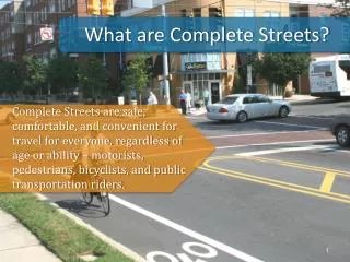
Complete Streets have pedestrian friendly enhancements • After TOD
Complete Streets enable transit -supportive mixed use development • After TOD
Context Sensitive Solutions consider place in design and create opportunities to attract new transit riders