Download
1 / 25
470 likes | 1.86k Views
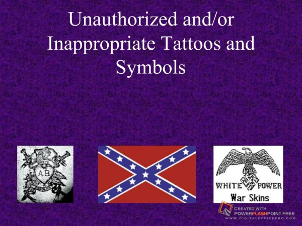
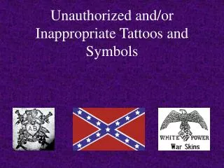
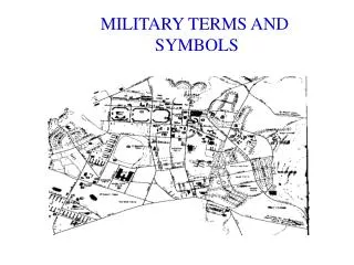
Ordnance Survey Map Symbols 1: 50 000 Nav 1_2_02. A. The Upland Environment. Rocky Outcrop. Contour Lines. Cliff. Scree. Slope. Marsh/Salting. Spoil Heap. Quarry. Coniferous Wood. Non-Coniferous Wood. Mixed Wood. Radio Mast. Triangulation Pillar. Wind turbine/pump.

E N D
Ordnance Survey Map Symbols 1: 50 000 Nav 1_2_02
A. The Upland Environment
Rocky Outcrop Contour Lines
Cliff Scree
Slope Marsh/Salting
Spoil Heap Quarry
Coniferous Wood Non-Coniferous Wood
Mixed Wood Radio Mast
Triangulation Pillar Wind turbine/pump
Electricity Line Building (Hut)
B. Water Features
Footbridge Aqueduct
Shingle Flat Rock
C. Paths, Roads & Other Lines
Tunnel Bridge
Path Track
National Boundary County Boundary
D. Tourist Information
Post Office Car Park
Public Convenience Public House
Coastguard Station Milestone
Tourist Information Viewpoint
Pick Nick Area Telephone
Campsite Youth Hostel