Census Geographic Programs Update
The U.S. Census Bureau's 2008 Annual Training Conference highlighted upcoming releases of nation-based, state-based, county-based, and American Indian area-based TIGER/Line shapefiles. Key updates include revisions from the Boundary and Annexation Survey (BAS), which collects data on legal area changes. The 2009 BAS will see significant changes, such as the early response deadline and a focus on cleaning up boundary distortions in time for the 2010 Census. The Local Update of Census Addresses (LUCA) program aims to refine the address list utilizing local knowledge and has already received updates from a majority of participating governments.

Census Geographic Programs Update
E N D
Presentation Transcript
Census Geographic Programs Update Linda M. Franz U.S. Census Bureau CIC/SDC Annual Training Conference October 8, 2008
2008 TIGER/Line Shapefiles • Release soon • Nation-based, state-based, county-based, and American Indian area-based files available • Will reflect realignment nationwide
Boundary and Annexation Survey (BAS) • Collects boundary and area change information for legal areas • Also permits review of area names and relationships • Survey universe includes all legal entities
Boundary and Annexation Survey (BAS) • Response modes • Paper • MAF/TIGER Partnership Software • Digital BAS • e-BAS for forms submission • Web BAS (starting in 2009)
Boundary and Annexation Survey (BAS) • What’s different for 2009? • No pre-notice or opt out • Deadline for early response is March 1, 2009 rather than April 1 • Planning for October/November mailout • SDC encouragement for response needed
Boundary Review and Repair • Nationwide cleanup of boundary distortions that are artifacts of the MAF/TIGER Accuracy Improvement Program • Desirable to complete in time for corrections to be reflected on 2010 BAS maps; must be completed in time for data tabulation
Local Update of Census Addresses (LUCA) • First implemented for Census 2000 • Purpose is to improve the census address list using local knowledge • Confidentiality of address information • Met a long-standing interest expressed by governmental stakeholders in the decennial census
2010 LUCA Program Status • Received updates from 8525 participating governments (78.7%) • Spatial and address update to MAF/TIGER Database • Next step is Address Canvassing, followed by LUCA feedback fall/winter 2009
Local Update of Census Addresses (LUCA) Feedback • Up to four listings depending on option and updates provided • Full address list • Feedback on specific address corrections/additions • Feedback on challenged blocks • Summary of actions • Also maps/shapefiles
Local Update of Census Addresses (LUCA) Feedback • No address feedback if only map corrections provided • Option 3 participants receive summary feedback and maps only • GQ Validation results not reflected • Block suffixes will change between initial review and feedback materials
Local Update of Census Addresses (LUCA) Appeals • Process under development in collaboration with the Office of Management and Budget • Procedures will be out for public comment in a Federal Register notice, likely toward the end of the year
Local Update of Census Addresses (LUCA) Appeals • What will likely be appealable: • Specific address corrections/additions not accepted • Any address missing from a block that was challenged • Address canvassing deletes that were untouched in initial LUCA review
Local Update of Census Addresses (LUCA) Appeals • Likely requirements for governments submitting an appeal • Identification of specific addresses and their locations • Documentary evidence supporting the existence of the address • Due 30 days from receipt of feedback
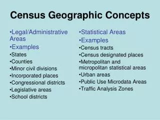
Participant Statistical Areas • Census Tracts • Block Groups • Census Designated Places (CDPs) • Census County Divisions (CCDs) • Link to final criteria: • http://www.census.gov/geo/www/psap2010/psap2010_main.html
Participant Statistical Areas Program • Participants identified early 2008 • Materials distribution will begin later this month • MAF/TIGER Partnership Software is the required submission vehicle • Participants will have 120 days to review and submit boundaries • Verification phase will occur fall 2009/winter 2010
Participant Statistical Areas Program • Focus is on area delineation, and not on feature update • Separate efforts are complete or underway to handle feature/boundary distortions
Participant Statistical Areas Program • 7 SDCs are taking on the delineation task for some counties for which we do not have a local participant designated • In 6 states, there are counties with no local participant identified and no SDC stepping in to delineate
American Indian/Alaska Native Areas • Tribal census tracts and block groups on reservations/trust lands for federally recognized tribes • Alaska Native village statistical areas • Oklahoma tribal statistical areas (OTSAs) • Tribal designated statistical areas • Subreservation statistical areas • Tribal subdivisions on OTSAs
American Indian/Alaska Native Areas • Comment period closed 6/16/08 for Alaska Native areas and 6/30/08 for American Indian areas • No revision to criteriacalled for by commenters • Final criteria to be published in Federal Register soon
American Indian/Alaska Native Areas • Implementation schedule very similar to that for Participant Statistical Areas Program • Participants have option to use paper maps for delineation or an ESRI-based software extension
Questions? • Linda M. Franz • Assistant Division Chief for Geographic Partnership Programs • linda.m.franz@census.gov • (301)-763-9061