Download
1 / 36
360 likes | 528 Views
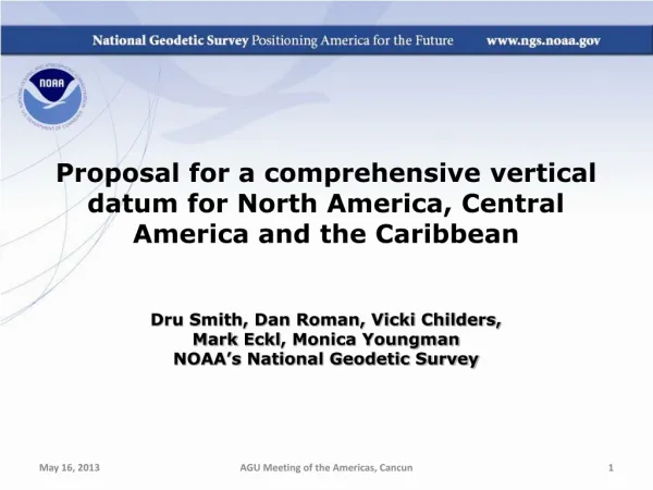
Proposal for a comprehensive vertical datum for North America, Central America and the Caribbean Dru Smith, Dan Roman, Vicki Childers, Mark Eckl , Monica Youngman NOAA’s National Geodetic Survey. Outline. Status of Vertical Datums in the Region

E N D
Proposal for a comprehensive vertical datum for North America, Central America and the Caribbean Dru Smith, Dan Roman, Vicki Childers, Mark Eckl, Monica Youngman NOAA’s National Geodetic Survey AGU Meeting of the Americas, Cancun
Outline • Status of Vertical Datums in the Region • Why isn’t NAVD 88 good enough anymore? • GRAV-D • North American Gravity Holdings • Future Work AGU Meeting of the Americas, Cancun
No official Vertical datum CGVD 28* NAVD 88 No official Vertical datum * NAVD 88 exists; also soon (2013) to be replaced by a new geoid/GNSS based datum AGU Meeting of the Americas, Cancun
? PRVD02 VIVD09 ? ? (1) ? ? ? ? ? Santo Domingo(1) ? ? Puerto Cortéz(1) ? Corinto 1952(1) ? ? ? San José(1) ? La Unión 1960(1) Puntarenas(1) Cristóbal(1) (1) Información cortesía de David Avalos AGU Meeting of the Americas, Cancun
Why isn’t NAVD 88 good enough anymore? • NAVD 88 suffers from use of bench marks that: • Are almost never re-checked for movement • Disappear by the thousands every year • Are not funded for replacement • Are not necessarily in convenient places • Don’t exist in most of Alaska • Weren’t adopted in Canada • Were determined by leveling from a single point, allowing cross-country error build up PID: EZ0840 AGU Meeting of the Americas, Cancun
Why isn’t NAVD 88 good enough anymore? • Approximate level of geoid mismatch known to exist in the NAVD 88 zero surface: AGU Meeting of the Americas, Cancun
Canada Height Modernization - 2013 The geoid model: 1. Entire coverage of the Canadian territory (land, lakes and oceans) 2. Compatible with space- based positioning (e.g., GNSS, altimetry) 3. Less expensive for maintenance 4. Fairly stable reference surface Levelling Networks: 1. Established over the last 100 years 2. 120,000 km of levelling lines 3. Some 80,000 benchmarks 1. Time consuming 2. Expensive 3. Limited coverage 4. BMs are unstable 5. BMs disappear 6. Local networks H = hGNSS – NModel
What is GRAV-D? (1 of 3) • Gravity for the Redefinition of the American* Vertical Datum • An NGS project whose target is to redefine the official civilian vertical datum as the geoid, realized through the use of GNSS technology and a gravimetric geoid model over at least the United States and its territories AGU Meeting of the Americas, Cancun
What is GRAV-D? (2 of 3) • GRAV-D means fast, accurate, consistent orthometric heights everywhere in the USA • GPS already gives fast accurate ellipsoid heights • If the geoid were modeled (and monitored) to highest accuracy…fast, accurate orthometric heights, anywhere, anytime • No need to use leveling to “bring in the datum” AGU Meeting of the Americas, Cancun
What is GRAV-D? (3 of 3) • GRAV-D will mean: • Primary access to the vertical datum will be through a GNSS receiver and a gravimetric geoid model • One consistent vertical datum for all of North America • CONUS, Alaska, Hawaii, PR, VI • Available for adoption by • Canada, Mexico, Caribbean, Central America AGU Meeting of the Americas, Cancun
“CONUS” Alaska Guam / Northern Marianas Hawaii Puerto Rico / Virgin Islands American Samoa Expected GRAV-D airborne gravity coverage by 2022 GRAV-D Planned Coverage AGU Meeting of the Americas, Cancun
Extent of 2022 geoid model used for new vertical datum AGU Meeting of the Americas, Cancun
Hawaii Many US Pacific Territories (not Guam, CNMI nor American Samoa) AGU Meeting of the Americas, Cancun
Alaska, including entire Aleutian Island Chain Canada CONUS (USA) AGU Meeting of the Americas, Cancun
Bermuda Mexico All Caribbean Countries All Central American Countries AGU Meeting of the Americas, Cancun
Gravity Holdings • GRAV-D is only funded to collect over USA by 2022 • Data collection plans beyond 2022: • Geoid monitoring across the continent • Airborne collection in surrounding countries if necessary and through cooperative agreements • Existing gravity holdings • Sparse • Metadata issues AGU Meeting of the Americas, Cancun
Alaska: Sparse coverage; GRAV-D has concentrated here first Greenland: Multiple airborne surveys, but not currently in NGS holdings Cuba: Political issues mean a gap on the largest Island in the Caribbean Guatemala, Belize, El Salvador: Gap between two historic computations: MEXICO97 and CARIB97 AGU Meeting of the Americas, Cancun
Close-up of gravity holdings currently available at NGS AGU Meeting of the Americas, Cancun
Gravity for the Redefinition of the American Vertical Datum (GRAV-D) FY13 FY13 FY13 FY13 FY13 FY13 Available on the Website In Processing Partially Collected Planned FY14 FY14 FY13/14 FY14 Status of and plans for data collection – more information and data available at www.ngs.noaa.gov/GRAV-D
Future Work • Engage all countries in North American Geoid working group (IAG Sub-commission 2.3c) • Chair: David Avalos (INEGI) • Collect up existing terrestrial gravity in gaps • Organize new collections collaboratively with other countries • Terrestrial • GRAV-D AGU Meeting of the Americas, Cancun
Future Work • Agreement on W0 value • USA and Canada have agreed to create all geoid models until 2022 using this new value • Done, in French and English AGU Meeting of the Americas, Cancun
Future Work AGU Meeting of the Americas, Cancun
Future Work Make geoid-based orthometric heights available via OPUS • Done, in extended output AGU Meeting of the Americas, Cancun
Future Work • www.ngs.noaa.gov/OPUS AGU Meeting of the Americas, Cancun
Future Work Develop a geoid-monitoring service • Plan with and without GRACE-type satellites • Likely to include: • A tracking network • Co-located CORS with gravimeters? • Geophysical Models • Working group established • Boulder conference in 2009 • Unstaffed at the moment AGU Meeting of the Americas, Cancun
The “secular” geoid change from the monthly GRACE models (2002-2008). Deglaciation The solution represents the effect due to total mass changes. The solution uses a 400-km Gaussian filter. Glacial Isostatic Adjustment Drought
Interested? • Geoid / Vertical Datum Contacts: • NA Geoid Working Group Chair & Mexico Geoid: • David Avalos (david.avalos@inegi.org.mx) • USA: Dan Roman (dan.roman@noaa.gov) • Canada: Marc Véronneau (marc.veronneau@nrcan-rncan.gc.ca) AGU Meeting of the Americas, Cancun
Extra Slides AGU Meeting of the Americas, Cancun
Geoid Slope Validation Survey of 2011 (GSVS11) • Terrestrial Survey using: • GPS • Leveling • DOVs • To quantify accuracy of: • Current geoid models • Geoids with GRAV-D added 325 km 218 points 1.5 km spacing AGU Meeting of the Americas, Cancun
GSVS11: Proving why we need GRAV-D Geoids without new GRAV-D data: 1-3 cm differential accuracy over distances from 0.4 to 325 km Geoids with new GRAV-D data: 1 cm differential accuracy over distances from 0.4 to 325 km AGU Meeting of the Americas, Cancun
How will I access the new vertical datum? (3 of 3) H2022=5.000m +/- 0.020m (GNSS/geoid) H2029=4.830m +/- 0.020m (GNSS/geoid) Height H2024=4.960m +/- 0.030m (GNSS/geoid) H2029=4.860m +/- 0.150m (modeled) 2022 2024 Year 2029 V(modeled 22/24) = -2 cm/yr +/- 2.5 cm/yr V(modeled 22/29) = -2.1 cm/yr +/- 0.3 cm/yr AGU Meeting of the Americas, Cancun
Monumented NGS Data AGU Meeting of the Americas, Cancun
Spot NGS + Canadian data AGU Meeting of the Americas, Cancun
Spot DMA AGU Meeting of the Americas, Cancun
Possible ways to fix NAVD 88 (1 of 1) • Long term fix: Replace NAVD 88 • Find a method of defining a vertical datum that seeks to fix all of the known issues with NAVD 88 • Best option: Define the datum as a given geoid model and realize it through GNSS technology • GRAV-D AGU Meeting of the Americas, Cancun