Download
1 / 13
130 likes | 254 Views
The 2013 Flash Flood and Intense Rainfall Experiment aimed to improve short-term quantitative precipitation forecasts (QPF) and flash flood predictions. Conducted from July 8 to 26, 2013, the study gathered insights from meteorological and hydrological experts, highlighting techniques using high-resolution models and probabilistic approaches. Key findings revealed gaps in understanding between meteorology and hydrology, the limitations of flash flood guidance, and the importance of spatial consideration in forecasting. Continued efforts focus on reducing data latency and enhancing forecasting methods.

E N D
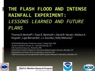
The 2013 Flash Flood and Intense Rainfall Experiment Faye E. Barthold1,2, Thomas E. Workoff1,3, Wallace A. Hogsett1, J.J. Gourley4, Kelly Mahoney5, Ligia Bernardet5, and David R. Novak1 1NOAA/NWS/Weather Prediction Center, College Park, MD 2I.M. Systems Group, Inc., Rockville, MD 3Systems Research Group, Inc., Colorado Springs, CO 4NOAA/National Severe Storms Laboratory, Norman, OK 5CIRES/University of Colorado/ NOAA Earth System Research Laboratory, Boulder, CO
Motivation • On average, flooding results in ~$8 billion in damages and ~90 fatalities per year • 7 of the last 10 NWS Service Assessments have involved flooding • WPC MetWatch Desk • Responsibility for heavy rainfall mesoscale discussions transferred from SPC to WPC on 9 April 2013 • Mesoscale precipitation discussions • Event driven • Highlight regions where heavy rainfall may lead to flash flooding in the next 1-6 hours
Flash Flood and Intense Rainfall ExperimentJuly 8 – 26, 2013 Explore techniques to improve short term QPF and flash flood forecasts • High resolution convection-allowing models • Exceedance probabilities • Hydrologic information
Flash Flood and Intense Rainfall ExperimentJuly 8 – 26, 2013 • 26 participants representing operations, research, and academia • 8 remote participants • Daily Activities • 12 hr probabilistic precipitation forecast (12 – 00 UTC) • Probability of exceeding 1” • 6 hr probabilistic flash flood forecast (18 – 00 UTC) • Prelim • Update • 12 hr probabilistic flash flood outlook forecast (00 – 12 UTC) • Subjective Evaluation
Featured Model Guidance ExREF NAM HRRR SSEO NAMX SREF
Flash Flood Diagnostics • Flash Flood Guidance (FFG) • Produced by NWS RFCs using one of four methods • Updated at the discretion of each RFC – does not update dynamically • Flooded Locations and Simulated Hydrographs (FLASH) • High resolution distributed hydrologic model (250m/5min) • Forced by real time radar estimated QPE • Forecasts simulated surface water flows 6 hours into the future • QPE recurrence intervals • QPE to FFG ratio http://flash.ou.edu
Ensemble Forecast Tools Probability 3hr QPF > 1” Probability 3hr QPF > 3hr FFG • Point probabilities • Probability of an event occurring at a specific grid point • Neighborhood probabilities • Probability of an event occurring within a certain distance of a grid point • 20 km radius • 40 km radius • Neighborhood maximum QPF • Events • Probability of QPF exceeding a threshold (e.g. >1”) • Probability of QPF exceeding flash flood guidance 40 km neighborhood probability 3hr QPF > 1” 40 km neighborhood probability 3hr QPF > 3hr FFG
Forecast Valid 00 UTC 24 July12 hr QPF 12 hr MRMS QPE NAM Nest NAMX Nest HRRR
Forecast Valid 00 UTC 11 July12 hr QPF 12 hr MRMS QPE SREF Mean SSEO Mean ExREF Mean
Forecast Valid 00 UTC 11 July6 hr probability QPF > FFG SSEO – 40 km neighborhood SSEO – point SSEO – 20 km neighborhood ExREF – 40 km neighborhood ExREF – point ExREF – 20 km neighborhood
Lessons Learned • Gap in understanding between the meteorological and hydrologic aspects of flash flood forecasting • Meteorological confidence ≠ hydrologic confidence • Location, location, location – slight spatial variations change antecedent conditions, basin response characteristics, etc. • Heavy rain ≠ flash flooding • Flash flood guidance has significant limitations – does not provide a complete assessment of the flash flood threat • Different methods used at different RFCs • Data latency due to varying issuance times • Multiple time periods – 1 hr, 3 hr, 6 hr • Complex terrain presents unique challenges Full report available at: http://www.wpc.ncep.noaa.gov/hmt/FFaIR_2013_final_report.pdf
Lessons Learned • High resolution convection-allowing guidance can provide valuable information about the potential for flash flooding before precipitation develops on radar • Probabilities of QPF > FFG provide valuable forecast guidance • Neighborhood probabilities can be a particularly useful forecast tool – account for spatial uncertainty in both QPF and hydrologic response • Forecasters successfully able to identify regions with a higher flash flood threat 6 – 12 hours in advance Full report available at: http://www.wpc.ncep.noaa.gov/hmt/FFaIR_2013_final_report.pdf
Ongoing Work • Reduce the data latency of FFG in QPF > FFG products • Continue to explore the utility of rapidly updating hydrologic information within the flash flood forecast process • Continue to explore flash flood forecasting beyond the near-term 6 hour period 2014 experiment planned for July