Download
1 / 5
50 likes | 168 Views
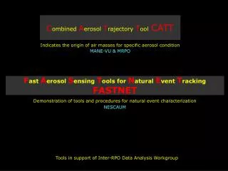
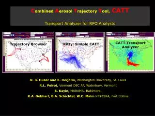
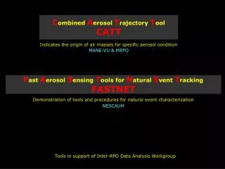
C ombined A erosol T rajectory T ool CATT. Indicates the origin of air masses for specific aerosol condition MANE-VU & MRPO. F ast A erosol S ensing T ools for N atural E vent T racking FASTNET. Demonstration of tools and procedures for natural event characterization NESCAUM.

E N D
Combined Aerosol Trajectory ToolCATT Indicates the origin of air masses for specific aerosol condition MANE-VU & MRPO Fast Aerosol Sensing Tools for Natural Event Tracking FASTNET Demonstration of tools and procedures for natural event characterization NESCAUM Tools in support of Inter-RPO Data Analysis Workgroup
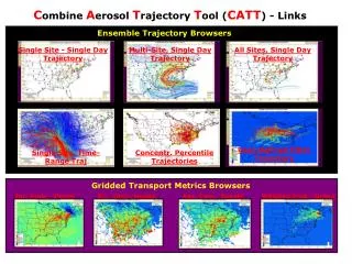
Combined Aerosol Trajectory Tool (CATT) Example: Airmass origin for high (2.5*average) nitrate Boundary Waters Doly Sods Lye Brook Smoky Mtn. Triangulation indicates nitrate source in the corn belt
CATT: Single web page Map View: Superimposed GIS layers Rendering Zoom, Pan, Point Color, Size, Visibility Layer Controls: Location selector Parameter selector Filter conditions CATT Tool User Interface
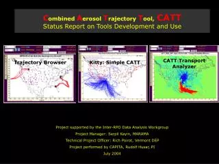
AEROSOL CATT-In CAPITA Aerosol Sensors Aerosol Data Integrated AerData TrajData Cube Aggreg.Aerosol Collection IMP. EPA Trajectory ARL Integration VIEWS Assimilate NWS CATT Weather Data Gridded Meteor. Traject.Data When? Where? Aggreg. Traject. Next Process AerData Cube CATT-In CAPITA Not There! Why? How? TRANSPORT Further Analysis Next Process GIS Grid Processing Emission Comparison There! CATT: A Community Tool! Part of an Analysis Value Chain
Fast Aerosol Sensing Tools for Natural Event Tracking FASTNET Analysts Console Community Website