Download
1 / 46
460 likes | 476 Views
This project aims to study the chemistry of ground water and surface water in Thiruvallur, Tamil Nadu to understand its relationship with health problems. Specifically, the impact of waterborne diseases and the financial burden it poses on the affected population and economy will be analyzed using geospatial techniques.

E N D
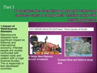
Part 1 To analyse the chemistry of ground water and surface water to study their relation ship with health problems DST NRDMS HEALTH GIS Project Water Quality & Health 1.Impact of Waterbourne diseases Waterbourne diseases have significant impact on National and International economy. Infected people are usually, confronted with related costs and seldom with a huge financial burden. This is especially in less developed countries. Sri Vaidya Veera Raghavar, the Lord of medicine. Coouam River and Tanks in study area
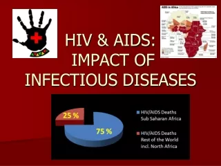
World Health Organization • classify the infections that predominantly transmitted through contact with or consumption of infected water as "waterbourne diseases". • It has estimated 3.6% of global population affected with daily global burden for economy, as, it causes about 1.5 million human deaths annually.
Monitoring and Managing Water bornE diseases at Thiruvallur Tamil Nadu using Geo spatial techniques • Impact of Waterbourne diseases • Waterborne diseases have significant impact on National and International economy. Infected people are usually, confronted with related costs and seldom with a huge financial burden. This is especially in less developed countries. • Long before modern studies established, any advanced understanding of the nature of water as a vehicle, for transmitting disease, traditional beliefs had cautioned against the consumption of water, rather favouring processed beverages such as beer, wine and tea.
When camel caravans crossed Central Asia along the Silk Road, the explorer • , Owen Baltimore noted,"The reason we drank so much tea was because of the bad water. Water alone, un-boiled, never drunk as it causes blisters on the feet."
58% Financial Burden • Out of this 58% of that burden, i.e., 842,000 deaths per year, because of unsafe water supply, sanitation and hygiene as pathogenic microorganisms are commonly transmitted in contaminated, fresh water while bathing, washing, drinking, preparation of food or consumption of infected food.
Loss to family The financial losses are mostly costs for medical treatment and medication, costs for transport, special food, and by the loss of wages and manpower. Many families may even sell their land to pay for treatment in a proper hospital. On an average, a family spends about 10% of the monthly household’s income per person infected.
100 year record flood project area BHUVAN IMAGE NRSC ISRO DEC 2015
Auth0urs • DST NRDMS HEALTH GIS Project G.Aiswarya1,Ramakrishnan.V.V2,Dr.J.Venkatesh3, GhouseShaik Mohamed 6 1*Final BE Student,2*ME (Cse) Scholar, *Principal,6*Dean Research *Geo Information Technology Dept,SriVenakateswara college of Enggg and Technology,Thirupachur,Thiruvallaur, Anna University,Chennai 600025 1svcetthirupachur@gmail.com,2vvramkee2k@yahoo.co.in, 3venkateshj2007@rediffmail.com,6shaik.mohamedghouse@gmail.com, Dr.Murthy Ramillah4 4Deputy Detector, ISRO Satellite centre, Bangalore, 4murthyremilla@gmail.com T.SrinivasanShridhar I.A.S (Rtd )5 5#Director General,EaswariEngg College, SRM Ramapuram,Anna University, Chennai 600025.tss1955@gmail.com 1+914427660119,2+917418202521,3+919840605812,4+919980853662, 5+9444386225, 6+919444055967
The HiruthaapanasanaTheertham, the biggest tank, • It has two temple tank float festivals on Full moon day of Thai Tamil month ( Jan- Feb ) end of winter season and in • Chitra pournami, Full Moon day in Mid summer (April and May). • The winter season known vector and water borne deceases due to impounded water in agricultural lands and water bodies. • On festival season of two months in summer people have to take preventive measures from sun stroke, virus fevers of small pox chicken pox and apart from water bourn deceases
Thiruvallur 5000 year old town • Tiruvallur is a First Grade municipality on the banks of Coouvam river about 42 km (26 mi) northwest of Chennai i, India which is also the District Headquarters • It is an ancient town linked with with 5000 year mythological history in Kaliyuga and recorderd history of about 2000 years • It is one of the 108 DivyaDesams sacred shrines for Vaishnavites and Sri VaidhiyaVeeraragavar to protect people by curing all deceases.
Coouam –Kakkalur PROJECT area • The water drains from Coouvam River to Kakkalur lake • All houses depends on septic tanks • The aquifer near Coouvam river is less contaminated than the area near Kakkalur which has clay and sand stone and water is not fit for drinking
Perumppakkam lake filled up 1st Dec 2015 , Thiruvallur court complex surrounded by floods The wetlands above the lake have become housing colonies and blocking natural drains The flood water was source for Dengue and other mosquitoes The septic tanks filled up and sewerage was mixing with flood water and a source of infection water Bourne diseases
Poonganagar segment Church with grass land on Chennai tvr road
Poonganagar part of mage and map of wells and septic tank
Interaction with Health Dept and Public • Advisory committee formed • Health Dept Govt • RMO / DD Academics Govt GH Thiruvallur in Project area • Deputy Director Public Health / District Malaria officer • Welfare Associations • Poonganagar, • VOC nagar • Jaya nagar and • Thiruvallur Municipality • Residents • Two Thiruvallur Bar council advocates living in the project area • Two Faculty of SVCET in Project area
Health GIS Selection of Observation wells GIS Attribute data base Bi Monthly Testing of well sample Geospatial analysis Web page in Tamil and English Revie Final Report and GIS Review Health Dept Team
Part of Project area ThiruvallurSri Veeraragava Temple and Tank 2016-17 Market Mosque Veerarargava Temple School Siva temple 1Ladies Milk Men TEMPLE Tank School Veeraragavar Temple area 100000 visit on Amavasai and festival days The Tank have three compartments for men wome and for milk , Few schools Mosques and Market of near by . Water quality may give notables data on contaminations in festival season Rain and Summer
The area near the temple have street house with narrow lanes without trees, dusty and affected by high intensity population and vehicles and summer diseases high in the area because of dense assembly of devotees on same day. • The Thiruvallur bus stand, hotels, food shops Markets make high solid waste and also civic issuses when temperature is above 35 to 45 degrees in summer. • The southern area like Poonganagar and new colonies are 1500 sq plots with compounds with street drains. But many vacant plots Ponds and tanks are potential source of Dengue as clean water is retained in pits, gardens and vegetation.
WaterBourne Diseases (CDC,WHO) • Amebiasis (CDC)Buruli Ulcer* (CDC, WHO)Campylobacter (CDC, WHO)Cholera (CDC, WHO)Cryptosporidiosis (CDC)Cyclosporiasis (CDC)Dracunculiasis (guinea-worm disease) (CDC, Carter Center, WHO)
WaterBourne Diseases Contd • Escherichia coli (CDC, WHO)Fascioliasis (CDC, WHO)Giardiasis (CDC)Hepatitis (CDC, WHO)Leptospirosis (CDC, WHO)Norovirus (CDC)Rotavirus (CDC, [WHO)Salmonella (CDC, WHO)Schistosomiasis (CDC, WHO, WHO-PPC)Shigellosis (CDC, WHO)Typhoid Fever (CDC, WHO)
Solid Waste and Sewarage from Colleges per day (Contd) * Treated water let in to field
EVACUATION SYSTEM ANALYSIS FOR MITIGATION OF PREDICTABLE DISASTERS • AkichikaIshibashi@, JanakiramanKumar#ofJaoan have observed that Predictable disasters such as land-slides, floods account for majority of natural disasters in the Asian region causing heavy loss of life and property every year. Demand for land is increasing and people are opted to live in flood prone areas resulting in heavy casualties during a calamity. Land exploitation in a watershed would further intensify the consequences by heavy soil washout, and alarming amount of mudflows in the floodplain is threatening the human lives. Non-structural measures like forecasting, warning and evacuation are essentially becoming important to reduce the loss of life and property to offset the marginal success with structural measures. This paper discusses a new strategy developed by us for assessment of Evacuation System, one of the non-structural disaster mitigation measures. Detailed GIS database consisting of topography, roads, houses and evacuation center was created. Considering the household distribution, proximity to evacuation centers and road network capacities, assignment and routing were carried out. Estimates of evacuation time and congestion were obtained through traffic simulation and ways to improve the evacuation system are highlighted. Creating effective non-structural mitigation measure, by means of designing efficient evacuation systems and coupling it with low cost “Hinomiyagura” observation towers, was also discussed for the case of Nepal.
Schematic DIAGRAM FOR EVACUATION DURING DISASTERS • Schematic Diagram
Monitoring and Managing Water Bourne diseases at Thiruvallur Tamil Nadu using Geo spatial techniques • Accepted Oral Presentation at American University International Conference at Sharja , Abu Dhubai , United Arab Emititus 28 Feb to 2 March 2017 • Dr.Ghouse Shaik Mohamed1*,Dr.J.Venkatesh2*,Dr.Vallimanikkam3%., Dr.Jagdeesh kumar4@,Gayatri5*,J.K.Thiyagarajan6*,Dr.G.Sreekanth7*
Geo spatial Management to increase immunity by herbal & allied medicines for EID( Emerging infectious diseases). • Accepted for Oral Presentation at Sharja Abu dubai UAE for International Conferance of Amrerican University 28 Feb to 2 April • R.Soundarya1a,Sindhuvenkat2a,Dr.GhouseShaik Mohamed3a , • Dr I V Muralikrishna National Coordinator • MohanramGovindarajulu PPP Member , • Dr Jagadeesh Kumar Civil Surgeon Govt Hospital Thiruvallur, • Dr.E.Padmanseasn6$, • 6Associate Prof, • $School of Public Health and Community Medicine, University of New South Wales. NSW 2052 Australia6Email:4E.padmanesan @unsw.edu.au ,6Mobile:+61 (2) 9385 2517,
Part 2 Impact on Health by floating population at Thiruvallur DST NRDMS HEALTH GIS Project Water Quality & Health G.Aiswarya1, Ramakrishnan.V.V2, Dr.J.Venkatesan3, GhouseShaik Mohamed 6 Dr.Murthy Ramillah4 ISRO T.SrinivasanShridhar I.A.S (Rtd )5 Paper no 173 Accepted oral presentation at LOCATE Ausralian Remote sensing confedrance Sydney April 2017 Sri Vaidya Veera Raghavar, the Lord of medicine. Coouam River and Tanks in study area
GIS Tools using Fuzzy Logic • Work under progress • Paper to be presented as Key note address by • Dr J Venkatesh with • Dr Ramakrishnan Director Inst of Remote sensing • Dr Ghouse Mohamed Shaik • and • Kalyan Janakiram3 • 3Senior System Analyst expert Fuzzy logic in evacuation in disasters in Japan • New south wales Land & Property Dev., Authority,Sydney,Australia, • Mobile +61425261181,kalyankj@gmail.com
MOU • Mou with Karnataka NRDMS centre and GIS Head and • ESRI to have their tools and mobile application and also to associate Kuppam Medical College, Adiyaman Engg College and MIT , VIT to develop Geo spatial tools as Networking Project Partners and submit papers to international journals with students and staff of SVCET
FINAL REPORT by MAY 2017 • Final Report in three volumes will be submitted • 1 Water bourne Diseases • 2. Health and Floating Population • 3.GIS tools for Health GIS and Creation of GIS web site in Tamil and English and Training of Medical staff to up date attribute table will be taken up in March 2017 and Reports and Web site will be presented in MAY 2017 • The project will be managed within 6.3 lakhs for 2016 -17 and • balance at SB Ac Indian Bank Thirupachur 2015-16 amount of Rs 0.65 lakhs will spent for micro biological testing of 100 samples at EswariEngg college SRM Ramapuram • Training will be conducted in Telemedicine with ISRO and Mobile application in March-April 2017 for public and schools students to update data
Dst NRDMS project • Thank You