Download
1 / 31
310 likes | 761 Views
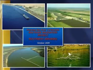
Arkansas Red River Commission RED RIVER NAVIGATION PROJECT SOUTHWEST ARKANSAS October 2009. The River Boats.

E N D
Arkansas Red River CommissionRED RIVER NAVIGATION PROJECTSOUTHWEST ARKANSASOctober 2009
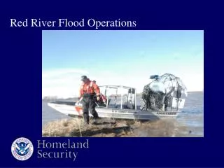
The River Boats You hardly know they are there - river boats - quietly pushing loaded barges on America’s rivers. Just one barge carries the load of 59 tractor-trailer rigs, as it moves almost silently – up and down the rivers, port to port. Towboats moved millions of tons of cargo on the waterways last year and they are the most economical, cleanest, safest and need we say, quietest means of transport. You might say they are the Strong, Silent type.
J. Bennett Johnston Waterway • Regional Visitor Center • Drawdown structure • 2 Realignments
Caddo-Bossier Port Natchitoches Port Alexandria Port
Fulton – 111 Miles Index – 134 Miles Garland City – 82 Miles
Alternative Plans Plan A: 2 L&D’s to Garland Plan B: 3 L&D’s to Fulton Plan D: 2 L&D’s to Fulton
GARLAND Lock & Dam 7 Lock & Dam 6
FULTON Lock & Dam 7 Lock & Dam 6
FULTON Lock & Dam 7 Lock & Dam 6
Benefit-to-Cost Ratio Total annual project benefitsTotal annual project costs = B/C Ratio
Benefit Categories • Transportation savings • Irrigation/water supply • Hydropower • Recreation • Non-traditional navigation benefits
Benefit Categories Transportation Savings • Potential user survey • Rate analysis • Transportation savings analysis
Benefit Categories Non-traditional Navigation Benefits • Air emission reductions and related health benefits • Reduced accidents • Reduced road travel time • Reduced highway maintenance costs
Benefit Summary Alternative Plans of Improvement 4-7/8% Benefit CategoryPlan A Plan B Plan D Recreation 9,800 12,844 12,844 Navigation 21,200 24,748 24,748 Externality 15,300 18,159 18,159 Water supply 2,2002,7912,791 48,500 58,542 58,542
Economic Summary Alternative Plans of Improvement 4-7/8% Plan A Plan B Plan D Annual Benefits 48,500 61,077 59,011 Annual Costs a/ 42,900 43,655 38,357 B/C Ratio 1.13 1.40 1.59 a/ Based on 6-year construction period
Total Project Costs Lands and damages Relocations Dams Locks Equipment Engineering & design Construction management Total estimated project first costs
Cost SummaryAlternative Plans of Improvement($ Millions) Plan APlan BPlan D Lands & Damages 43,489 45,779 54,038 Relocations 1,400 62,544 59,263 Bank Stabilization 159,858 219,536 212,923 Locks and Dams 270,129 394,124 294,167 Planning, Engineering& Design 53,966 78,463 69,760 Construction Mgmt. 29,09346,48438,773 Total 557,935 846,930 728,924 Plan A – Two Lock and Dam Plan to Garland Plan B – Three Lock and Dam Plan to Fulton Plan D – Two Lock and Dam Plan to Fulton
Current Status • Draft Report Prepared • Independent Technical Review (ITR) Complete • Headquarter Policy Review Complete • Alternative Formulation Briefing • Planning Guidance Memorandum (PGM) • Report revised in accordance with PGM
Remaining Milestones • Submit Revised Report to Headquarters • Headquarters Approve Draft Report for Public Review • Public Review of Draft Report • Public Meetings • Final Report
Tennessee Valley Authority Completed Rate Analysis on tonnage submitted by the Arkansas Red River Commission. No longer provides Rate Analysis; however, has instructed Baylor University how to. Baylor University will provide new Rate Analysis on updated tonnage submitted by ARRC.
WRDA WATER RESOURCES DEVELOPMENT ACT • This bill is presented every two years to the Senate and Congress in order to appropriate funds for selected water related projects throughout the United States.
WRDA – Bill Language RED RIVER NAVIGATION into SOUTHWEST ARKANSAS and LOUISIANA is authorized as a continuation of navigation on the Red River from Shreveport, Louisiana to Index, Arkansas, using the discount rate and local cost sharing requirements used in authorization of the existing J. Bennett Johnston Waterway Project, subject to completion of a favorable report by the Chief of Engineers.
DALLAS / FORT WORTH Dallas/Ft. Worth has lusted after river navigation since the late 1890s when the last steam ship made it up the Trinity River from the Gulf of Mexico to Dallas. Now, the Trinity River is dammed at Lake Livingston, cutting off any future possibility of making the Trinity River navigable to the Dallas area. The Red River is the ONLY possible solution.
WHY IS DFW INTERESTED IN RIVER NAVIGATION? With a current population of 6.25 million, and growing, the DFW area is the largest inland population center in the United States without a port of any kind with access to water transportation.
DFW WATER NEEDS CURRENT PLAN Currently, their “Plan” is to construct several lakes throughout East Texas – one of these being Marvin Nichols Reservoir – and pump the water to Dallas. Environmental problems, excessive costs for ROW for waterlines & pumping stations and the possibility of making enemies of East Texans by cutting off their future water supplies would be a high cost to pay. This costly plan would be paid for by the end users – water customers in the DFW area.
DFW WATER NEEDS ALTERNATIVE PLAN An alternative plan, extending the navigable Red River to Lake Texoma - north of the DFW area - would be more feasible. This plan requires 10-15 pools (lakes) to be formed along the Red River from the Fulton, AR area to Lake Texoma, in order to operate the Locks & Dams required to transport water. Each of these lakes could be used to meet the water needs of the Dallas area.
DALLAS/FT. WORTH WATER NEEDS Who else would benefit? • Dallas/Ft. Worth would benefit the most by not having to pay the costs associated with their current plan. Extending navigation on the Red River would have a much less financial impact on them as the Federal government would “cost share” navigational costs. • All communities along the river due to: • Creation of jobs for fueling, repairing and maintaining tugs & barges using the channel • Access to water transportation. • Water recreational activities, producing local income. • Flood control by the locks & dams • Stabilizing river banks resulting in cost savings for land owners/farmers using land on banks.
What Next? • Complete the SW Arkansas Navigation Project – making the Red River navigable from Shreveport to the Texarkana area. • Support letters for extending the “reach” of the Red River to the DFW area. • Action with the U.S. Army Corps of Engineers by the U.S. Senatorial and Congressional Delegations from OK, TX, AR and LA to secure funding. • Implement feasibility and environmental studies. • Secure appropriations to make the Red River navigable all the way to the DFW area.