Lecture 4. Interpolating environmental datasets
Lecture 4. Interpolating environmental datasets. Outline creating surfaces from points interpolation basics interpolation methods common problems. Introduction. Definition:
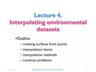

Lecture 4. Interpolating environmental datasets
E N D
Presentation Transcript
Lecture 4.Interpolating environmental datasets Outline creating surfaces from points interpolation basics interpolation methods common problems GEOG2590 - GIS for Physical Geography
Introduction • Definition: “Spatial interpolation is the procedure of estimating the values of properties at unsampled sites within an area covered by existing observations.”(Waters, 1989) • Complex problem • wide range of applications • important in addressing problem of data availability • quick fix for partial data coverage • interpolation of point data to surface/polygon data • role of filling in the gaps between observations GEOG2590 - GIS for Physical Geography
Creating surfaces from points • Waters (1989) provides list of potential uses: • to provide contours for displaying data graphically • to calculate some property of a surface at a given point • to change the unit of comparison when using different data models in different layers • to aid in the decision making process both in physical and human geography and in related disciplines such as mineral prospecting and resource evaluation GEOG2590 - GIS for Physical Geography
Surfaces from points Points Surface GEOG2590 - GIS for Physical Geography
An essential skill • Environmental data • often collected as discrete observations at points or along transects • example: soil cores, soil mositure, vegetation transects, meteorological station data, etc. • Need to convert discrete data into continuous surface for use in GIS modelling • interpolation GEOG2590 - GIS for Physical Geography
Interpolation basics • Methods of spatial interpolation: • many different methods available • classification according to: • exact or approximate • deterministic or stochastic • local or global • gradual or abrupt • examples: • thiessen polygons • spatial moving overage • TINs • Kriging GEOG2590 - GIS for Physical Geography
Data sampling • Method of sampling is critical for subsequent interpolation... Transect Regular Random Contour Stratified random Cluster GEOG2590 - GIS for Physical Geography
Question… • How do you choose a method of interpolation? GEOG2590 - GIS for Physical Geography
Classification: local or global • Global methods: • single mathematical function applied to all points • tends to produces smooth surfaces • Local methods: • single mathematical function applied repeatedly to subsets of the total observed points • link regional surfaces into composite surface GEOG2590 - GIS for Physical Geography
Classification: exact or approximate • Exact methods: • honour all data points such that the resulting surface passes exactly through all data points • appropriate for use with accurate data • Approximate methods: • do not honour all data points • more appropriate when there is high degree of uncertainty about data points GEOG2590 - GIS for Physical Geography
Classification: gradual or abrupt • Gradual methods: • produce smooth surface between data points • appropriate for interpolating data of low local variability • Abrupt methods: • produce surfaces with a stepped appearance • appropriate for interpolating data of high local variability or data with discontinuities GEOG2590 - GIS for Physical Geography
Classification: deterministic or stochastic • Deterministic methods: • used when there is sufficient knowledge about the surface being modelled • allows it to be modelled as a mathematical surface • Stochastic methods: • used to incorporate random variation in the interpolated surface GEOG2590 - GIS for Physical Geography
Question… • Think of data types that require: • local or global interpolation? • exact or approximate interpolation? • gradual or abrupt interpolation? • deterministic or stochastic interpolation? GEOG2590 - GIS for Physical Geography
Interpolation methods • Most GIS packages offer a number of methods • Typical methods are: • Thiessen polygons • Triangulated Irregular Networks (TINs) • Spatial moving average • Trend Surfaces GEOG2590 - GIS for Physical Geography
Thiessen Polygons • Thiessen (Voronoi) polygons: • assume values of unsampled locations are equal to the value of the nearest sampled point • Vector-based method • regularly spaced points produces a regular mesh • irregularly spaced points produces an network of irregular polygons GEOG2590 - GIS for Physical Geography
Thiessen polygon construction GEOG2590 - GIS for Physical Geography
Example Thiessen polygon Source surface with sample points Thiessen polygons with sample points GEOG2590 - GIS for Physical Geography
Question… • What categories does the Thiessen polygon method fall into: • exact or approximate? • deterministic or stochastic? • gradual or abrupt? • local or global? • What could it be used for? GEOG2590 - GIS for Physical Geography
TINs • Another vector-based method often used to create digital terrain models (DTMs) • adjacent data points connected by lines (vertices) to create a network of irregular triangles • calculate real 3D distance between data points along vertices using trigonometry • calculate interpolated value along facets between three vertices GEOG2590 - GIS for Physical Geography
TIN construction value b value c value a b c a Interpolated value x Isometric view Plan view GEOG2590 - GIS for Physical Geography
Example TIN Source surface with sample points Resulting TIN GEOG2590 - GIS for Physical Geography
Question… • What categories does the TIN method fall into: • exact or approximate? • deterministic or stochastic? • gradual or abrupt? • local or global? • What could it be used for? GEOG2590 - GIS for Physical Geography
Spatial moving average • Vector and raster method: • most common GIS method • calculates new value of each location based on range of values associated with neighbouring points • Neighbourhood determined by a filter • size, shape and character of filter? GEOG2590 - GIS for Physical Geography
Spatial moving average (SMA) GEOG2590 - GIS for Physical Geography
Example SMA (circular filter) Source surface with sample points 11x11 circular filter SMA with sample points 21x21 circular filter SMA 41x41 circular filter SMA GEOG2590 - GIS for Physical Geography
Question… • What categories does the SMA method fall into: • exact or approximate? • deterministic or stochastic? • gradual or abrupt? • local or global? • What could it be used for? GEOG2590 - GIS for Physical Geography
Trend surfaces • Uses a polynomial regression to fit a least-squares surface to the data points • normally allows user control over the order of the polynomial used to fit the surface • as the order of the polynomial is increased, the surface being fitted becomes progressively more complex • higher order polynomial will not always generate the most accurate surface, it dependent upon the data • the lower the RMS error, the more closely the interpolated surface represents the input points • most common order of polynomials is 1 through 3. GEOG2590 - GIS for Physical Geography
Fitting a single polynomial trend surface interpolated point data point GEOG2590 - GIS for Physical Geography
Goodness of fit (R2) = 92.72 % Example trend surfaces Source surface with sample points Linear Quadratic Cubic Goodness of fit (R2) = 82.11 % Goodness of fit (R2) = 45.42 % GEOG2590 - GIS for Physical Geography
Question… • What categories does the trend surface method fall into: • exact or approximate? • deterministic or stochastic? • gradual or abrupt? • local or global? • What could it be used for? GEOG2590 - GIS for Physical Geography
Common problems • Input data uncertainty • Too few data points • Limited or clustered spatial coverage • Uncertainty about location and/or value • Edge effects • Need data points outside study area • improve interpolation and avoid distortion at boundaries GEOG2590 - GIS for Physical Geography
Low High Effects of data uncertainty Interpolation based on 100 points Error map Original surface Error map Interpolation based on 10 points GEOG2590 - GIS for Physical Geography
Low High Edge effects Error map and extract Interpolated surface Original surface with sample points GEOG2590 - GIS for Physical Geography
Question… • Is it possible to use explanatory variables to improve interpolation, and if so, how? GEOG2590 - GIS for Physical Geography
Conclusions • Interpolation of environmental point data is important skill • Many methods classified by • local/global, approximate/exact, gradual/abrupt and deterministic/stochastic • choice of method is crucial to success • Error and uncertainty • poor input data • poor choice/implementation of interpolation method GEOG2590 - GIS for Physical Geography
Practical • Interpolating surfaces from point data • Task: Interpolate a selection of point data using the most appropriate methods of your choosing • Data: The following datasets are provided for the Yorkshire area… • 200m resolution DEM (derived from 1:50,000 OS Panorama data) • 25m interval contour data (derived from 1:50,000 OS Panorama data) • metstation data (mean annual rainfall) GEOG2590 - GIS for Physical Geography
Practical • Steps: • Look at the data carefully and choose appropriate technique(s) for interpolating rainfall– which is most appropriate and why? • Interpolate rainfall data using chosen method(s) – have you chosen more than one method and if so why? • Display the resulting surface – does it look right, if not why? GEOG2590 - GIS for Physical Geography
Learning outcomes • Familiarisation with range of different interpolation techniques • Experience at applying interpolation methods in Arc and ArcGRID to environmental datasets GEOG2590 - GIS for Physical Geography
Next week… • Grid-based modelling • linking models to GIS • basics of cartographic modelling • modelling in Arc/Info GRID • Practical: Land Capability Mapping GEOG2590 - GIS for Physical Geography