Download
1 / 1
10 likes | 140 Views
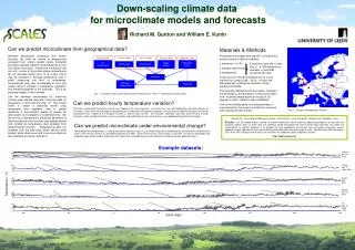
Down-scaling climate data for microclimate models and forecasts. Richard M. Gunton and William E. Kunin. Can we predict microclimate from geographical data?. Materials & Methods Temperature recorders were placed 1 cm below the ground surface in different habitats: 2 elevations (1 in Fi )

E N D
Down-scaling climate data for microclimate models and forecasts Richard M. Gunton and William E. Kunin Can we predict microclimate from geographical data? Materials & Methods Temperature recorders were placed 1 cm below the ground surface in different habitats: 2 elevations (1 in Fi) 2 habitats (open/forest) 3 temperatures These sensors recorded temperatures at hourly intervals for a year (2009 – 2010). At each site, data were also collected for elevation, slope, aspect and latitude. Five example datasets are shown below. Analyses will be based on the deviations of these time series from modelled temperatures at a scale of 2.5 degrees (or less, subject to data availability). One of the ultimate goals is to produce maps of microclimate for the present and also for scenarios with ongoing climate change. Whereas geophysical processes and human activities can often be related to temperatures averaged over coarse spatial scales, biological processes typically depend on temperatures at very fine scales: microsites. A plant that is killed by frost will only survive at microsites where temperatures do not decrease below zero; or an insect colony may be sensitive to average temperature over a patch measuring just tens of centimetres. Temperatures may vary considerably at such fine scales owing to variation in topography, vegetation and thermal properties of the substrate. This is an important aspect of microclimate. Can we estimate microclimate by combining coarser-scale climate data with fine-scale data on topography or other features (Fig. 1)? This project seeks to obtain a statistical model using topographic and vegetation data to predict deviations in microclimate relative to climate tile data (scales of 2.5 degrees or sometimes less). We will do this for temperature, predicting deviations of data recorded by point sensors (see graphs below) from climate tile temperature data available from meteorological services Topographical data are available from the microsites where sensors were located, while cloud cover and snow cover data are also available at coarse resolutions. 5 countries, most with 2 sites (Fig. 2) 108 temperature recorders, of which 81 recovered with data. Climate models Climate models Climate models Elevation maps Vegetation maps Air temperature Slope, Aspect Vegetation cover Snow cover Cloud cover Fig. 1. A model of factors influencing microsite temperatures. Terms in red indicate sources of data. Insolation Can we predict hourly temperature variation? Short-term temperature fluctuations can be very important for living organisms, and these may vary with topography and other aspects of microsites. Even where climate models make predictions at arbitrarily-fine temporal resolutions, we may want to model the temporal variance of microclimate with respect to the temporal variance of coarser-scale climate. For example, vegetation and snow cover tend to insulate microsites, while biological activities such as respiration and modification of the substrate may cause additional temperature fluctuations. Microsite temperature Substrate Fig. 2. Locations of temperature sensors. Securing the Conservation of biodiversity across Administrative Levels and spatial , temporal and Ecological Scales SCALES is an EU-funded project seeking to improve biodiversity conservation by addressing problems arising from the disparate spatial scales at which data are collected, stored and processed, and at which policy decisions are made and implemented. Its general objective is “to provide the most appropriate assessment tools and policy instruments across ecological scales and administrative levels and to disseminate them to a wide range of users.” Between May 2009 and August 2013, over €3m is being invested across 30 institutions for ecological, social and policy research. http://scales-project.net Can we predict microclimate under environmental change? The distribution of microclimates is a key determinant of species’ ranges. It is therefore important to understand the relationship of microclimate to coarse-scale climate scenarios as provided by geoclimatic models, and the influence of as many factors as possible. Our data on topography and vegetation cover will be used to explore the most robust ways of predicting future microclimates and hence species’ potential ranges. Example datasets: Finland, low, flat, forest France, high, N slope, open Greece, high, open Poland, low, flat, open UK, high, S slope, forest