GIS 投影法 、遙測、 GIS Software and Spatial Analysis Techniques/Software
GIS 投影法 、遙測、 GIS Software and Spatial Analysis Techniques/Software. 圓柱投影法 Cylindrical projections. 1552 年一位荷蘭的製圖家麥卡托,發明了一種特別的圓柱投影法,這種方法是將地球儀投影在圓柱筒上,再攤開成為平面地圖的方法,地球儀與圓柱接觸的地方是一個大圓,通常是赤道。. 圓柱投影法. 圓錐投影法 Conic projections.

GIS 投影法 、遙測、 GIS Software and Spatial Analysis Techniques/Software
E N D
Presentation Transcript
GIS投影法、遙測、GIS Software and Spatial Analysis Techniques/Software
圓柱投影法Cylindrical projections • 1552年一位荷蘭的製圖家麥卡托,發明了一種特別的圓柱投影法,這種方法是將地球儀投影在圓柱筒上,再攤開成為平面地圖的方法,地球儀與圓柱接觸的地方是一個大圓,通常是赤道。
圓錐投影法Conic projections • 圓錐投影法是將地球儀投影到圓錐上,再展開成平面地圖的一種方法,球體與圓錐接觸的地方 通常都是中高緯度的一條緯線,這種投影法雖然是會造成扭曲,但是狀況比較不嚴重。
平面投影法Azimuthal projections • 平面投影又稱為方位投影或天頂投影,這種投影法的投影面和地球儀相交於一個點,通常是南北極,但也可以是地球上的任何一點,投影出來的平面地圖呈圓形,緯線是一個一個的同心圓,經線則是從圓心向外的一些放射線,這種投影法所投影出來的地圖,面積比例和實際的相符。
台灣地區遙測影像來源包括: • 中等解析度衛星SPOT(法國光學遙測衛星) • 高解析度衛星EROS A1 (以色列) • 高解析度衛星IKONOS (美國Space Imaging公司) • 高解析度商業衛星Quick Bird影像 (美國) • 雷達衛星ERS 2 (歐洲太空總署, European Space Agency) • 雷達衛星Radarsat (加拿大資源衛星 ) • 福爾摩沙衛星 (台灣) • 航空攝影像片 • 空載多譜掃描儀影像 • 無人載具遙測影像
GIS Data Transformation:Making Maps • Determining what spatial and attribute data sets would be helpful and then to link them • Geocoding • Data display: event mapping, overlays, … etc
Selected GIS Software Products: Advantages and Disadvantages
SAS/GIS® This software also enables you to do more than simply view data in its spatial context. It allows you to interact with data by selecting features and performing actions based on those selections. SAS/GIS software draws on computing capabilities of the SAS System and enables you to access, manage, analyze, and present your data easily. • SAS/GIS software uses two basic types of data: • Spatial data - containing the coordinates and identifying information describing the map itself • Attribute data - containing information that can be linked to the spatial data--for example, matching addresses or coordinates in the spatial data • For example, the U.S. Census Bureau distributes both types of data: • TIGER line files - contain spatial information that you can use to build maps. • summary tape files - contain population and other demographic information that you can link to the maps.
SAS/GIS • Start a SAS/GIS session with the following selection from the Solutions menu: Solutions ->Analysis ->Geographic Information System • GIS: Tutorial Help -> Getting Started with SAS/GIS Software -> Begin Tutorial
TECHNIQUES GIS
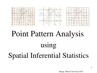
TECHNIQUES(Point Patterns) • Point pattern statistics are used to analyse the spatial distribution of features which can be modelled as discrete points. • Quadrat analysis • GIS08 • Kernel estimation • Nearest neighbour analysis • K-functions
TECHNIQUES(Point Patterns) • Statistics calculated using these methods are often used to test hypotheses of Complete Spatial Randomness (CSR) – i.e. a homogeneousPoison process throughout the study region. However, other models (e.g. a heterogeneous Poison process) can be explored. • Other methods have been developed to test for interactions between multiple event types, space-time clustering, variations in the underlying population at risk, clustering around specific point sources, etc.
TECHNIQUES(Spatially Continuous Data) Methods developed for continuous data include: • Spatial moving averages • Trend surface analysis • Delauney triangulation / Thiesen polygons / TINs • Kernel estimation (for the values at sample points) • Variograms / covariograms / kriging • Principal components analysis / factor analysis • Procrustes analysis • Cluster analysis • Canonical correlation
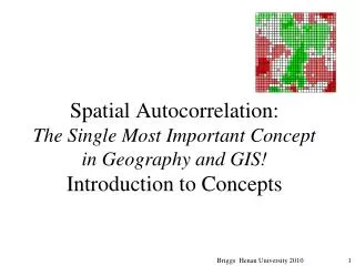
TECHNIQUES(Area Data) We frequently need to analyse attribute data which refer to polygons (i.e. areas). • Methods developed for this purpose include: • Spatial moving averages • Kernel estimation • Spatial autocorrelation (Moran’s I, Geary’s c) • Spatial correlation and regression
TECHNIQUES(Area Data) • Various models may be developed for spatial correlation and regression (e.g. to relax the assumption of second order stationarity) . • Methods have also been developed for special types of area data (e.g. counts, proportions). In the context of regression, many of these involve applications of the generalised linear model (e.g. Poison regression, logistic regression). • When dealing with rates based on small numbers there is a risk of extreme values in areas with a low population (the small numbers problem). One response to this is to map Poison probabilities. This, however, tends to place the emphasis upon the larger areas. Bayesianmethods appear to provide a reasonable balance between these two tendencies.
ArcGIS • - ArcView 3.2, like most commercial GIS application programs, contained very few options for spatial statistics. ArcGIS is little better. The Geostatistical Analyst extension, introduced in ArcGIS 8.1, provides some tools but it is still very limited. Although it provides tools for kriging and other simpler forms of spatial interpolation (e.g. inverse distance weighting), many other geostatistical options are missing. Likewise, many of the other non-field spatial statistical techniques mentioned above are not currently available elsewhere in ArcGIS.
Idrisi • Given its origins in an academic Geography Department, Idrisi not surprisingly provides a wider range of spatial statistical options, although it falls short in some areas (mainly because of its preference for raster / field data). Modules in the GIS Analysis | Statistics menu include: • • Pattern – Calculates various descriptive statistics used in landscape ecology for a moving pixel window. • • Regres – Simple regression analysis for images or values files. • • Multireg – Multiple regression for images or values files. • • Logisticreg – Binomial logistical regression for images or values files (multiple independent variables). • • Trend – First, second and third order trend surfaces. • • Autocorr – Moran’s I measure of first-lag autocorrelation in a raster image. • • Quadrat – Quadrat analysis for counts of point features saved as a raster image. • • Center - Weighted or unweighted mean centre and standard radius of point data saved as a raster. • • Cratio – Compactness ratio (compares area of a polygon to a circle with the same perimeter). • • Crosstab – Crosstabulation of images with various statistics (Cramer’s V, Chi-Square, Kappa). • • Validate – Compares similarity of two multicategory maps using Kappa statistic. • • ROC – Relative Operating Characteristic. Compares predicted likelihood of a class occurrence with Boolean • image of actual occurrence. • • Sample – Produces vector file of random, systematic or stratified random sample points. • • Standard – Converts values in an image into standardised normal deviates (z-scores).
S-Plus • Some of the deficiencies can be remedied using third party stand alone programs or add-ons. Perhaps the best examples are provided by a company called Insightful (formerly MathSoft). Insightful markets an advanced statistical software package called S-Plus. S-Plus includes a user-friendly GUI to the more commonly used statistical techniques (similar to SPSS – Statistical Package for the Social Sciences), including a very comprehensive suite of graphics routines. It also incorporates its own object-orientated programming language, similar to C+, which enables statisticians to develop their own statistical models. Of more relevance to the present discussion, Insightful produces an add-on called S+SpatialStats which adds a number of important spatial statistical functions to S-Plus. They also market an ArcView extension which allows you to access the full power of S-Plus, including the graphics routines and S+SpatialStats from within ArcView. • S+SpatialStats includes tools for the following: • • Nearest neighbour tests; • • Kernel estimation (plus other density estimation methods); • • Ripley’s k-function tests of second order stationarity; • • Variogram fitting; • • Ordinary and Universal Kriging; • • Moran test for spatial autocorrelation; • • Geary test for spatial autocorrelation; • • Spatial regression using covariance structures.
R • S-Plus is produced by a commercial company (Insightful), but there is also an Open Source equivalent called R. The Comprehensive R Archive Network website (http://cran.at.r-project.org/) provides free downloads of the base system plus contributed packages for Windows, Macs and Linux platforms. There are several packages and projects dealing • specifically with spatial data (e.g. sp, spatstat, DCluster, spgwr).
BUGS • Other useful software can be downloaded from the World Wide Web. A good example is a program called BUGS (Bayesian analysis Using Gibbs Simulation). A Windows version (WinBUGS) can be downloaded for free from • http://www.mrc-bsu.cam.ac.uk/bugs/. This is a general purpose program for Bayesian statistics, but it includes a spatial sub-set called GeoBUGS.