Download
1 / 1
10 likes | 161 Views
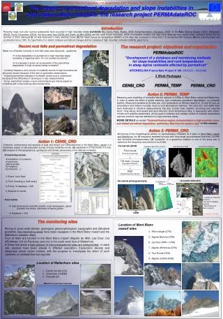
The research project: objectives and organization. PERMAdataROC. ‘‘Development of a database and monitoring methods for slope instabilities and rock temperatures in steep alpine rockwalls affected by permafrost ’’. INTERREG IIIA France/Italy Project # 196 (03/2006 – 03/2008).

E N D
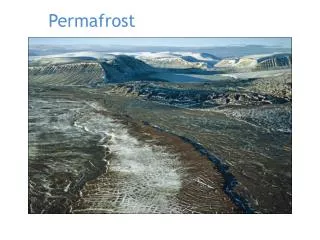
The research project: objectives and organization PERMAdataROC ‘‘Development of a database and monitoring methodsfor slope instabilities and rock temperaturesin steep alpine rockwalls affected by permafrost’’ INTERREG IIIA France/Italy Project # 196 (03/2006 – 03/2008) 3 Work Packages Matterhorn (2003) ICE PERMA_TEMP CENSI_CRO PERMA_CRO Brenva (1997) Point-clouds(5 cm point spacing) TIN mesh (Triangular Integrated Network) Thurwieser (2004) Les Drus (2005) Action 3: PERMA_CRO Monitoring of the morphological activity on representative rockwalls, at 9 sites on Mont Blanc massif and Matterhorn, by: (i) frequently repeated surveys with long-range ground-based laserscan (LIDAR) and terrestrial photogrammetry; (ii) installation of a geophone network in one of the study site to determine the frequency and volume of rock falls. DEM(Digital Elevation Model) Action 1: CENSI_CRO Collection, maintenance and analysis of past and recent rock fall/avalanches in the Mont Blanc massif in a data base, based on: (i) systematic survey of slope instability events, (ii) digitalisation of the events in a GIS,(iii)analysis of the topographical, geological and climatic parameters of the affected rockwalls. - Terrestrial LIDAR Aiguille du Midi (Piton Central) Diachronic comparison High Resolution DEM - Present-day events • Installation of a network of observers (alpine guides, hut keepers, excursionist …) Carrel Hut 1. Event : form filled 2. Form checking (+ field study) 3. Forms database + GIS 4. Analysis of events - Acoustic detection - Terrestrial photogrammetry Comparison: DEMphoto / DEMLidar Matterhorn: Carrel Hut (3810 m) Oriondè • Location of acoustic emission • sources (instability sectors) • Test method for alarm system - Past events Past and present scientific studies, local newspapers, alpine journals, hut books, interviews of alpine guides… DEM author P.Vacher DEM Database + GIS 4 channels (f=20 KHz) 4 5 1 Carrel hut (m3830) 2 Cheminée CHEM 9 Cheminée site 1 3 7 6 8 ONFR OFR Oriondé: high and low fractured International Union of Geodesy and Geophysics XXIV Perugia, Italy 2-13 July, 2007 The relation of permafrost degradation and slope instabilities in high alpine steep rockwalls: the research project PERMAdataROC Philip Deline (1), Edoardo Cremonese (2), Umberto Morra di Cella (2), Paolo Pogliotti (3,2), and the PERMAdataROC Team. 1. EDYTEM Lab - Université de Savoie, France 2. ARPA Valle d’Aosta A. O. Cambiamenti Climatici, Italia 3. Dipartimento di Scienze della Terra, GEOSITLAB, Università degli studi di Torino, Italia Contact: pdeli@univ-savoie.fr Introduction Recently, large rock and rock/ice avalanches have occurred in high mountain areas worldwide (Mc Ginnis Peak, Alaska, 2002; Kolka-Karmadon, Caucasus, 2002). In the Alps, Brenva Glacier (1997), Matterhorn (2003), Punta Thurwieser (2004), the Drus west face (2005) and Dents du Midi (2006) are the most recent examples, while innumerable smaller rock falls have detached from alpine steep rockwalls during the hot summer of 2003. Because (i) ice was observed in many starting zones; (ii) the mean annual air temperature (MAAT) in the Alps has increased in more than 1°C during the 20th Century; (iii) the warming trend has accelerated since 1980, the hypothesis of a relation between permafrost changes and an increase of high mountain rockwall instability gains force. Recent rock falls and permafrost degradation Water run-off and/or ice body in rock falls scars was observed... questions: • is the degradation of permafrost in high mountain steep rockwalls, a triggering factor for rock avalanche activity? • is it already in action an acceleration of the permafrost degradation in high mountain steep rockwalls? - Currently frequency and volume of instability events in high mountains are still poorly known because of the lack of systematic observations. - Ongoing permafrost changes in rockwalls remain poorly understood because of the difficulties in carrying on in situ measurements. - So far, permafrost studies in such environments are mainly based on modelling with a few existing instrumented sites. Action 2: PERMA_TEMP Measuring and modelling of rockwalls thermal regimes in 9 sites on Mont Blanc massif and Matterhorn in order to asses the effect of global warming, and consequent permafrost degradation, on rockwalls stability. Measured variables at all sites are: rock temperature at different depths (3, 30 and 55 cm), air temperature and relative humidity close to rock-atmosphere interface. Two sites (CC and AdM) have been dedicated to intensive measurements that also include solar radiation (incoming and outgoing short / long wave), wind speed and wind direction. Rock temperature data, in association with meteo-climatic and radiative parameters, will be used to calibrate and validate models of rockwall temperature regimes and their regional distribution in high-mountain areas. MORE DETAILS on poster “Rockwall thermal regime characterization in high mountain areas and related permafrost degradation: preliminary data from the western alps” in this session Matterhorn (2003) Event’s georeferentiation Description event’s form GIS analysis The monitoring sites Location of Mont Blanc massif sites Aiming to cover wide climatic, geological, geomorphological, topographic and altitudinal gradients, five monitoring areas have been equipped in the Mont Blanc massif and the Matterhorn (western Alps). Four of them are located in the Mont Blanc massif (Aiguille du Midì; Les Drus; Col d’Entrèves; Col du Peuterey) and one is the south-west face of Matterhorn. In these five areas a total amount of nine measurement sites are instrumented; in each site, sensors have been placed in different exposition, fracturation density and steepness (snow cover) context, with the purpose to investigate the effect of such variables on rockwall thermal regimes. 4 - Pilier d’angle (CPS) 5 - Aiguille Blanche (CPN) 6 - Les Drus (DRN + DRS) 7 - Aiguille d’Entrèves (CEN) 8 - Tour Ronde (CES) 9 - Aiguille du Midì (AdM) Location of Matterhorn sites 1 - Carrel hut site (CC) 2 - Cheminée (CHEM) 3 - Oriondè (O) CCS Matterhorn south face landscape Carrel hut South site CCW Carrel hut North-West site