Comprehensive Sensitive Habitat Inventory and Mapping in Central Okanagan, BC
260 likes | 385 Views
The Sensitive Habitat Inventory Mapping (SHIM) project focuses on collecting and mapping high-quality, spatially accurate information about local habitats and watercourses in Central Okanagan, British Columbia. The primary objective is to identify, inventory, and map all watercourses, facilitating the integration of this data into GIS using GPS technology. Through a series of methodological approaches, including data review, photodocumentation, and public education, the project aims to assess fish distributions, recognize sensitive zones, detect human impacts, and foster habitat restoration opportunities for future sustainability.

Comprehensive Sensitive Habitat Inventory and Mapping in Central Okanagan, BC
E N D
Presentation Transcript
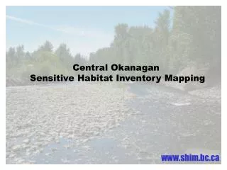
Central Okanagan Sensitive Habitat Inventory Mapping
What is SHIM? The collection and mapping of reliable, high quality, current and spatially accurate information about local habitats and watercourses.
Intended as a standard for habitat mapping in urban and rural BC. • Principal objective is to identify, inventory and map all watercourses. • Technique allows information to be incorporated into GIS using GPS.
Methods • Review existing data. • Watershed map. • ID main information gaps. • Air photo interpretation. • Survey / Assessment • Photodocumentation • Data management (QA/QC) • Final deliverables
RDCO Objectives • Determine precise stream and feature locations. • Collect stream and riparian habitat information. • Determine fish distribution and the major activities of those fish. • Determine the nature of streamflows. • Identify and locate sensitive zones. • Identify and locate human related impacts to water quality and fish. • Identify restoration and rehabilitation opportunities. • Educate the public of local fish and fish habitat needs. • Compile information for easy user access. • Summarize and present the results of the assessment.
Identify sensitive habitats for fish….
Assist in determining setbacks for sensitive zones.
ID and map sources of pollution
Public education
ID and map water intakes and identify improper screening
Assist in the design of stormwater management plans
Monitor changes in habitat resulting from known disturbance
Assist with fish distribution information and identifying limiting factors
Identify stability or water quality concerns
Identify stream restoration opportunities and priorities
Monitoring for the future.
Westside Study Area Phase I initiated in September 2001.
Ellison Study Area Phase II initiated in January 2002.
Northwestside Study Area Phase III began September 2002.
Middle Vernon Creek Study Area
Christina Lake Study Area
Efficient, low cost & accurate. • Information can be easily shared and updated. • Large gaps in information. • 30-40% of small streams are incorrectly mapped. • Enhancing local land use planning decisions.