Download
1 / 84
840 likes | 959 Views
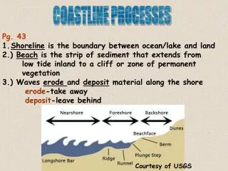
Coastal Ranges Coastline. Chapter 12. California Coastline 1100 miles long!. Upwelling Brings Nutrients to Photic Zone. Coastline. Moderate maritime temperatures. Tides. Tidal cycle varies over day Extremes vary according to relative position of moon sun & earth Neap tide= puny

E N D
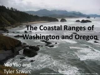
Coastal RangesCoastline Chapter 12
Coastline • Moderate maritime temperatures
Tides • Tidal cycle varies over day • Extremes vary according to relative position of moon sun & earth • Neap tide= puny • Spring tide= excellent
Tides • Influence of gravitational pull from Sun and Moon. Moon’s pull is stronger because it is closer. • Centrifugal force also important. • Spring tides (Upwelling) every two weeks or so • Sun’s pull adds to moon’s pull • Neap tides (Scarce) every two weeks or so. • Moon’s pull partially counteracts sun’s pull. • Sun’s influence changes with season, • closer in June and December stronger tides.
Tidal Cycle • Approximately Every “day” (24 hrs. 48 mins.) has two high tides and two low tides. • One high tide is higher than the other: Hi-Hi • One low tide is lower: Lo-Lo • Daily Tidal cycle: • Hi-Hi; Lo-Lo; Hi-Lo; Lo-Hi repeat……. • tides change every 6 hrs. 12 mins. • full cycle in 24 hrs. 48 mins. (one Lunar orbit) • offset by about an hour per day
Tidal Sequence Hi-Hi Lo-Hi Sea level Hi-Lo Lo-Lo
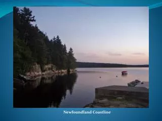
Coastal Habitats • Rocky coastlines • Sandy beaches • Estuaries
Hostile Environment Shifting substrate Changing water level Salinity Low productivity Sandy Beaches
Rocky Intertidal • Hard coastal rock • Little weathering & erosion • High species richness • Harsh living conditions • High competition
Intertidal life • Dessication • Salinity • Waveshock • Real estate • Light
Spray Zone (1) • Aka spray zone, littoral zone, lichen zone • Dryest zone- “desert of intertidal” • Wet only during high tides • Semi-terrestrial animals • Isopod • Periwinkle Littorina sp • black lichen
High Intertidal- Zone 2 Aka upper intertidal Covered during high tide Dry periods every day Characteristic species Brown turban snail Limpets Gooseneck barnacle
Midtide Zone 3 • Regularly covered by water • Uncovered at low tides, covered at high tides • Chitons • Brown algae • Some pelvetia, lots more fucus, Egregia • Red Algae • Gigartina, Porphyra,