Download
1 / 24
260 likes | 622 Views
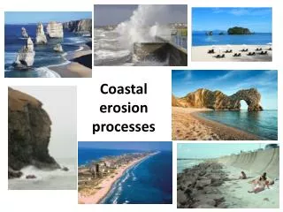
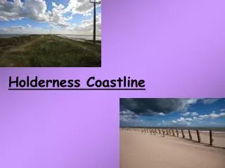
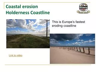
Coastal erosion Holderness Coastline. This is Europe’s fastest eroding coastline. Link to video. Case study. To understand that coastlines work as a system and are dynamic . To understand the processes of coastal erosion and how these shape the Holderness Coastline.

E N D
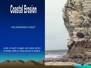
Coastal erosionHolderness Coastline This is Europe’s fastest eroding coastline Link to video
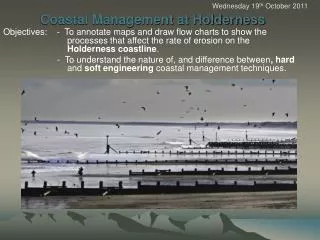
Case study • To understand that coastlines work as a system and are dynamic. • To understand the processes of coastal erosion and how these shape the Holderness Coastline. • To discover how the coastline is being protected. • To gain in depth knowledge of the Holderness Coastline, looking at Flamborough Head, Hornsea, Mappleton and Spurn Point.
Location : HoldernessCoastline The Holderness Coastline is located on the North East coast of England.
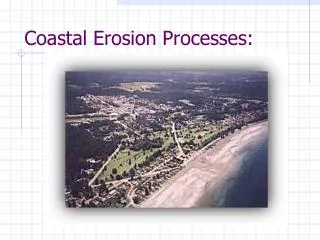
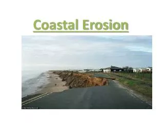
Focus areas along the Holderness Coastline • The Holderness Coastline of the East Riding of Yorkshire is suffering from the worst coastal erosion in Europe. In the last 2000 years the coastline has retreated by almost 400m and since Roman times over 30 villages have disappeared into the sea between Bridlington (just south of Flamborough Head) and Spurn Head. • Although large towns such as Hornsea are protected by sea walls they may eventually be left cut off at the end of a long peninsula. • About a million years ago the Yorkshire coastline was a line of chalk cliffs almost 32km west of where it now is. During the Ice Age deposits of soft boulder clay (or till) were built up against these cliffs to form the new coastline. It is this soft sand and clay which is easily eroded by the action of waves.
Waves breaking at the rate of 10 per minute or less are building up beach deposits. Waves breaking at a rate of 10 or more (especially 15) are removing sand and pebbles from the beach. How do waves erode the Holderness Coastline ? Constructive waves have a strong swash and a weak backwash. Destructive waves have a weak swash and a strong backwash. The Holderness coast is subject to the full force of the waves from the north sea with minimal loss of energy before they reach the cliffline.
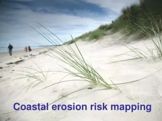
Journey along the Holderness Coastline We will take a journey along the Holderness coast from Flamborough Head, stopping at Hornsea, Mappleton and ending at Spurn Point. Along the way we will be looking at coastal features, defences, processes and the impact the sea has on the people that live there.
Holderness journey fact file The Holderness Coast is Europe's fastest eroding coastline. The average annual rate of erosion is around 2 metres per year. The main reason for this is because the bedrock is made up of till. This material was deposited by glaciers over 18,000 years ago. • The Holderness Coast is a great case study to use when examining coastal processes and the features associated with them. The area contains text book examples of coastal erosion and deposition. • The chalk of Flamborough provides examples of erosion, features such as caves, arches and stacks. • The soft boulder clay underlying Hornsea provides clear evidence of the erosional power of the sea. • Mappleton is an excellent case study of an attempt at coastal management. • Spurn Point provides evidence of longshore drift on the Holderness Coast. It is an excellent example of a spit.
Geology at Flamborough Head The most striking aspect of Flamborough Head are the white chalk cliffs that surround it. The chalk lies in distinct horizontal layers, formed from the remains of tiny sea creatures millions of years ago. Above the chalk at the top of the cliffs is a layer of till (glacial deposits) left behind by glaciers 18,000 years ago, during the last Ice Age. As the cliffs below are worn away by the action of the waves, the clay soil often falls into the sea in huge landslips.
The sea attacks the coast around the headland in two ways. Waves beat against the vertical cliffs and, at the high water line, weak points in the chalk are worn away into caves. The weakest points are where vertical cracks or fault lines have appeared in the horizontal beds of chalk. At places on the cliffs where the chalk juts out, these caves are worn away into rock arches. If the top of an arch collapses, the result is a pillar of chalk cut off from the rest of the headland - this is called a stack. Flamborough Head has many caves and arches, as well as a few stacks. The process of erosion that has created them can take hundreds of years to do its work. Structure of Chalk Flamborough Head Joint Bedding plane / fault line
Flamborough Head Coastal featuresErosion of a Headland Caves Arch Stack
Hornsea • Location • A 2.9km stretch of shoreline fronting the town of Hornsea. A high density urban development containing residential and various tourist related properties, Hornsea's local economy is dependent on tourism and recreation as well as incorporating a small fishing industry. • Geology • Hornsea lies upon unconsolidated till. This material was deposited by glaciers during the last ice age 18,000 years ago. • Coastal Features • The groynes on Hornsea beach ensure wide and relatively steep beaches. The beach material is made up of sand and shingle.
Hornsea Coastal Management The position of the coastline at Hornsea has been artificially fixed since existing coastal defences were erected in the early 1900s. Hard defences in the form of a concrete seawall and timber groynes afford protection and an on going refurbishment programme ensure this has continued. More recently a stone gabion has been erected to the south of Hornsea. This helps protect the caravan park. Beach material is being transported south along the Holderness Coast by longshore drift. In Hornsea sand has accumulated where protection exists. This is because the groynes provide a barrier to sediment transportation. This has reduced erosion within the section but increased rates are evident further south.
Hornsea’s Coastal defences Wooden groyne – notice the difference in sand heights. Wooden groynes and rock wall. Gabions. Concrete sea wall, protects the caravan park.
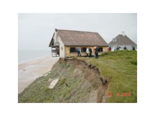
Mappleton • Location • Situated approximately 3km south of Hornsea lies the village of Mappleton. Supporting approximately 50 properties, the village has been subject to intense erosion at a rate of 2.0m per year, resulting in the access road being only 50m from the cliff edge at its closest point. • Geology • Mappleton lies upon unconsolidated till. This material was deposited by glaciers during the last ice age 18,000 years ago. • Coastal Features • The two rock groynes at Mappleton have helped develop wide and steep sandy beaches.
Why protect Mappleton ? In 1990, Mappleton was under threat from losing 30 houses along the coast of Holderness. Its main road, the busy B1482, would´ve disappeared into the sea and would be very expensive to rebuild. So, a coastal management scheme was set up. Blocks of granite were imported from Norway so two groynes could be built. This would trap the beach sediment that is being eroded away due to longshore drift. This would then absorb some of the energy from the waves so less energy would be directed on the cliff's side. This would reduce erosion.
Mappleton Coastal Management In 1991 two rock groynes and a rock revetment were built, as a consequence a substantial beach accumulated between the groynes halting erosion. However, further south the rate of erosion has increased significantly. This is because material which is being carried south is not being replaced (it is trapped within the groynes). Therefore there is no beach to protect the cliffs. Even during a neap tide ( a tide which is 30% less than the average tidal range) the sea reaches the base of the soft cliffs and erosion occurs.
Mappleton’s coastal defences The rock groynes prevent longshore drift and encourage deposition of sediment. This creates a beach and a natural barrier that prevents waves from breaking directly on the cliff base. This therefore prevents erosion.
However, further south towards Withernsea erosion has been increased – Why ??
No beach, no defence ! The process of longshore drift can no longer transport material along the coastline to be deposited at the base of the cliffs. All the sand has gathered at Mappleton, this leaves the glacial till cliffs exposed to the sea. The rates of erosion just south of Mappleton have in places been as much as 10 metres per year. People have lost their homes, farmland and livelihoods.
Spurn Point • Spurn Point is a narrow sandy coastal spit aproximately five kilometers long. It is located on the south-eastern tip of the Holderness plain which forms the northern banks of the Humber estuary. • Spurn Point is a feature of coastal deposition and reguires a constant supply of sediment from the process of longshore drift.
Spurn Point The strategic position of the sand spit, guarding the entrance to a major waterway lead to its use as a position for shipping beacons and lighthouses. Historical accounts of settlements and lighthouses, particularly accounts of their destruction and the break up of the spit have enabled us to discover that over the last 1000 years there have been five 'Spurn points'. Each spit has grown until it has become unstable, been destroyed and then rebuilt slightly to the west of the former one, the cycles lasting approximately 250 years. The current spit is nearing the end of the cycle, and despite considerable coastal defences the neck is in continual danger of being breached.
Why protect Spurn Point ? Spurn Point protects many wildlife habitats and ecosystems which have developed behind the spit. Spurn Point itself has essential services such as the Lifeguard station. Many wooden groynes and other coastal defences have been built to protect and preserve the spit. However if sediment is prevented from reaching Spurn Point the consequences could be immense.
Implications of protecting the Holderness Coastline • Saved the village and road. Mappleton row has a beach and a growing tourist trade. But - local downstream farmers are losing land at an even quicker rate. The farmers profits are being threatened. • Withernsea, a large resort town, has now to spend millions to build toe revetment sea defences to protect the town. This is very costly. • Industry at Easington is being threatened with the gas terminals coming too close to the sea. This is not only dangerous but could force the gas terminal to close with the loss of 1000s of jobs • Essential services at Spurn Point (Coastguard, Lifeboat) are now threatened as the spit is being starved of material. • Wildlife to the rear of the Spit is losing a good migrating spot. These species are seen even less in the area. • Long term effects on King' s Lynn and Amsterdam have yet to be analysed but they may need to take on extra sea defences
Summary • The Holderness Coastline is shaped by erosion, transportation and deposition. These work together to create a variety of coastal features (caves, stacks, beaches, spits). • Erosional processes (corrasion, corrosion, attrition and hydraulic pressure) produce some interesting features especially at Flamborough Head. They also cause many problems further down the coast where the geology is less resistant (Mappleton, Hornsea). • Coastal defences include wooden groynes, rock gabions, concrete sea walls and the beach. Developing these in certain areas however has important implications further along the coast. • However careful planning is needed to ensure that the whole coast is managed in the most sustainable manner. • Study the guide for the coastal landscape and process enquiry carefully, this will be an assessed piece of work.