Download
1 / 18
320 likes | 1.02k Views
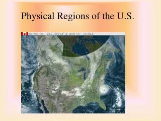
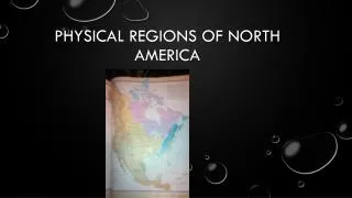
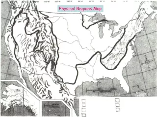
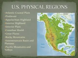
U.S. PHYSICAL REGIONS. Atlantic Coastal Plain Piedmont Appalachian Highland Interior Highland Interior Plain Canadian Shield Great Plains Rocky Mountains Intermountain Basin and Plateaus Pacific Mountains and Valleys. North America’s Landforms.

E N D
U.S. PHYSICAL REGIONS Atlantic Coastal Plain Piedmont Appalachian Highland Interior Highland Interior Plain Canadian Shield Great Plains Rocky Mountains Intermountain Basin and Plateaus Pacific Mountains and Valleys
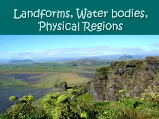
North America’s Landforms Landforms range from vast plains to high mountains, plateaus, and volcanic islands. Eastern half of the continent is older than western half. Eastern mountains have eroded, and rolling hills and flatlands cover most the area. In the west you will find steep mountains, active volcanoes, deep canyons, and high plateaus.
Atlantic Coastal Plain • Ranges from Texas to New York • Gently sloping land caused by diverging plates • Often has Barrier Island – long narrow islands formed by sand • Flat plains in the East and Southeast U.S.
Atlantic Coastal Plain • Coastal Plain has soft limestone which erodes easily causing large rivers • Navigable River – rivers deep and wide enough to sail boats and small ships • Fall Line – area where Coastal Plains meets the Piedmont. Many cities are located on this fall line. WHY?
Piedmont • Region of hard rock with shallow, rapid rivers. • Many rolling hills • Transition area to mountain region • Ranges from Alabama to New York on the east coast
Appalachian Mountains • Considered old due to erosion and thick vegetation • Ranges from Georgia through New England and Newfoundland, Canada • First Major barrier to Westward Expansion
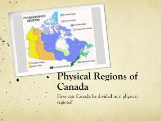
Canadian Shield • Large sheet of ancient rock that covers most of Canada • Great Lakes of the US line the southern border • Hudson Bay is the center of the Shield
Interior Highlands • Many old uplands and plateaus • Ozarks • Located in Oklahoma, Arkansas, and Missouri
Interior and Great Plains • Very flat open plains • Tornado Alley • Some of the best farm lands in the World
Landforms • The East and the Interior • Atlantic Coastal Plain - stretches from New England to Mexico along the Atlantic Ocean and Gulf of Mexico. • Appalachian Mountains – stretch from Alabama to southeastern Canada and include the Blue Ridge, Catskill, and Green Mountain Ranges. • Between the Appalachian and Rocky Mountains lie the vast interior plains. The Mississippi River and its many tributaries drain most of this region. The Great Lakes, Ozarks, and The Great Plains are found in the interior. • North of the interior plains lies the Canadian Shield. This arc of ancient rock covers nearly half of Canada.
Rocky Mountains • Ranges from New Mexico through Canada and into Alaska • Considered new due to its size and lack of vegetation • Aka: Great Divide, Continental Divide • Rivers only flow East or West in the western US… Why?
Interior Mountains, Basins, and Plateau • Area between Rockies and the Sierras • Basin – Low, dry, hot areas surrounded by mountains or plateaus • Death Valley – lowest point in the US at 282 feet below sea level.
Pacific Mountains and Valley • Ranges from Baja California through southern Alaska • Includes: Sierra Nevada, Cascade Range, and Central Valley (in California) • Volcanoes: Mount Rainier, Hood, Shasta, and St. Helen
Landforms • The West • The Rocky Mountains stretch from New Mexico to Canada. Highest peaks reach more than 14,000 feet. West of the Rockies lie the Cascade Range and the Sierra Nevadas. • The rugged western US is part of the Ring of Fire which is a tectonically active region at the edges of the Pacific. Made up of many active volcanoes and earthquake faults including the San Andreas Fault.
Bodies of Water Major Rivers: Used for exploration, travel, trade, irrigation. -Include Mississippi, Missouri, Ohio, St. Lawrence Many western rivers originate in the Rockies: Colorado, Columbia, Yukon Many Lakes found in North America