Download
1 / 20
200 likes | 331 Views
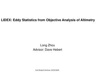
LIDEX: Eddy Statistics from Objective Analysis of Altimetry. Long Zhou Advisor: Dave Hebert. 2nd Student Seminar, 03/20/2006. Outline Reasons for Objective Analysis Mapping domain Dataset Examples of mapped sea level anomalies (SLA) Comparing between outputs from 4 and 2 satellites

E N D
LIDEX: Eddy Statistics from Objective Analysis of Altimetry Long Zhou Advisor: Dave Hebert 2nd Student Seminar, 03/20/2006
Outline • Reasons for Objective Analysis • Mapping domain • Dataset • Examples of mapped sea level anomalies (SLA) • Comparing between outputs from 4 and 2 satellites • Evolving eddy field during 2 months • Comparison with the hydrographic survey • Eddy statistics during 02/25/2003 to 05/08/2005 • rms SLA and EKE • Averaged velocity • Eddy propagation • Summary and future work
Reasons for this work b. Correlation scales should vary in different regions, while AVISO merged maps use identical along-track correlation for the same latitude. c. This mapping technique is expected to show a more realistic picture of ocean mesoscale activity.
Lagrangian Isopycnal Dispersion Experiment (LIDEX) Figure 1: Spatial coverage [4.75N 12.86N 24.25W 32.45W]
Dataset • JETG along-track SLA for 02/25/2003 to 05/08/2005 • JEalong-track SLA for 03/13/2003 to 12/02/2003 • CTD data from LIDEX cruise, 03/25/2003 to 04/16/2003 • Next page: sample satellite ground tracks for b Note: GFO=Geosat Follow-on
Comparison with the hydrographic survey Red line and circles show the cruise zigzag track and CTD stations. Two black squares represent casts taken on 4/5/03 and 4/15/03. It took 22 days (3/25/03-4/16/03) to cover the stations from west to east.
NEC NECC NSEC Eddy Statistics during 02/25/2003 to 05/08/2005 Root-mean-square SLA field Time averaged eddy kinetic energy
-24 to 17 -4.6 to 6.3
Distance-time plot of SLA along a latitudinal section. Numbers of days are relative to 1/1/2003. The slope of the black line signifies a westward eddy propagation speed of 8.1 cm/s.
Summary • SLA maps with high spatial and temporal resolutions (9km&1day) can be produced with the mapping error variance below 60% of the measurement error variance from the along-track altimeter data. • Root-mean-square SLA and eddy kinetic energy (EKE) show high levels of eddy energy within 2 degrees south of the southern LIDEX deployment site. • Time-averaged geostrophic velocity and SLA field describe the existence of strong flow between 5°N and 6°N west of 29°W and between 9°N and 11°N east of 26°W. • Averaged u along each latitude ranges from -24 to 17 cm/s and averaged v along longitude, from -4.6 to 6.3 cm/s. • The longitude-time SLA distributions at 11.88°N are dominated by westward propagation at a speed of 8.1 cm/s probably due to wind-forced Rossby wave motions.
Future Work • Expand spatial coverage. • Effective diffusion from numerical experiments based on advective-diffusion equation with idealized passive tracer in generated geostrophic flow field. • Random walk. • Compare results with floats statistics.
Acknowledgement • GSO: • Dave Hebert • Tom Rossby • Everybody in Watkins • WHOI: • Valery Kosnyrev • Dennis McGillicuddy • Real-time Altimeter Data Research Group at Colorado Center for Astrodynamics • CLS Space Oceanography Division
0.8 0.6 0.4 0.2 0 -0.2 -0.4 -1000 -800 -600 -400 -200 0 200 400 600 800 1000 spatial correlation scale based on 24 altimeter tracks 1 mean ACF 0.8 standard deviation fitted curve 0.6 0.4 autocorrelation function 0.2 250km 0 -0.2 -1000 -800 -600 -400 -200 0 200 400 600 800 1000 distance (km) Figure 2. Fitted curve: , where 250km is the zero crossing value that defines OA search radius. Establishment of the Correlation Model
1 The final correlation model: , where R is the time-dependent radial coordinate that accounts for the westward migration in this region. 0.5 0 -0.5 -300 -200 -100 0 100 200 300 temporal correlation scale based on time series at 40 points 1 mean ACF standard deviation fitted curve 0.5 12days autocorrelation 0 -0.5 -300 -200 -100 0 100 200 300 time (days) Figure 3. Fitted curve: , 12 days is the e-folding time scale.