Download
1 / 26
270 likes | 417 Views
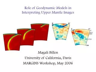
Role of Geodynamic Models in Interpreting Upper Mantle Images. Magali Billen University of California, Davis MARGINS Workshop, May 2006. Coupled Imaging & Dynamics Studies. Wiens & Conder : Synthetic Velocity & Attenuation. Lassak, Fouch et al., EPSL 2006:

E N D
Role of Geodynamic Models in Interpreting Upper Mantle Images Magali Billen University of California, Davis MARGINS Workshop, May 2006
Coupled Imaging & Dynamics Studies • Wiens & Conder : • Synthetic Velocity & Attenuation • Lassak, Fouch et al., EPSL 2006: • Corner flow models & regions of A vs. B type fabric • Predicted shear wave splitting magnitudes.
Why do we need Geodynamic Models? Already need to know/assume a lot to make geodynamic model…
Rheology Primary Geodynamics Parameters Phase Changes Composition Pressure Density Temperature Thermal Expansion Melt Thermal Conductivity Geodynamicist’s Goal: Translate your observations and experiments into density and rheology. Advected during convection: requires tracers. Depth dependent.
n = 1 & 3.5 10 mm fixed ignore + Rheology: Where Things Complicated • Viscosity depends on pressure,temperature, • stress (strain-rate),grain size, water, melt, &mineralogy… • Ideally: water, melt content and grain-size should vary spatially, • with composition, and evolve with time in a physically/chemically • consistent way • Most models: fixed everywhere or fixed in regions.
Primary Geodynamics Parameters Phase Changes Phase Changes Composition Composition Pressure Pressure Density Temperature Rheology Stress/ Strain-rate Thermal Expansion Melt Melt Grain-Size Thermal Conductivity Water Geodynamicist’s Goal: Translate your observations and experiments into density and rheology. Advected during convection: requires tracers. Depth dependent.
Geodynamic Models:A Tool for Hypothesis Testing • Why do we need Geodynamic Models? • Physically consistent way of synthesizing/testing a range of observations. • Only as good as what you put in… • Initial conditions (geometry, temperature, composition) • Boundary conditions (geometry, isolating region of interest) • Rheology (crust, lithosphere, mantle) • Compositional variations (bulk, water content, melt) • … and the questions you ask. • What are the underlying physical processes? • Generic models (2D & 3D). • When are steady-state models appropriate? • What is the structure/history in a specific region? • Region specific models. • Input constraints v. Observational constraints.
Types of Geodynamic Models • Equations of Motions • Conservation of mass, Momentum & energy • Fully Dynamic • Time-dependent. • Each time step, solve for: temperature, pressure, velocity (stress, strain-rate…), & viscosity. • Boundary conditions important. • Mechanical model • Dynamic, but no temperature evolution (no energy equation). • Instantaneous Dynamic • No time dependence: instantaneous balance of forces. • Solve for: pressure & velocity • Coupled Kinematic/Dynamic • Some regions evolve in time (e.g. mantle wedge) - dynamic • Other regions have prescribed flow (e.g. slab) - only temperature changes in time.
Rules of Road • BEWARE: There are always more knobs to turn than there are observational constraints. • Additional layers of complexity≠ additional understanding. • Clever use of observations & well-conceived simulations are required.
Road Map • Examples & lessons learned from coupled imaging and geodynamic studies. • Regional Models: • 1) Instantaneous Models: Tonga-Kermeadec Subduction Zone • 2) Mechanical Model of the Lithosphere: S. Calif • Process-Oriented Models: • 3) Kinematic Slab & Mantle Wedge Convection (Process) • Dynamic Models of Subduction: • 4) Water in the Mantle Wedge • 5) Stress-Dependent Viscosity & Early Subduction • 6) Rheology and Slab Dynamics
1. Instantaneous Dynamic Models • Tonga-Kermadec SZ • Mismatch of back-arc region topography. • Hypothesis: a low viscosity mantle wedge will basin topography. • Observations: • Slow seismic velocity • High attenuation. • Laboratory constraints on water & viscosity 0 700 1400 18 20 22 24 0 -5 Topography Log10(Viscosity) 18 20 22 24
1. Instantaneous Dynamic Models • Works, but how low is mantle wedge viscosity & where is it low viscosity (geometry)? • Geodynamic models are inconclusive • Only constrain minimum decrease in viscosity. • Only constrain shallow extent of low viscosity region.
1. Instantaneous Dynamic Models • Constraining Mantle Wedge Viscosity • Tomography: • regions of slow seismic velocity (too low for temperature alone). • Low-Q regions indicate melt or water. • Attenuation-Viscosity Relationship (Karato, 2001) • Assuming water affects attenuation and viscosity through a similar mechanism • /o = (Q/Qo)1/ = 0.23 • Predicts 25 - 100 x lower viscosity. D. Wiens Log10(Viscosity) 18 20 22 24
2. Mechanical Model of Lithosphere Downwelling • S. California: Tomographic image and Geodynamic Model • Observations: seismic tomography & surface deformation. • 2D dynamic model consistent with observations. Kohler, JGR 2002
2. Mechanical Model of Lithosphere Downwelling • More data over larger region leads to different interpretation? Edge of Basin & Range extension could lead to small-scale convection (lithospheric instabilities). Nielsen & Hopper, G3, 2004 D. Forsyth
3. Mantle wedge convection with kinematic slab • Composition structure with variable rheology & buoyancy • Parameterized fluid and melt effects • Shear heating. • Develops “cold plumes” • What would this look like in seismic tomography images?
3. Water in Dynamic Models of Subduction • Adding water to the wedge (fixed amount) • Triggers instability & convection • Creates thin overriding plate beneath “arc” region • Applicable to initial stages of subduction? • What about melting? Arcay et al, G3, 2006
+ 5. Rheology in Time-Dependent Dynamic Models • Observations: • Flow law for olivine predicts that dislocation creep accommodates deformation at high strain-rates in the upper mantle. • LPO also requires dislocation creep. • Effect on slab dynamics?
5. Rheology in Time-Dependent Dynamic Models • Initial stages of subduction • Newtonian (Diffusion Creep) Model • Cooling of wedge corner • Viscous coupling and/or high suction forces: flat slabs • Composite Diffusion & Dislocation Creep Model • High strain-rates in wedge corner • Counters cooling effect • Facilitates subduction initiation.
6. Time-dependent Dynamic Models • Large-scale viscosity structure • Strong Temperature Dependence • Layered Structure • Composite Rheology (Diffusion + Dislocation Creep)
6. Time-Dependent Subduction Models 1) Comparison: need to make “synthetic” tomography from model. 2) Careful of interpretation of flow paths… Karason & van der Hilst, 2001
6. Time-Dependent Subduction Models • Snap-shot of slab shape vs. tracer particle paths. • Current slab shape is not necessarily indicative of flow path.
Conclusions • Geodynamical modeling is a well-suited tool for hypothesis testing, but… • there are limitations. • most models/programs focus on subset of behavior • issues of non-uniqueness. • Need good input constraints • Geology, rock mechanics (lab, theory), mineralogy • Relationships between seismic observations and primary dynamics parameters. • Need multiple ways of testing model uniqueness • Direct comparison to surface observations (be clever!) • Comparing observational images to synthetic images from models. • Tracing chemical compositions. • Retain bottom-up approach… build up to complexity.
What is on the Horizon? • Near future: • Compositional/geochemical tracing. • Parameterized effects of fluid & melts. • A little later: • Coupled fluid & solid flow models Katz & Speigelman, 2005
Questions for Discussion • Is it possible to get error bounds on observations? • Show final models at end-members of acceptable range. • How difficult is it to create synthetic tomography images or waveforms? • Not just maps of corresponding theoretical velocity/attenuation, trace real rays through model structure. • Can we distinguish melt from water or temperature? • Probably not going to come from geodynamic models. • Why is there such a big difference in apparent slab width in the upper vs. lower mantle?