Download
1 / 19
250 likes | 625 Views
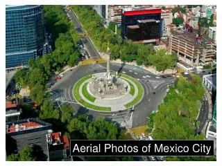
Interpreting Aerial Photos and Satellite Images. By: J.Verplanke, ITC. Unit: M11U03. Image interpretation. How is information extracted from images? visual image interpretation (in this Unit) semi-automatic processing by computer. Image interpretation.

E N D
Interpreting Aerial Photos and Satellite Images By: J.Verplanke, ITC Unit: M11U03
Image interpretation • How is information extracted from images? • visual image interpretation (in this Unit) • semi-automatic processing by computer
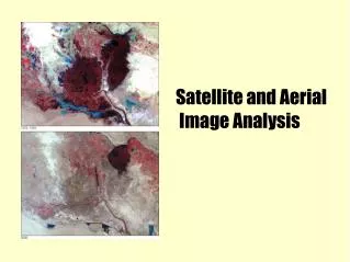
Image interpretation Visual interpretation is based on relating colours and patterns to real-world features. Images can be displayed on a computer monitor or in hard copy form. Mapping conveys the findings.
Fundamentals Analysing an image is typically done through a combination of: direct and “spontaneous recognition”; using several clues to draw conclusions through a reasoning process (i.e. “logical inference”).
Fundamentals Spontaneous recognition refers to identifying objects or features at first glance.
Fundamentals Logical inference means that the interpreter applies reasoning.
Elements • Seven interpretation elements provide guidelines to recognise certain objects: • tone/hue • texture • pattern • shape • size • height/elevation • location/association
Elements Tone is the relative brightness in a black-and-white image. Hue refers to the colour space. Tonal variations are related to the amount of light reflected (or emitted). Variations in hue are related to spectral characteristics. The human eye has a greater sensitivity for hue (10,000 colours) than for tone (200 grey levels).
Elements • Texture relates to the frequency of tonal change and may be described as coarse or fine, smooth or rough, etc. • Pattern refers to spatial arrangement: concentric, radial, checkerboard, rivers with their branches, patterns related to erosion, etc.
Elements • Shape or form characterises the two-dimensional projection and the height of an object. • Size can be considered in a relative or absolute sense.
Elements • Height is important for distinguishing among different vegetation types, building types, etc. • Location/association refers to the situation in the terrain or in relation to its surroundings.
Elements Tone or hue can be defined for a single pixel. Texture is defined for a group of adjacent pixels, not for a single pixel. The other interpretation elements relate to individual objects or to a combination of objects.
Mapping The interpretation process involves delineating areas which appear similar and which are also different from other areas. After establishing the features on the ground, “interpretation keys”’ can be constructed. Based on these keys, an interpretation of features can be made; these are described as interpretation elements.
Scale There is a limit to what can be drawn. In practice, polygons smaller than 5 x 5 mm should not be drawn: the "smallest allowable unit". The scale of the image(s) thus limits the interpretation cell on the ground.
Fieldwork Maps should reflect what is actually on the ground. Field visits observe what is there in reality. During fieldwork, the location of boundaries is verified. Data are gathered about features that can not be derived from remote sensing.
Quality The quality of image interpretation depends on the: professional experience of photo-interpreters; images used; interpretation guidelines. These three points ensure the replicability of the work.
Replicability • Replicability refers to the degree of correspondence obtained: • by different persons for the same area; or • by the same person for the same area at different instances.