Contents
Electricity Meter Installation QC and Audit Total Geo-spatial Information Solutions Johann Engelbrecht Director. Contents. Base Map Information Meter and Debtor Information in Financial System Mobile GIS Quality Control on Installations Audit Delivery Conclusion.

Contents
E N D
Presentation Transcript
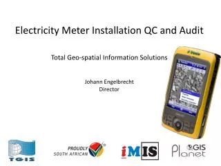
Electricity Meter Installation QC and AuditTotal Geo-spatial Information SolutionsJohann EngelbrechtDirector
Contents • Base Map Information • Meter and Debtor Information in Financial System • Mobile GIS • Quality Control on Installations • Audit • Delivery • Conclusion
Consumer Meter Audit: Form Design • Data gathered: • Basic Property Information: • position, photo, building information • Electrical Connection Information • position, photo, phase type, meter no, meter reading, meter type, condition, etc
Mobile GIS • Traditional definitions: • Mobile GIS is the expansion of GIS technology from the office into the field. A mobile GIS enables field-based personnel to capture, store, update, manipulate, analyze, and display geographic information; • Mobile GIS is the use of geographic data in the field on mobile devices • Adopted Mobile GIS definition for municipal service delivery • Mobile GIS is the use of geographic data in the field on mobile devices focusing on information gathering • Mobile data capture integrates six essential components: • Rugged handheld computers; • Global Positioning System (GPS); • Camera; • Mapping (GIS)software; • Database software; and • Wireless communications
Mobile GIS Uses • GIS Analysis and Decision Making • Execute GIS analysis while in the field – not really needed except for field data capture monitoring • Mapping • Create, edit and use GIS maps in the field – not cost effective, use aerial photography, etc and only do annotation • Asset Inventory and Maintenance • Create and maintain an inventory of asset location, condition, components and maintenance • Incidents and Inspections • Create a portfolio of evidence with regards to complaints and services rendered, e.g. water leaks, illegal connections, site inspections
IMIS Mobile – Summary: field data gathering Position of feature Data of feature or its components Photographs of feature or its components
IMIS Mobile – from field to office Merging Software Field Units Export Planet GIS
OFFICE FIELD OFFICE Field Forms Quality Control - Data Capture Processes C o n v e n t i o n a l P r o c e s s Database Database V a l u e a d d e d P r o c e s s Field Database & Logger Database Control Database Processes
Audit • 10% Sample after installation • Data capture – Position, Photo and Readings • Supply ASCII file or Spreadsheet in pre-described format to import into Municipal Financial System