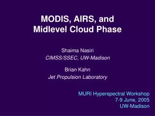
MODIS, AIRS, and Midlevel Cloud Phase
300 likes | 473 Views
MODIS, AIRS, and Midlevel Cloud Phase. Shaima Nasiri CIMSS/SSEC, UW-Madison Brian Kahn Jet Propulsion Laboratory. MURI Hyperspectral Workshop 7-9 June, 2005 UW-Madison. Outline. Introduce midlevel/potentially mixed phase clouds MODIS IR phase retrievals for midlevel clouds

MODIS, AIRS, and Midlevel Cloud Phase
E N D
Presentation Transcript
MODIS, AIRS, and Midlevel Cloud Phase Shaima Nasiri CIMSS/SSEC, UW-Madison Brian Kahn Jet Propulsion Laboratory MURI Hyperspectral Workshop7-9 June, 2005 UW-Madison
Outline • Introduce midlevel/potentially mixed phase clouds • MODIS IR phase retrievals for midlevel clouds • Frequency of midlevel clouds • Radiative transfer calculations for MODIS and AIRS for a variety of cloud heights
Midlevel Clouds • Definition: Clouds occurring at a level (height) where water cloud, ice clouds, or mixed-phase clouds could occur (potentially mixed-phase clouds). • Typically between 253 and 263 K • Cloud height depends on latitude and season ~6 km in midlatitudes ~1 km in polar regions (“midlevel” clouds a misnomer here)
ARM M-PACE: 12 October, 2004 2200 UTC Aqua MODIS False Color Phase Image Proteus flight track Barrow N. Alaska False color cloud phase image: R = 0.65 µm Ref., G = 2.1 µm Ref., B = 11 µm BT
ARM M-PACE: 12 October, 2004 2200 UTC Aqua MODIS False Color Phase Image Barrow Slightly Broken Cloud Uniform Cloud N. Alaska Ice False color cloud phase image: R = 0.65 µm Ref., G = 2.1 µm Ref., B = 11 µm BT
245 250 255 260 265 270 ARM M-PACE: 12 October, 2004 2200 UTC Aqua MODIS 11 µm Brightness Temperature Slightly Broken Cloud Uniform Cloud Ice MODIS Band 31: 11 µm BT (K)
ARM M-PACE: 12 October, 2004 2200 UTC Aqua MODIS Infrared Cloud Phase Retrieval Slightly Broken Cloud Uniform Cloud Ice MODIS IR Cloud Phase at 1 km
ARM M-PACE: 12 October, 2004 2200 UTC Aqua MODIS Infrared Cloud Phase Retrieval Scene is “unknown” because BT[11 µm] is between 253 and 263 K,and BTD[8.5-11 µm] is between -1.0 and 0.25 K MODIS IR Cloud Phase at 1 km
AHSRL Circular Depolarization Ratio (%) Aqua MODIS 2200 UTC 11 µm Brightness Temp. ARM M-PACE: 12 October, 2004What are we looking at? • Lidar shows water cloud with ice precipitating • MODIS 11 µm brightness temperature is around 258 and 259 K Barrow N. Alaska
Aqua MODIS 2200 UTC IR Phase ARM M-PACE: 12 October, 2004 AHSRL Circular Depolarization Ratio (%) • Lidar shows water cloud with ice precipitating • MODIS IR phase classifies scene as “Unknown”
ARM M-PACE: 12 October, 2004 AHSRL Circular Depolarization Ratio (%) Question remains: What is the infrared cloud phase? • Lidar shows water cloud with ice precipitating • MODIS IR phase classifies scene as “Unknown”
12 October • Averaged S-HIS spectra with averaged MODIS observations overlaid MODISBand 32 MODISBand 31 MODISBand 29
Modeling • Beginning set of modeling studies to characterize HSR IR cloud sensitivities for the M-PACE case MODIS 8.5 µm MODIS 12 µm MODIS 11 µm Simulations using LBLDIS Still need to simulate mixed-phase and overlapping cloud cases
How much of a problem are these potentially mixed phase clouds? • Unable to answer the question directly, but we can look at frequency of MODIS IR phase retrievals of ice, water, unknown. • Consider 8 days (and nights) of global Aqua MODIS data from 1-8 April 2003.
Aqua MODIS 1-8 April, 2003 Water CloudsCloudy pixels classified as liquid water using IR MODIS channels Between 60 S and 60 N, Water Cloud Frequency: 52%
Aqua MODIS 1-8 April, 2003 Ice CloudsCloudy pixels classified as ice using IR MODIS channels Between 60 S and 60 N, Ice Cloud Frequency: 28%
Aqua MODIS 1-8 April, 2003 Scale is from0 to 0.5 Unknown CloudsCloudy pixels classified as unknown phase using IR MODIS channels Between 60 S and 60 N, Unknown Cloud Frequency: 14%
Aqua MODIS 1-8 April, 2003 Mixed Phase CloudsCloudy pixels classified as mixed phase using IR MODIS channels(mixed phase should be considered another flavor of unknown) Between 60 S and 60 N, Mixed Cloud Frequency: 6% Scale is from0 to 0.5
20% 10% Zonal frequencies of cloud phase(frequency out of all cloudy data) Mean cloud phase frequencies between 60°S and 60°N Water: 52 % Ice: 28 % Unknown: 14 % Mixed (Unknown): 6 % Sum of curves = 1 Aqua MODIS 1-8 April, 2003
Zonal frequencies of cloud phase(frequency out of all data) Mean cloud phase frequencies between 60°S and 60°N Water: 35 % Ice: 18 % Unknown: 9 % Mixed (Unknown): 4 % Sum of curves = Frequency of cloudiness Aqua MODIS 1-8 April, 2003
Mid-talk Summary • ~20% of MODIS IR cloud retrievals are classified as “unknown” • Because of the IR phase algorithm, these unknown classifications are likely due to midlevel or potentially mixed-phase clouds
The Question • Can hyperspectral IR data improve our characterization of midlevel/potentially mixed phase clouds?
Brightness Temperature Differences for Water and Ice Clouds Midlatitude winter atmospheric profile Optical thickness at 11 µm MODIS sims from DISORT AIRS sims from CHARTS
Brightness Temperature Differences for Water and Ice Clouds 9 km, T = 226 K7 km, T = 238 K 3 km, T = 262 K2 km, T = 265 K1 km, T = 269 K Optical thickness at 11 µm MODIS sims from DISORT AIRS sims from CHARTS
Brightness Temperature Differences for Water and Ice Clouds = 1 K Optical thickness at 11 µm MODIS sims from DISORT AIRS sims from CHARTS
Z3_water Brightness Temperature Differences for Midlevel Water and Ice Clouds Optical thickness at 11 µm MODIS sims from DISORT AIRS sims from CHARTS
Brightness Temperature Differences for Midlevel Water and Ice Clouds = 0.5 K Optical thickness at 11 µm MODIS sims from DISORT AIRS sims from CHARTS
Brightness Temperature Differences for Midlevel Water and Ice Clouds AIRS Sims show little sensitivity to water cloud height Optical thickness at 11 µm MODIS sims from DISORT AIRS sims from CHARTS
Summary • ~20% of MODIS IR cloud retrievals are classified as “unknown” • Because of the IR phase algorithm, these unknown classifications are likely due to midlevel or potentially mixed-phase clouds • Simulations shows that hyperspectral IR data can potentially differentiate between ice and water in midlevels (
Future Plans • Continue simulations for • More atmospheric profiles • Overlapping clouds (cirrus over water) • Mixed-phase clouds • Consider different channel combinations • Apply what we learn from simulations to S-HIS and AIRS data from M-PACE • Consider combined hyperspectral and MODIS phase algorithm