Download
1 / 22
220 likes | 326 Views
From Emodnet Chemical Pilot to Emodnet Chemistry 2 Matteo Vinci and Alessandra Giorgetti, – OGS – NODC group, OCE - MODEG meeting, Copenhagen, 4 and 5 July 2013. NORTH SEA. BLACK SEA. MEDITERRANEAN SEA. The Chemistry Pilot : where. Regional Leaders: North Sea – NERI Black Sea– MHI

E N D
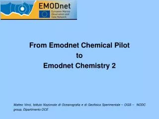
From Emodnet Chemical Pilot to Emodnet Chemistry 2 Matteo Vinci and Alessandra Giorgetti, – OGS – NODC group, OCE- MODEG meeting, Copenhagen, 4 and 5 July 2013
NORTH SEA BLACK SEA MEDITERRANEAN SEA The Chemistry Pilot :where Regional Leaders: North Sea – NERI Black Sea– MHI Med Sea – HCMR
The Chemistry Pilot : what -parameters choice based on MSFD requirements, from 8 groups of compounds, in 3 matrices( water, biota, sediment), 17 selected parameters for product generation.
The Chemistry Pilot : How • Based on SeaDataNet : • An efficient distributed Marine Data Management Infrastructure for large and diverse sets of data deriving from in situ and remote observation of the seas and oceans. • Actively involved in standardsimplementation following INSPIRE; • An european de-facto standard with: 44 partners and 14 subcontractors from 35 countries european and not.
The Chemistry Pilot : How • Principle of “ADOPTED AND ADAPTED” • SDN Standards for metadata ,data and products : • for metadata (xml ISO 19115 ISO 19139) CDI; • for common termsStandard Vocabs (P021,P011,P061...); • for background data exchange ASCII format ODV, • SDN Infrastructure: • Service to access data with data policy management CDI mechanism, • Service for users registrations SDN Security Services, • Service for discovery, visualization and downloading of products SDN Products viewing services • SDN Softwares: • MIKADO → metadata mapping and xml generator • NEMO → data formatting tool • DIVA software → gridded data products and error maps as NetCDF files, • ODV software → for “time series” products generation and QC
The Pilot Project • Partners: 25 partners; • OGS coordination; • Contract had a duration of 3 years from June 2009 to June 2012; • Work Packages: • WP1 - Project Coordination • WP2 – Data collection and metadata compilation • WP3 – QC/QA and data products • WP4 – Technical development and operation • WP5 – Analysis and Evaluation
The Pilot Project NORTH SEA BLACK SEA MEDITERRANEAN SEA • WP2 Data collection and • metadata compilation : • All partners collected and updated : • Data → ODV file → managed by Reg. Leaders at level of the 3 Regional data pools → (de-centralized) • Metadata → CDI entries → Maris (centralized) • All partners gave access to: • metadata (unrestricted); • and data according to the data policy as agreed with the data ORIGINATOR.
The Pilot Project:challenge to face along the path from DATA to PRODUCTS • Data complexity: • from 8 groups of compounds; • 3 matrices (sediment, water column and biota); • 17 selected parameters for products generation; • Heterogeneity: • Of the sampling/data distribution (coastal points time series Vs homogenous sampling at basins level); • Of measurement methods (instrument, method, target species, target basis, grain sizes).
The Pilot Project WP3 QC/QA and data products: • The analysis of available data; • The Expert workshop with contribution of the Marine Conventions; • Highlighted 2 main substets from the available data : Homogeneous ditribution In time and space (basins) Not homogeneous ditribution In time and space (basins) • Expert workshop, summary of decisions to highlight data features with Products generation: • -Standard Diva Interpolated maps produced for parameters with homogeneous and suitable data coverage, measured on basin scale; • -“Time series plots”. Showing station maps linked to plots of measured time series. This for not homogeneous data as: • coastal points repeated in time, • datasets with fragmented coverage.
Data products DIVA interpolated maps: • Focus on nutrients in the water column based on data availability; • Focus on annual and seasonal scale based on data availability; • Interpolated maps generated by Diva software; • Metadata file generated by DivadoXML script;
DIVA interpolated maps * * * * * Ocean Browser (Gher group) * Interpolated fields loaded as WMS layers
Data products Time Series plots: -Focus on the parameters with fragmented coverage (spatial/temporal); -suggested use of ODV software for plots generation; -ratio of 1plot:1station:1parameter:1depth; -metadata collected in a INDEX file (http://www.data-assimilation.net/mediawiki/index.php/OceanBrowser#Observation_index_files ) Recommendations: -to avoid plots for stations with less than 3 points; -to avoid linkage lines between single points; -to provide TS plots in vector format (as SVG);
Time Series plots Ocean Browser (Gher group) * * products loaded as WMS layers
The Pilot Project WP5 Analysis and Evaluation: 2 online questionnaire
Lessons Learned/Open issues from Pilot • QC for «exotic parameters» (eg:contaminants...) nospikes aredetect for them, they are events. At the moment not enough data to calculate regional ranges. • Lack of «Under detection limit» information; • Technical development/usersfriendliness: • Finalization of products metadata catalogue to load and search Maps metadata /Time series plots metadata; • Improvements of web interfaces searchcriteria as highlighted by SDN2 userpanel and Chemistry Lot users; • Improvement of handling of Chemical Parameters metadata with Common Vocabs (transparency/flexibility); • Need of group of experts for the data-products periodic validationfor each regions + workshop.
The New Phase (MARE/2012/10) • Enlarged partnership: 32 partners + 14 sub-contractors = total of 46 participants (about twice!) coordinated by OGS; • Official starting? • Kick-off meeting: Trieste, 3rd -5th June 2013; • New parameters: chlorophyll, silicates, partial pressure of dissolved gasses, plastics, acidity; • 3 matrices: water column, biota, sediment; • The portal should cover all European waters; • New products: coastal visualization + a proposal for assessment tool; • Specific focus on Coastal Data.
The New Phase • The portal should cover all European waters Note: This map is derived from the EU Tender document but lacks the Norwegian sea The parameters:
The New Phase:WPs • WP0- Project Management • WP1- Data collection and metadata compilation in sea regions • WP2- Data Products generation in sea regions • WP3 - QA/QC - Validation - MSFD interaction • WP4- Portal development and operation • WP5 - Analyses and Recommendations • Collaboration with other projects/activities: • SDN since the pilot phase; • Emodnet Lots ongoing; • ODIP for this second phase; • ...and open dialogue with Marine Conventions.
Regional level: • Data harvesting (WP1) and products generation (WP2) will be always organized at Regional level. This time 5 sea regions have been defined as: • Greater North Sea(including Norwegian Sea and Celtic Sea); • Atlantic Sea(including Atlantic Coast and Macaronesia); • Baltic Sea; • Black Sea; • Mediterranean Sea.
Ongoing activity to face the Pilot open issues: • QC for exoticparameters: • Open dialogue with MSFD requirements/guidelines; • Data harvesting willprovide new data for regionalranges; • Open dialogue with Marine Conventions experts; • Efforts to collect «detection limits» for an inventory in the different areas; • A technical meeting under definition ( September?) for: • Finalization of productsmetadata catalogue; • Improvement of web interfaces searchcriteria ; • Improvement of handling of Chemical Parameters; • the data-products periodic validation: • Regional experts group already searching for candidates; • QC workshop to be organized at month 12.
What is expected from the activity within 2014 • Sea Regionsdefinition (November 2013?); • Updateddatasets for the 5 Regions; • First release of updatedclassicproducts (interpolatedmapsans TS); • A test case for an assessmenttool; • At M12 first validation workshop with experts from: Marine Conventions, MSFD and WG-DIKE.