Download
1 / 25
250 likes | 339 Views
This project focuses on improving inundation modeling, tools, and mapping for Gulf Coast communities. Explore the history, findings, objectives, and achievements to enhance resilience and communication on storm surge information.

E N D
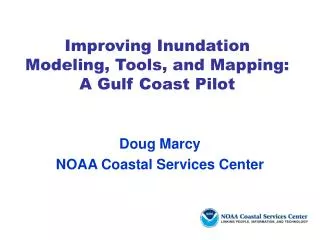
Improving Inundation Modeling, Tools, and Mapping: A Gulf Coast Pilot Doug Marcy NOAA Coastal Services Center
Presentation Overview • Project History • Hurricane Isabel Assessment • NOAA Storm Surge Needs Assessment • Pilot Project to Address Findings from Needs Assessment • Project Outputs and Accomplishments • Future Efforts
Project History: NOAA Storm Surge Needs Assessment Purpose of the Needs Assessment Hurricane Isabel assessment showed that NOAA needed to improve its communication on storm surge information within the agency and with external users • Process (On-Line Survey and Focus Groups) • Needs Assessment = 315 participants • Modeling Assessment = 30 participants • Forecast Products and Services Assessment
Project History: NOAA Storm Surge Needs Assessment • Findings/Issue Areas • Datum and Nomenclature • Models • Graphical Display and Tools • Training, Education, and Outreach • Data • Access • Interagency Coordination • Socioeconomics Information
Pilot Project Area Hurricane Ivan Impact Area Gulf of Mexico Pilot Project • Goal:NOAAand its partnerswill work to enhance the resilience of Gulf of Mexico coastal communities to storm surge and flooding • Project Objectives • Determining needs of management community • Assembling needed data • Testing a prototype storm surge model • Improving inundation mapping • Developing mapping and educational products
Data Collection/ Integration Decision-Support Tools Model Development Identify Needs Modeling Mapping Gulf of Mexico Pilot Project • What it takes to model and map storm surge. . . Customer Customer
Gulf of Mexico Pilot Project:Identifying Needs • User Needs Assessment • Community-based modeling workshop • 3 community-based products and services focus groups • Storm Surge Needs Assessment findings driving the pilot project • Findings –Improvements and Enhancements To: • Modeling • Forecast and decision-support tools • Communication • Outreach and training Decision-Support Tools Data Collection/ Integration Model Development Identify Needs Mapping Modeling Customer Customer
Gulf of Mexico Pilot Project:Data Collection/Integration • Purpose • Storm surge model requires a continuous elevation dataset • Activities • Acquired from many data sources (topographic and bathymetric data) • Aerogravity and lidar collection for geoid/ VDATUM-related research • Topo-bathy lidar collected within study region • New station for Weeks Bay, Mobile, AL Data Collection/ Integration Decision-Support Tools Model Development Identify Needs Mapping Modeling Customer Customer
Gulf of Mexico Pilot Project:Model Development and Testing • Tidal Models • Purpose • Tidal model forms basis for storm surge model • Activities • Designed model domain and grid for delivery to NGS • Extracted tidal datums from model time series • Corrected model results to match 74 NOS tide gauges with datums Decision-Support Tools Data Collection/ Integration Model Development Identify Needs Mapping Modeling Customer Customer
Gulf of Mexico Pilot Project:Model Development and Testing • VDATUM (Vertical Datum Transformation Tool) • Purpose • In order to accurately map land-water elevations (heights and depths), the datums for each dataset must be consistent • Activities • Transform between datums • Merged all bathymetric and topographic data • Enabled development of a seamless digital elevation model • Draft VDATUM tool for Pensacola, Bay area Decision-Support Tools Data Collection/ Integration Model Development Identify Needs Mapping Modeling Customer Customer
WGS 84 (G873) ITRF2000 WGS 84 (G1150) MHHW WGS 84 (G730) WGS84 (orig.) ITRF97 MHW ITRF96 NGVD29 ITRF94 MTL ITRF93 NAD 83 NAVD 88 LMSL ITRF92 ITRF91 TSS GEOID99 (GEOID2003) DTL ITRF90 ITRF89 MLW ITRF88 SIO/MIT92 NEOS90 MLLW PNEOS90 VDATUM “Roadmap” 3-D EllipsoidOrthometricTidal Datums Datums Datums [Source: NGS] Transformations by Equation Transformation by Gridded Data
Preliminary VDATUM Model Approximately 150,000 nodes
Gulf of Mexico Pilot Project: Modeling • Purpose • Model areas of inundation; calibrate ADCIRC model • Activities • Storm surge model calibration; winds added • Recreate Hurricane Ivan water levels • Develop mapping products from model output sample model run (max. surge) Data Collection/ Integration Identify Needs Decision-Support Tools Model Development Mapping Modeling Customer Customer
Gulf of Mexico Pilot Project: Modeling Model domain Narrow obstructions to flow (e.g., jetties, barrier islands) are incorporated into the model Prototype storm surge grid and bathymetry (m NAVD88)
Western N. Atlantic 60 W Gulf of Mexico Pilot Project: Modeling Storm surge model domain developed for four estuaries and bays: Mobile Bay, Perdido Bay, Pensacola Bay, Choctawhatchee Bay
Gulf of Mexico Pilot Project:Mapping Inundation • Purpose • Inundation maps for decision-making • Determine where inundation has occurred; water depth and extent • Activities • Developing mechanism for displaying ADCIRC model output in GIS • Process for creating inundation maps using GIS • “See” Hurricane Ivan inundation for study area Decision-Support Tools Data Collection/ Integration Model Development Identify Needs Mapping Modeling Customer Customer
Gulf of Mexico Pilot Project: Mapping Draft GIS model to produce GIS inundation layers from ADCIRC water surface elevationsOutput = inundation data layer for each time stamp
Gulf of Mexico Pilot Project: Decision-Support Tools • Mapping Application • Interactive mapping application to display inundation layers with hazard planning and other data; impact assessment and planning • Visualizations • 3D visualizations of inundation; “See” impacts to a community Decision-Support Tools Data Collection/ Integration Model Development Identify Needs Mapping Modeling Customer Customer
Gulf of Mexico Pilot Project: Decision-Support Tools • Visualizing impacts • Researching mechanisms for scientifically-based visualizations
Gulf of Mexico Pilot Project: Decision-Support Tools • Coastal Inundation Mapping Course • GIS-based course on elevation data, vertical datums, varying map products, and mapping inundation • Practitioner’s Guide to Inundation Map Products • Educational resource for understanding different inundation map products and their uses Decision-Support Tools Data Collection/ Integration Model Development Identify Needs Mapping Modeling Customer Customer
Future Efforts • Comparison of ADCIRC and SLOSH for Gulf of Mexico • Topo/bathy grid available to other agencies (e.g., FEMA for future flood insurance studies) • Transition from ADCIRC as test forecast model to operational forecasts of entire Gulf region • National Research Council study to evaluate Flood Insurance Studies modeling accuracy
QUESTIONS? Thank you for attending! For additional information, please contact Doug Marcy Doug.Marcy@noaa.gov
Gulf of Mexico Pilot Project • Project Outputs • Topographic bathymetric, gravimetric, and geodetic control data for the eastern Gulf of Mexico • Vertical datum transformation tool (i.e., VDATUM), including improved geodetic model of the Gulf region • Improved capabilities for working with digital elevation, water level, and geodetic data • User-friendly model output in the form of GIS layers, animations, and visualizations Hurricane Ivan wind speed near landfall as produced by the SLOSH parametric hurricane model (m/s).