Download
1 / 16
160 likes | 268 Views
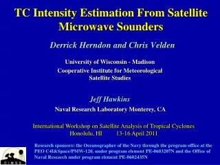
67 th IHC/Tropical Cyclone Research Forum March 5-7, 2013. Enhancement of SHIPS RI Index Using Satellite 37 GHz Microwave Ring Pattern: A Year-2 Update. PI: Haiyan Jiang 1 PhD Research Assistant: Margaret Kieper 1 Postdoc: Tie Yuan 1 Collaborators: Edward J. Zipser 2 and John Kaplan 3

E N D
67thIHC/Tropical Cyclone Research ForumMarch 5-7, 2013 Enhancement of SHIPS RI Index Using Satellite 37 GHz Microwave Ring Pattern: A Year-2 Update PI: Haiyan Jiang1 PhD Research Assistant: Margaret Kieper 1 Postdoc: Tie Yuan1 Collaborators: Edward J. Zipser2 and John Kaplan3 1Florida International University 2University of Utah 3NOAA Hurricane Research Division Acknowledgements: 1) NHC Points of Contact: Jack Beven, Todd Kimberlain, Dan Mundell, and Chris Landsea 2)This NOAA Joint Hurricane Testbed project was funded by the US Weather Research Program in NOAA/OAR's Office of Weather and Air Quality. 1
Outline • Project Overview • Updates during Yr-2: Real-time testing at NHC • Works in progress
Project Overview: Background • SHIPS RI index (Kaplan and DeMaria 2003; Kaplan et al. 2010) is a well-established RI index which uses the environmental parameters to predict the probability of RI. • M. Kieper (AMS presentations 2008; Tech. Doc. for NOAA NHC 2009) found that the first appearance of a cyan (or pink) color ring (from NRL 37 GHz color product, Lee et al. 2002; Hawkins and Velden 2011) around the eye could be an indicator of RI when environmental conditions are favorable. • Kieper’s subjective RI forecast method has been unofficially tested in real time for 2008, 2009 and 2010 hurricane seasons.
Decoding the 37 GHz color Product • The NRL 37 GHz color product: 1) combines 37 GHz Polarization Corrected brightness Temperature (PCT), 37 GHz vertically and horizontally polarized TB’s; 2) no quantitative information; 3) pink cloud & precipitation with ice, cyanlow level clouds/shallow or light rain, green sea surface (Lee et al. 2002). • To automate Kieper’s subjective method into an objective method, we have determined quantitative values of the 37 GHz TB’s in different color regions using the TRMM Tropical Cyclone Precipitation Feature (TCPF) database (http://tcpf.fiu.edu; Jiang et al. 2011, JAMC). NRL 37 GHz Color Product for Hurricane Ivan (2004), WindSat overpass at 09/04/2004 2043Z. 55 kt intensity increasing during the next 24 hours.
Forecast method developed The Objective 37 GHz Ring RI Index • A ring pattern is detected by the automatic 37 GHz ring pattern identification algorithm. • Initial TC intensity is between ~45 - 100 kt. • The core of the TC is currently over water and is anticipated to remain over water for 24 hours. • The past 6 h intensity change >=0. The Combined Ring+SHIPS RI Index • Satisfy the Ring index definition • The SHIPS RI probability >= 20%
Summary of Work During Yr-1 Evaluation 1: Using More TMI Data • Evaluation of the objective method using TRMM TMI observed TCs from 1998-2010. • Evaluation of the subjective method using all microwave sensors for Atlantic storms during 2003-2007 (Kieper and Jiang 2012, GRL) • RI event based verification results: • The method may miss the first 6-12 h of the onset of RI, but for most cases, the 37 GHz ring is associated • with the highest • intensity increase.
Updates During Yr-2: Real Time Testing at NHC (http://tcpf.fiu.edu/JHT/Txt/)
The Atlantic Basin 2012 RI events • Each RI event is defined as the whole RI period which usually includes several 24-h overlapping RI periods with each of them having 24-h intensity increase >=30kts. Note that more than one RI events for each storm is possible.
Performance for Atlantic Basin 2012 Season Chris: WindSat 06/20 10:03UTC (26 h before RI ends) Gordon: TMI 08/18 02:04 UTC (28 h before RI ends) Kirk: TMI 08/30 00:41 UTC (35 h before RI ends) Sandy: WindSat 10/23 22:43UTC (37 h before RI ends) Michael: TMI 09/05 15:00UTC (27 h before RI ends)
Performance for Atlantic Basin 2012 Season • Subjective method: Miss: 4 out of 5! • Objective methos: Miss: 5 out 5% • SHIPS RII values were <20% for • these 4 misses.
Performance for East Pacific 2012 Season Bud: WindSat 05/23 13:29UTC (34 h before RI ends) Carlotta: TMI 06/15 10:08 UTC (14 h before RI ends/landfall) Daniel: TMI 07/07 09:27 UTC (21 h before RI ends) Emilia: SSMIS 07/09 01:07UTC (34 h before RI ends) Miriam: WindSat 09/23 13:48UTC (34 h before RI ends) Paul: WindSat 10/15 01:25UTC (29 h before RI ends)
Performance for East Pacific 2012 Season • Subjective method: Hit: 6 out of 6! • Objective method: Hit: 3 out 6! • SHIPS RII was correct.
Summary of Yr-2 Real-time Tests • Atlantic RI events are harder to predict: • Hard to get environmental conditions correct; low SHIPS RII values • TC center fix problem: a linear interpolation was used to determine TC center between NHC track points • East Pacific RI events seem easier to predict: • Correct SHIPS RII • The storm track is more linear so that a linear interpolation between track points works OK • EPAC TCs seem intensify more quickly once ring feature is seen (need one more season to verify)
Works in Progress • For Atlantic storms: • Recalibrate SHIPS RII threshold to increase hits and minimize false alarms • For Atlantic & East Pacific storms: • Using additional methods to determine an accurate center fix • We are adapting CIMSS ARCHER algorithm (Wimmers and Velden 2010) to determine TC center using 37 GHz data • We are also testing a pattern recognition algorithm • Working on West Pacific basin storms: • Margie has been working with JTWC actively. Tie Yuan has developed an algorithm for WPAC.
Future Work • Will do real-time testing again at NHC for 2013 season • Modify the “yes” & “no” type of prediction into “probability” format – by adding additional 85 GHz predictors such as area of 85 GHz PCT < 275 K, 250 K, and 225 K. Related Publications • Kieper, M., and H. Jiang, 2012: Predicting tropical cyclone rapid intensification using the 37 GHz ring pattern identified from passive microwave measurements. Geophys. Res. Lett., 39, L13804,doi:10.1029/2012GL052115. • Jiang, H., 2012: The relationship between tropical cyclone intensity change and the strength of inner core convection. Mon. Wea. Rev., 140, 1164-1176. • Jiang, H., C. Liu, and E. J. Zipser, 2011: A TRMM-based Tropical Cyclone Cloud and Precipitation Feature Database. J. Appl. Meteor. Climatol., 50,1255-1274.