Download
1 / 14
140 likes | 263 Views
Learn about radiosondes, dropsondes, and driftsondes used in atmospheric research projects. Explore profiles of temperature, humidity, and wind to study weather patterns and climate change effects. Discover how this data aids in weather forecasting, environmental monitoring, and model validation.

E N D
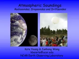
Atmospheric Soundings:Radiosondes, Dropsondes and Driftsondes Kate Young & JunhongWang kbeierle@ucar.edu NCAR Earth Observing Laboratory
National Center for Atmospheric Research • Weather/Climate • Societal Impacts • Pollution/Air Chemistry • Ocean/Atmosphere • Space weather/Sun
Earth Observing Laboratory Mission: Develop of state-of-the-art technologies for atmospheric research Deploy instruments for scientific research projects Data Services - providing high-quality project data for scientific advancement and discovery Discovery – promote curiosity about earth science and educate others on atmospheric research
Atmospheric Profile Moist Layer with high relative humidity Wind barbs show strength and direction of wind Space between lines represents the relative humidity Dew-point Temperature (degC) Temperature (degC) Atmospheric pressure at sea level is ~1000 millibars and decreases with height
Maximum radiosonde height ~19 mi THERMOSPHERE 54 Mesopause MESOSPHERE Altitude (mi) 30 Stratopause STRATOSPHERE Average dropsonde height ~10 mi TROPOSPHERE 8 Tropopause 0 -120 -80 -40 0 40 80 120 Temperature (deg F)
GPS – 1. allows us to track radiosondes 2. provide wind measurements Temperature & Relative humidity Pressure Windy downdraft Antenna Radiosondes
NCAR GPS Dropsondes Licensee (Vaisala) makes ~ 5,000 per year Currently on 21 research aircraft
Driftsondes Iridium LEO Satellite Communications Flight Altitude 125mb to 50mb (~58,000’) Gondola 20-50 Sonde Capacity
Hurricane Research Courtesy of Dr. Chris Davis (NCAR/ASP)
T-PARC (airborne) Sounding SystemsDriftsonde Temperature versus Altitude (4 drops) from 30km! Nominal Driftsonde Drop altitude Nominal Falcon and DOTSTAR drop altitudes Nominal C-130 Drop altitude Nominal P-3 Drop altitude Courtesy of Terry Hock and Steve Cohn
warmer and drier sondes (sondes were launched in a parking lot, sfc met was set up in vegetation) T RH Provides analysis tools (skew-t diagrams, xy-plot) Removes suspect data points Performs smoothing P wind speed Wind direction Quality Control of Radio/DropsondeData In field data inspection by operator Individual examination raw data profiles Takes into account solar angle at time of launch and removes solar heating that could skew T. Apply Radiation Correction ASPEN Batch mode for processing large datasets Comparisons of prelaunch and surface data Histograms of PTU and Wind Timeseries plots of PTU and Wind Visually examine QC sounding profiles
How is this data useful? It allows us to: • Examine changes in weather patterns • Create long term records for climate change research • Develop local severe storm, aviation, and marine forecasts • Improve weather prediction models using near real-time data assimilation • Validate satellite data • Provide feedback to EOL engineers on instrument performance