Download
1 / 5
50 likes | 76 Views
Hire professionals from TerraDat to get void detection surveys or seismic survey. Theyu2019re one of the leading geophysical survey companies in Europe. Their team consists of specialists, engineers, and consultants, and provides highly professional services for all kinds of survey. For more details, click here- https://www.terradat.co.uk

E N D
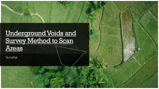
Voids are sinkholes underground. These can be caused due to geological reasons or can be human-made. Broken water pipe, old sewers, buried basements and disused mine shafts which have been compromised, are some of the reasons why voids or sinkholes are formed underground. To detect these, Void Detection Surveysare performed. Introduction
It is a risk reduction process performed to detect and determine voids, sinkholes, and subsidence below the surface gaps in the land. It is one of the types of geophysical surveys, which is applied to check the integrity of the ground before beginning any work like using heavy equipment, cranes, etc. In Void Detection Surveys, GPR or ground-penetrating radar is utilized. It is a fully non-destructive and non-intrusive technology. And, it involves utilizing lightweight equipment to ensure the surface being surveyed remains undamaged. It is a low-risk method to scan an area of ground, which helps in determining the location and extent of underground voids. Void Detection Method
Geophysical surveys are performed to produce a detailed image or map of an area. It is an architectural method that involves ground-based physical sensing techniques. Different methods like ground-penetrating radar, radiometric survey, gravity survey, electromagnetic survey, induced polarity, and Seismic Survey are practised to detect and determine different aspects & details about the underground surface of areas. These types of surveys are carried out by professional geophysical companies. Geophysical consultants provide complete information, details, and assistance related to voids, their detection, and surveys. Approaching Geophysical Consultantsfor Surveys
If you are looking forward to void detection or Seismic Survey or any other geophysical survey assistance, you can contact TerraDat, one of the leading geophysical survey companies in Europe. The team consists of specialists, engineers, and consultants, and provides highly professional services. For more information, visit - Terradat.co.uk. Contact us