Radar Requirements
200 likes | 342 Views
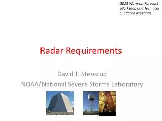
2013 Warn-on-Forecast Workshop and Technical Guidance Meetings. Radar Requirements. David J. Stensrud NOAA/National Severe Storms Laboratory. Dual-Polarization Radar. Radar reflectivity ( Z ) – backscattered power related to the drop-size distribution

Radar Requirements
E N D
Presentation Transcript
2013 Warn-on-Forecast Workshop and Technical Guidance Meetings Radar Requirements David J. Stensrud NOAA/National Severe Storms Laboratory
Dual-Polarization Radar • Radar reflectivity (Z) – backscattered power related to the drop-size distribution • Radial velocity (VR) – component of wind velocity oriented along the radar beam • Differential reflectivity (ZDR) - ratio of backscattered power at orthogonal polarizations • For targets with isotropic scattering properties such as spherical or chaotically tumbling particles, ZDR is 0 dB. High ZDRis mostly associated with large, wet hydrometeors. • Good indicator of median particle shape and can be useful to detect hail, updraft location and melting layer.
Specific differential phase (KDP) – range derivative of differential propagation phase. • KDPis a good indicator of the liquid water content within the radar sampling volume, as it is nearly zero for heavily aggregated snow or dry graupel/hail. • Strongly related to rain rate, so used for QPE. • Correlation coefficient (ρHV) - correlation coefficient between the backscattered returns at horizontal and vertical polarizations at zero lag time. • approaches unity in pure rain or pure dry hail at S band, but is decreased when a mixture of rain and hail is present. • Low values may indicate mixed precipitation types, non-meteorological scatters or large hail.
Dual-Polarization Benefits Tornado debris signature from dual-pol NWS radar in Huntsville, Alabama 2 March 2012
Hail signature (large Z, low ZDR) ZDR arc (high ZDR indicating large raindrops) Conceptual model of dual-pol signatures in thunderstorms being developed.
Dual-Polarization Benefits • Tells us something about the characteristics of precipitation as seen by radar • May be used to classify hydrometeor types • Should help with radar data quality control • Benefits of direct assimilation of DP variables to Warn-on-Forecast are uncertain
Functional Radar Requirements 2030 • NOAA/NWS Functional Weather Radar Requirements Integrated Working Team was formed in late 2012 • FAA has December 2014 decision point • Near simultaneous volume scans every 1 or 2 minutes • Sample variances as new radar variables • Staggered pulse repetition times to improve radial velocities • Improved quality control within signal processor or radar system
Value of Phased Array Radar Observing System Simulation Experiments (Yussouf and Stensrud 2010 MWR)
After 1 hour of Assimilation Truth Model Analysis Yussouf and Stensrud (2010 MWR)
Benefits of PAR15 minutes of assimilation Truth PAR Analysis WSR88D Analysis Yussouf and Stensrud (2010)
Real Data Case: 24 May 2011 Courtesy of Lou Wicker • PAR data with 1-min volume scans, 10 tilts • Degrade to 88D using 2/3 tilts per minute, so full volume scan in 5 minutes • Radar data thinned to 4 km grid
Assimilation Details • 60 members • LETKF + adaptive inflation • Perturbations to u,v profiles • Bubble initialization • 1.5 km horizontal/200 m vertical • NCOMMAS with LFO and turbulent mixing • Assimilate from 2020 to 2100 UTC • Assimilate 0 dBZ away from storms • Reflectivity data only assimilated every 5 minutes for all experiments
Main Points • Radar observations key to Warn-on-Forecast • Unique in-storm observations • Dual-pol should help with quality control, maybe with direct assimilation or through use of HCA • PAR “snapshots” seem to yield better results • Radar requirements for 2030 being discussed