Download
1 / 22
260 likes | 565 Views
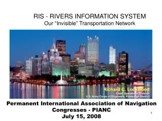
RIS - RIVERS INFORMATION SYSTEM Our “Invisible” Transportation Network. Richard C. Lockwood Chief, Operations Division U.S. Army Corps of Engineers, Pittsburgh District. Permanent International Association of Navigation Congresses - PIANC July 15, 2008. RIVERS INFORMATION SERVICE. RIS GOALS

E N D
RIS - RIVERS INFORMATION SYSTEMOur “Invisible” Transportation Network Richard C. Lockwood Chief, Operations Division U.S. Army Corps of Engineers, Pittsburgh District Permanent International Association of Navigation Congresses - PIANC July 15, 2008
RIVERS INFORMATION SERVICE RIS GOALS RIS will be an electronic system that will pull data from various existing sources both Government and commercial and process and display that information in customizable user friendly formats Modify or replace existing USACE systems to achieve a single system that will inform and be informed by the systems already in use by our navigation partners. Use existing layered GIS based technology, Electronic Navigation Charting and data summarizing to provide all partners with the specific information they need to staff, operate and use the Inland Navigation system. Eliminate duplication of data entry and ensure seamless transfer between USACE systems and Navigation and Government partners.
Generate confidence both within and outside USACE that RIS is a valuable tool that will improve operational reliability of the system while reducing data entry requirements and costs. • RIS will use existing technology, Electronic Navigation Charting and data summarizing to provide all partners with the specific information they need to staff, operate and use the Inland Navigation system. • RIS will eliminate duplication of data entry and ensure seamless transfer between USACE systems and Navigation and Government partners. • RIS will generate confidence both within and outside the Government that the Inland Waterways System is an efficient, safe and reliable transportation system.
CONSTRAINTS • RIS must protect sensitive and proprietary information of the commercial Navigation partners. • RIS must fit seamlessly into the bigger CRIS service and use existing standards for data coding and classification • RIS must be capable of informing and being informed by USCG’s AIS (Automated Identification System) and other existing commercial systems for tow tracking and scheduling • RIS must be capable of informing and being informed by other USACE systems (Asset Management, OMBIL, CWMS, etc) and other Partner systems (NWS, USGS, IRS, Customs, etc.) • Navigation data (current, wind speed, lock condition, gauge readings, dam operating data, etc.) provided via or by RIS must not expose USACE to any liability concerning the use of that data.
CURRENT DATA COLLECTION • Lock Operators receive hard copy information from deckhand on the tow and then manually enter the data into OMNI or LPMS. (2 systems) • OMNI/LPMS require 123 Different Items to be entered • Result is some “simplification” • Barge tonnage information is not accurate. • Not every jumbo barge has 1500 tons • Facilities are not getting credit for the tonnage they pass each year.Lower tonnage means lower funds • The Corps have teams of personnel reconciling the OMNI data with the Monthly Commodity Reports submitted to the IRS & Department of Commerce by Industry. • The data is inaccurate and unreliable.
Readings Work AreaGage information entered every hour or after a dam gate move
RIVER INFORMATION SERVICE USACE ASSET MANAGEMENT OMBIL NATNL WEATHER SER TOWING VESSELS USGS CWMS IRS SYSTEM DATA RIS LOCK USCG AIS LOCAL DATA DHS PORT AUTHORITIES CUSTOMS TOWING COMPANIES DOE SHIPPERS RECREATIONAL BOATERS TERMINAL OPERATORS
STRATEGY • LEVERAGE WORK OF PIANC WG 125 TO CREATE A NEW INFORMATION SYSTEM • USE EXISTING INFORMATION • CUSTOMIZABLE DATA DISPLAY FOR ALL USERS • UTILIZE MARINE INFORMATION OVERLAYS • ELIMINATE MULTIPLE DISPLAYS • REPLACE OMNI/LPMS WITH LOMA (LOCK OPERATION MANAGEMENT) • NO MANUAL DATA INPUT • AUTOMATIC CAPTURE OF REAL TIME DATA AT LOCK • ELIMINATE REDUNDANT AND CONFLICTING SYSTEMS
Hydrographic Overlay The latest data provides a clear view of the channel and river bottom contours.
SMART LOCK OVERLAY Connected
CURRENT INITIATIVES • FIRST MEETING OF US NATIONAL RIS TEAM 15 JULY 2009 • ENDSTATE, GOALS AND INITIATIVES DEFINED • MARK STEVENS VP @ INGRAM BARGE HAS PILOTHOUSE PROTOTYPE • JIM McCARVILLE / PORT OF PITTSBURGH COMMISSION AND CMU STUDENT PRACTICUMS • SMARTLOCK • RIVER NET • WIRELESS WATERWAYS
Questions? ?Questions? www.lrp.usace.army.mil