Download
1 / 16
160 likes | 257 Views
Learn about piloting High-Resolution NHDPlus v2 data for Minnesota, including project goals, core inputs, and data preparation processes to ensure accurate results.

E N D
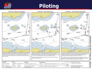
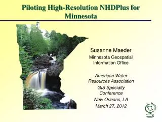
Piloting High-Resolution NHDPlus for Minnesota Susanne Maeder Minnesota Geospatial Information Office American Water Resources Association GIS Specialty Conference New Orleans, LA March 27, 2012
Project Goals • EPA NHDPlus v2 Design Document (EPA, USGS): • Quick to run – can refresh Med-Res frequently • Ability to distribute functions so that other users can create data • Ability to build from scratch with higher-res source data • Minnesota’s Project Goals: • Test Build of High-Res NHDPlus v. 2 Data for Minnesota • Understanding Data Inputs • Understanding NHDPlus Build/Refresh v. 2 Tool • Evaluating Results
Area of Interest All drainage upstream of Lake Pepin, beginning with 070101
Input Data Sets Core Inputs: NHD, WBD, NED • High-Res NHD – rigorous editing required • WBD – 8/25/2011 version based on MN DNR ‘catchments’ layer • NED – USGS statewide 10-m DEM Ancillary Data: Stream gages, diversions, additions, removals • Stream Gages (flow benchmarks) • USGS NHDPointEvents/NWIS data; DNR-PCA HYDSTRA • Large-Scale Diversions • Additions/removals (DNR Water Appropriation Permits); consumptive use
NHDPlus v. 2 Creation Steps Source: Horizon Systems
High-Res NHD Data Preparation NHDUpdate/NHD GeoEditor Version 4.0 - Released March 13, 2012 - Full NHDPlus Build/Refresh QA/QC Tools? - Only runs on NHD Model 2.1(ComID issue) NHDGeoEdit QA/QC Process NHDPlus Build/Refresh QA/QC Process
NHD Data Preparation Issues • NHDPlus Build/Refresh QA/QC • Need to be able to unequivocally identify the main flow path and construct a traversable flow network • GNIS names are very important • Ensure calculation of VAA values • Potential severe errors: • Flow table entry never navigated; improper network end; invalid or duplicate flow table entry; potential loop; incomplete divergence • Warnings/ informational errors: • Isolated network; circular named path, possible inflowing connection
NHD Data Preparation – Selecting Main Path • PlusFlowlineVAA • DivFracMP
Questions? Lake Itasca State Park – Headwaters of the Mississippi Photo Source: Minnesota Department of Natural Resources