Download
1 / 18
180 likes | 307 Views
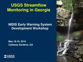
USGS Streamflow Monitoring in Georgia. NIDIS Early Warning System Development Workshop May 18-19, 2010 Callaway Gardens, GA. Natural Hazards—one of the strategic directions for USGS. Enhance our ability to collect and deliver RT info from earth-observation networks

E N D
USGS Streamflow Monitoringin Georgia NIDIS Early Warning System Development Workshop May 18-19, 2010 Callaway Gardens, GA
Natural Hazards—one of the strategic directions for USGS • Enhance our ability to collect and deliver RT info from earth-observation networks • With our partners, assess the vulnerability of cities and ecosystems • Ensure science is effectively applied to reduce losses Facing Tomorrow’s Challenges, USGS Science in the Decade 2007—2017, Circular 1309
USGS National Monitoring Network Real-Time Data Networks: • 9,329 surface-water stations • 386 lake & reservoir stations • 3,635 raingagestations • 1,353 groundwater wells • 1,742 continuous water-quality Effort underway to upgrade entire network to hourly transmissions
USGS in Georgia • 316 surface-water stations • 251 have raingages • 51 have continuous water-quality • 100% transmit hourly • All have emergency random transmissions
USGS Stream Gage Installation Housing with raingage Pressure orifice line buried Outside gage (staff)
Reasons for monitoring streamflow • Flood control • Drought monitoring • State Water Planning • Resolving disputes • Water supplies • Maintaining flows for assimilative capacity • Hydro-electric power • Navigation • Safe bridge and roadway design • Recreation and tourism • Long-term climate analyses • Modeling Allatoona Dam
USGS Hazards Products—NHSS • Interactive map to see all hazards currently happening • Different colors for different types of events • Click on event and popup window gives more details
National Water Information System— NWISWeb • All real-time data collected by USGS • All historical data • All daily, monthly, annual statistics • All field measurements • All peak flows
USGS Hazards Products—Streamail • Streamail • Water data on request to your cell phone/email. • Send email to streamail@usgs.gov and in the subject line put the USGS station number, like “02336300” • Get a reply: • The latest river stage and streamflow values you requested from StreaMail. • Site: 02336300Station name: PEACHTREE CREEK AT ATLANTA, GADate: 09/30/2009Time: 09:00:00Stage: 2.95 feetStreamflow: 90 cubic feet per second (cfs) • Link to charts for 02336300:Stage: http://waterwatch.usgs.gov/wwapps/zchart.php?i=nwis2&&vt=uv&&cd=00065&site_no=02336300Streamflow: http://waterwatch.usgs.gov/wwapps/zchart.php?i=nwis2&&vt=uv&&cd=00060&&site_no=02336000
WaterAlert USGS WaterAlert Sends emails/texts based upon user pre-set thresholds All real-time parameters Hourly or daily intervals Thresholds: greater than less than between a range outside a range Courtesy AJC
USGS Hazards Products—Webcam Peachtree Creek Webcam 1st for USGS in SE US Continuous streaming feed User can control camera on webpage for 3 min. timeslot USGS can override at any time
Social Media Twitter YouTube Facebook Flickr Pageflakes Netvibes RSS Podcasts
Lessons Learned • Must QA/QC data even more rigorously on a daily basis and respond to gage issues faster because critical decisions are being made with limited resources. • Streamgage funding is more prevalent during droughts because of duration and areal extent of droughts compared to floods. • Raingages are critical and relatively inexpensive addition to streamgage. • Drought field operations are can be difficult to manage due to prolonged nature of event producing long-term personnel needs.
Lessons Learned (cont.) • Gages must be retrofitted to be able to measure extremely low water levels. • Portraying streamflow levels in easy to comprehend way is very important (see WaterWatch pages). • Droughts are not all about lack of water—water quality becomes more important with less water for dilution. • Early and continued monitoring of groundwater levels can be critical to understanding the extent of drought problems.
Questions…? Brian McCallum bemccall@usgs.gov (770) 903-9127