Download
1 / 34
340 likes | 520 Views
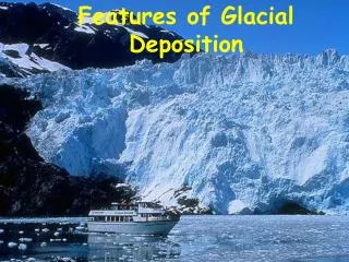
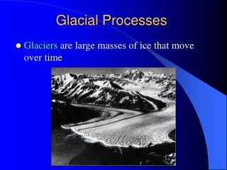
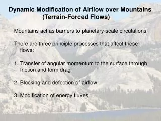
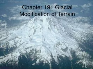
Chapter 19: Glacial Modification of Terrain. The Impact of Glaciers on the Landscape. Snowpack over years turns to ice Ice mass motion under gravity grinds anything in its path Glaciation increases erosion rate on a mountain by at least 10 times to an unglaciated mountain

E N D
The Impact of Glaciers on the Landscape • Snowpack over years turns to ice • Ice mass motion under gravity grinds anything in its path • Glaciation increases erosion rate on a mountain by at least 10 times to an unglaciatedmountain • Modifies flat landscapes as well
Types of Glaciers • Continental ice sheets • Exist in nonmountainousareas • 2 in existence:Antarctica & Greenland • Outlet glaciers • Mountain glaciers • Highland icefields: ice sheets that submerge underlying topography • Valley & piedmont glaciers • Alpine glaciers: develop individually instead of part of ice field • Cirque glaciers Figure 19-2
Glaciations Past and Present • Glacial ice volume varied considerably over last few million years • Evidence allows scientists to determine chronology of past glaciations • Pleistocene glaciation • Began at least 2.59 million years ago • Last major ice retreat = 9000 years ago • Climate: cooling of high-latitude and high-elevation areas • Consistent alterations of glacial & interglacial periods • At peak, 1/3 of total land covered in ice
Glaciations Past and Present • Indirect effects of Pleistocene glaciation • Periglacial processes • Periglacial zone—zone where ice never existed but glacial factors affected the landscape such as erosion from ice melt, solifluction • Sea-level changes—ice on continents = less drainwater& lower sea levels • Crustal depression—ice weight caused continents to sink, ice melt allowed for continental rebound • Pluvial developments—considerable runoff = increased moisture, increased precipitation & less evaporation • Developed many lakes, including the Great Salt Lake (formed from Lake Bonneville)
Glaciations Past and Present • Sea level decrease 20,000 years ago (above) • Potential sea level rise due to climate change (right)
Glaciations Past and Present • Maximum extent of the Pleistocene glaciation • Maximum extent of glacial ice today Figure 19-5a Figure 19-7
Glaciations Past and Present • Contemporary glaciation • Limited ice cover today (~10% of land surface) • 96% is in Greenland & Antarctica • Antarctic ice cap • Greenland ice cap • North American glaciers
Glaciations Past & Present • Climate change related to contemporary glaciation • Retreating of polar ice caps • Shrinking ice caps an indicator of a warming climate • Antarctic ice shelves breaking • Higher flow rates of outlet glaciers Figures 19-10 & 19-B
Glacier Formation and Movement • Snow begins as crystallized water vapor • Compression • Coalescence • Firn (AKA Névé) • Further compression results in glacial ice • Balance between accumulation & ablation • Accumulation zone • Ablation zone • Equilibrium zone Figure 19-11
Ice balance Ice inputs (zone of accumulation) vs. ice outputs (zone of ablation) 3 conditions Inputs > outputs – advancing glacier Inputs = outputs – stationary glacier Inputs < outputs – retreating glacier end moraine till plain end moraine Glacier Formation and Movement
Glacier Formation and Movement • Glacier “flow” is orderly sliding of ice molecules • Ice under extreme pressure deforms instead of slipping • Meltwater contributes surface for glacier to slide on • Flow in response to overlying weight • Plastic flow & basal slip • Glacier flow versus glacier advance Figure 19-12
The Effects of Glaciers • Erosion by glaciers • Volume and speed determine success of glacial erosion • Erosive power of moving ice slightly larger than that of water • Glacial plucking—picking up of rock material through refreezing of meltwater • Glacial abrasion—bedrock worn down by rock debris embedded in glacier • Subglacialmeltwatererosion Figure 19-15 Meltwater freezes In sub-glacial rock
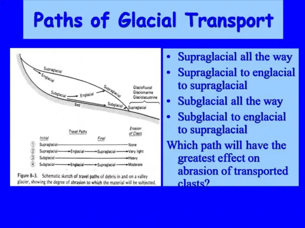
The Effects of Glaciers • Transportation by glaciers • Glaciers effective to move large rock pieces • Typically move glacial flour • Most rock material transported along base of ice • Bottom-load vs. top-load transport • Bulldozing • Remaining glacial ice free of rock debris • Role of melt streams
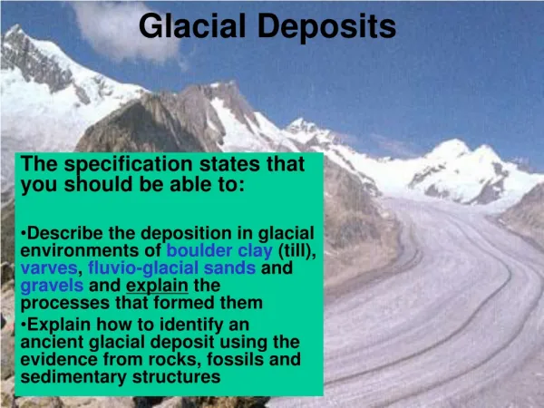
The Effects of Glaciers • Deposition by glaciers • Drift—All material transported & deposited by glaciers • Till—rock debris deposited by ice • Unsorted/unstratified • Glacial erratics—Large boulders; different from surrounding local bedrock • Glacial flour • Most common Figures 19-17 & 19-18
The Effects of Glaciers • Deposition of meltwater • Large portion of debris carried by glaciers deposited or redeposited by meltwater • Subglacial streams from glaciers carry sedimentary material • Glaciofluvialdeposition • Sorted/stratified Figure 19-16
Continental Ice Sheets • Ice sheets 3rd most extensive feature on the planet • Development & flow • Pleistocene: originated in midlatitudes& subpolar regions • Flowed outward from center of accumulation • Ebbed & flowed with changing climate Figure 19-19
Continental Ice Sheets • Erosion by ice sheets • Principal topography from ice sheet is gently undulating surface • Valley bottoms created from moving ice • Roche mountonnée, stoss side versus lee side • Postglacial landscape has low relief but is not absolutely flat Figure 19-20
Continental Ice Sheets Figure 19-21 • Deposition by Ice Sheets • Irregular, uneven surface of deposition, till plain • Moraines—depositmostly made of till • 3 types of moraines • Terminal moraine—marks outermost limit of glacial advance • Recessional moraine—positions where ice front is stabilized • Ground moraine—large quantities of till laid down under glacier instead of at its edge; kettle • Drumlins— elongated hill
Continental Ice Sheets • Glaciofluvial features • Deposition of debris by ice-sheet meltwaterproduces features composed of stratified drift (gravel, sand, silt); • Meltwater can’t move larger material • Outwash plains • Eskers • Ridge of stratified drift from glacial stagnation • Kames • Lakes very common Figure 19-28
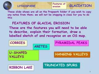
Mountain Glaciers • Mountain glacier development & flow • Usually form in sheltered depressions near heads of stream valleys • Erosion by mountain glaciers • Basic landform in glaciated mountains is the cirque • Marks the location where an alpine glacier originated • Shifting equilibrium line generate quarrying action Figure 19-29
Figure 19-31 Mountain Glaciers
Mountain Glaciers • Erosion by mountain glaciers (cont.) • Fragments carried away when ice flows out of cirque • Tarn—depression that holds water when cirque ice melts • Arête—spine of rock formed when several cirques cut into interfluve • Horn—pyramidal rock where cirques join • Col (AKA pass) Figures 19-35 & 19-36
Mountain Glaciers Figures 19-38 & 19-40 • Erosion in the valleys • Some glaciers never leave cirques • Principle erosive work is to deepen, steepen, & widen valley • U-shaped glacial troughs • Glacial steps & crevasses result from differences in rock resistance • Small cliffs & small lakes (AKA paternoster lakes) • Hanging valleys
Mountain Glaciers • Deposition by mountain glaciers • Continental ice sheets more responsible for deposition than mountain glaciation • Moraines primary deposition mechanism • Lateral moraines • Medial moraines Figures 19-41 & 19-44
Mountain Glaciers • Distribution of moraines around a valley glacier Figure 19-42
The Periglacial Environment • Periglacial—on the perimeter of glaciation • Permafrost • Permanently frozen ground • Extends to great depths • Patterned ground • Proglaciallakes Figure 19-45
Causes of the Pleistocene Glaciations • What initiates ice ages? • Any plausible theory must account for 4 characteristics • Ice accumulation is in both hemispheres but is non-uniform • Concurrent development of pluvial conditions in drylandareas • Multiple ice advance & retreat cycles • Eventual total deglaciation Figure 19-46
Causes of the Pleistocene Glaciations • Cold versus warm climate for glaciation • Role of Milankovitch cycles • Variations in solar output • Variations in carbon dioxide in atmosphere • Changes in continental positions • Atmospheric circulations • Tectonic upheaval Figure 19-47
Causes of the Pleistocene Glaciations • Paleoclimatology • Proxy measures of climate • Dendrochronology—study of past climate via tree ring analysis • Oxygen isotope analysis • Lighter vs. heavier isotopes (18O : 16O) • Coral reefs • Ratio of 18O/ 16O & reef height • Ice cores • Ratio of 18O/ 16O = thermometer • Atmospheric composition measurements • Pollen data • Radiocarbon dating Figure 8-42
Causes of the Pleistocene Glaciations • Causes of Long-Term Climate Change • Atmospheric aerosols • Block insolation & lower temperature • Volcanic eruptions or asteroid impacts • Anthropogenic impacts • Solar output fluctuations • Sunspot activity vs. solar output • Roles of the oceans • Absorb large amounts of carbon • Methane hydrates • Heat transfer from low latitudes to high latitudes Figures 8-43 & 45
Causes of the Pleistocene Glaciations • Are we still in an Ice Age?
Summary • Glaciers impact the landscape through ice mass motion and associated erosion • There are two primary well known eras for glaciation, the Pleistocene and contemporary glaciation • During the Pleistocene, ice occupied a third of the total land mass of the Earth • There were four indirect effects of the Pleistocene glaciation • Antarctica and Greenland make up a large percentage of the contemporary glaciation • There are two primary types of glaciers, continental ice sheets and mountain glaciers • Glacier formation involves process of converting snow to ice through intense pressure & snow accumulation • Glaciers move via sliding along a land surface; meltwater helps enhance the ability of glaciers to move • Glaciers have two primary erosive effects • Glaciers are capable of transporting large rock material as well as glacial flour • Glaciers deposit material through their transport as well as meltwater • Continental ice sheets have a unique set of erosive and depositional characteristics • Moraines are glacier-deposited landforms that consist entirely or largely of till • Glaciofluvial features play an important role in the distribution of deposited glacier material • Mountain glaciers have limited erosive and depositional characteristics • Valley effects of mountain glaciers can drastically alter the landscape in these regions • The region surrounding a glacier that is modified by the glacier but not under it is called the periglacial • There are numerous unique characteristics of the periglacial environment • The exact causes of ice ages, including the Pleistocene, are unknown, though many theories hypothesize about the different effects that could have contributed • It is unknown if we are still in an ice age